


Get to know Yancheng District
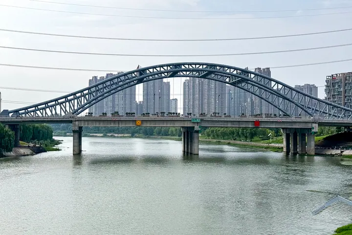
Photo adjustments
Full frame retained; proportionally resized and converted to WebP. No retouching or changes to the photographed subject. Card displays may crop the view.
- Administrative area
- District · 市辖区
- Part of
- Luohe
- Chinese name
- 郾城区
- Local areas
- District guide
Area & population
- Area in the source
- 413.00 km²
- Population · 2019
- 516,700
Source: cited geographic source, as of the dates shown.
Setting and landscape
Shaoling District (召陵区) lies to the east, Wuyang County (舞阳县) and Xiangcheng County (襄城县) to the west and Linying County (临颍县) to the north, while Yuanhui District (源汇区) faces Yancheng across the river to the south. The land is low plain tilting from northwest to southeast, from about 65 metres above sea level in the west to 51 metres in the east. Eleven waterways with a combined length of 209 kilometres cross the district, among them the Sha, the Ying (颍河) and the Li (澧河). The climate is warm-temperate monsoon: July averages 27.3°C and January 1.4°C. The district is a national base for high-quality wheat.
History
Yancheng County was created under the Sui in 585, with its seat at an old town 2.5 kilometres southwest of the later county town. After the Ru River (汝水) flooded thousands of homes in 722, the seat moved the following year from the south bank of the Yin River, today's Sha, to the north bank, where the town still stands. In July 1140 Yue Fei's forces defeated the Jin commander Wuzhu (兀术) at Wangdian (王店) north of the town, at Wulidian (五里店) and at Xiaoshangqiao (小商桥), pushing the Jin army back to Kaifeng. In 1638 the earthen town wall of 1482 was rebuilt in brick and stone, 11.7 metres high with five gates; the wall is gone, but stretches of its moat can still be seen. Yancheng and Luohe were separated in October 1949, and on 27 December 2004 the old county was divided into three and this part became Yancheng District.
What to see
Haojiatai (郝家台) is a raised-platform structure of the middle Longshan culture from about 5,000 years ago. Huashentai Temple (化身台寺) is linked by local tradition to the Western Zhou story of Chang Juan (常娟) waiting for her husband's return and to Confucius teaching there. The stone sutra pillar of Bi'an Temple (彼岸寺) is Northern Song, 12.1 metres tall, raised by the monk Qizong (契宗) during a 15-year restoration of the temple. From the Daoguang reign of the Qing come an octagonal glazed well (八角琉璃井) and an iron ox set up to guard against the river (镇河铁牛). The former home of Zhao Yiping (赵伊坪故居) and the former seat of the Shabei County Communist Party committee (中共沙北县委旧址) were among Luohe's first party-history education sites.
Getting oriented
Four railways cross the district, among them the Shijiazhuang–Wuhan high-speed line and the Beijing–Guangzhou line, as do the Beijing–Hong Kong–Macau and Nanjing–Luoyang expressways.
Highlights
- Haojiatai 郝家台: Raised-platform structure of the middle Longshan culture from about 5,000 years ago.
- Bi'an Temple sutra pillar 彼岸寺经幢: Northern Song stone pillar, 12.1 metres tall, raised when the monk Qizong restored the temple.
- Huashentai Temple 化身台寺: Linked by tradition to the Western Zhou tale of Chang Juan and to Confucius teaching.
- River-guarding iron ox 镇河铁牛: Qing Daoguang-era iron ox, listed with the octagonal glazed well among the district's historic sights.
Sources for this guide
走进郾城 · Yancheng District People's Government, Luohe
历史沿革 · Yancheng District People's Government, Luohe
资源概况 · Yancheng District People's Government, Luohe
Original English written from the listed sources and checked sentence by sentence against quoted extracts by a separate reviewer. Updated 2026-09-24.
Explore Yancheng District
Core places to explore, with English and Chinese names.
Yancheng District 郾城区
Plan your visit
Getting there
Yancheng District covers the centre of Luohe. Search for 郾城区 in a map app to find stations and your accommodation.
Where to stay →More in Luohe
Sources & geographic information
Administrative names and parent areas: Official geographic directory · Reference date 2026-09-06.
Map data © OpenStreetMap contributors. Pins mark approximate centres, not entrances or boundaries.