


Get to know Changge
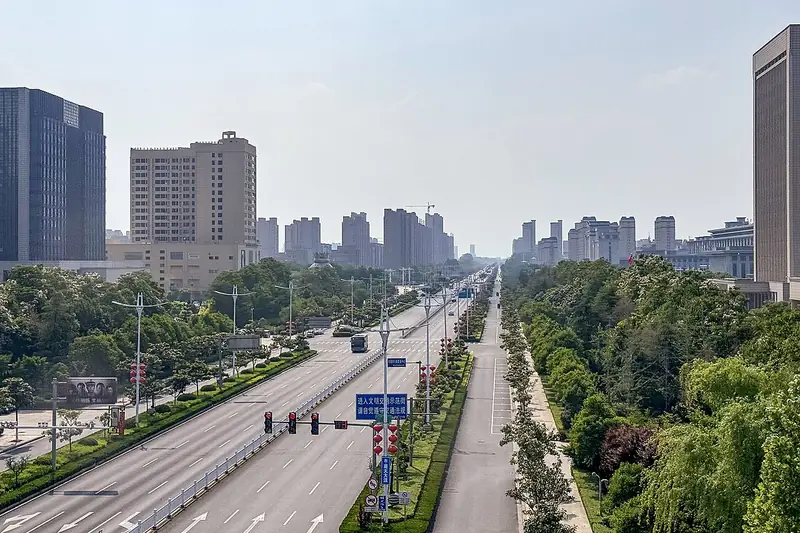
Photo adjustments
Full frame retained; EXIF orientation normalized, proportionally resized to at most 800 pixels and converted to WebP. No generated pixels or subject changes. Cards may crop the display.
- Administrative area
- County-level city · 县级市
- Part of
- Xuchang
- Chinese name
- 长葛市
- Local areas
- County-level city guide
Area & population
- Area in the source
- 650.00 km²
- Population · 2019
- 698,600
Source: cited geographic source, as of the dates shown.
Setting and landscape
The land is high in the north-west and low in the south-east. The low hills in the north-west, about 2.5 per cent of the city's area, are the last spurs of the Song Mountains (嵩山) in the Funiu (伏牛山) system. Two ridges, Bawang Ridge (霸王岗) and Hanwang Ridge (汉王岗), rise three to four kilometres west of the city, and bands of sand ridges run north-south to its north-east. Plain covers about 87 per cent of the city: west of the Beijing–Guangzhou railway it is a piedmont alluvial plain, and east of it a plain laid down by floods of the Shuangji River (双洎河) and the Yellow River.
Xinzheng (新郑) lies to the north, Yuzhou (禹州) to the west, Weishi (尉氏) to the north-east and Yanling (鄢陵) to the south-east; the city centre is 62 kilometres south of Zhengzhou (郑州). The Beijing–Guangzhou railway, the Beijing–Guangzhou high-speed railway and the Beijing–Zhuhai expressway run north to south through the city.
History
The name first appears in 718 BC, when Song troops besieged Changge, then a walled town of Zheng. After Wei took it in the mid-fourth century BC it was renamed Changshe (长社), and Qin made Changshe a county. Changge County was carved out in 586 under the Sui, and it became a county-level city in December 1993.
What to see
The Shigu site (石固遗址) in Shigu Town (石固镇) is a Neolithic settlement with Peiligang and Yangshao culture layers, listed as a national protected site in 2006. Changge Old Town (长葛老城), the county seat until 1960, keeps the Chanjing Temple statue stele (禅静寺造像碑), a national protected site prized for its Wei stele (魏碑) calligraphy, and the old county yamen.
Mount Xing (陉山), 329.7 metres, is the highest point in Changge and sits where Changge, Xinzheng and Yuzhou meet; the tomb of Zichan (子产), the Spring and Autumn chancellor of Zheng, is on its summit. The Shuangji River National Wetland Park (双洎河国家湿地公园), opened in 2020, stretches 34.71 kilometres from Fo'ergang Reservoir (佛耳岗水库) to the Lihekou sluice. The Zhong Yao Cultural Park (钟繇文化园), opened in 2011 beside the tomb of the calligrapher Zhong Yao (钟繇), remembers the man called the founder of regular script.
Food and local products
Among local bee products, Changge propolis (长葛蜂胶) is listed as a Chinese geographical-indication product.
Highlights
- Shigu site 石固遗址: Neolithic Peiligang and Yangshao site; national protected site since 2006.
- Mount Xing 陉山: Highest point in Changge at 329.7 m, with Zichan's tomb on the summit.
- Chanjing Temple statue stele 禅静寺造像碑: National protected stele in Changge Old Town.
- Shuangji River National Wetland Park 双洎河国家湿地公园: 34.71 km river wetland opened in 2020.
- Changge propolis 长葛蜂胶: Chinese geographical-indication product.
Sources for this guide
长葛市人民政府 自然地理 · Changge Municipal People's Government
历史沿革 · Changge Municipal People's Government
长葛市 - 维基百科,自由的百科全书 · Wikipedia (Chinese) · CC BY-SA 4.0
Original English written from the listed sources and checked sentence by sentence against quoted extracts by a separate reviewer. Updated 2026-09-24.
Explore Changge
Core places to explore, with English and Chinese names.
Plan your visit
Getting there
Changge is about 20 km in a straight line from central Xuchang. Search for 长葛市 in a map app to find stations and your accommodation.
Where to stay →More in Xuchang
Sources & geographic information
Administrative names and parent areas: Official geographic directory · Reference date 2026-09-06.
Some facts checked against 长葛市 — Wikipedia contributors, CC BY-SA 4.0.
Map data © OpenStreetMap contributors. Pins mark approximate centres, not entrances or boundaries.