


Get to know Xiangcheng County
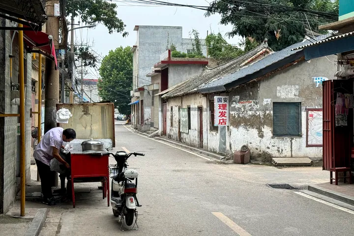
Photo adjustments
Full frame retained; proportionally resized and converted to WebP. No retouching or changes to the photographed subject. Card displays may crop the view.
- Administrative area
- County · 县
- Part of
- Xuchang
- Chinese name
- 襄城县
- Local areas
- County guide
Area & population
- Area in the source
- 920.00 km²
- Population · 2019
- 695,500
Source: cited geographic source, as of the dates shown.
Setting and landscape
The county government sums up the terrain as nine hills, nine ridges and sixteen rivers, with mountains, water and open plain together. Pingdingshan (平顶山) is 20 kilometres to the south and Xuchang 40 kilometres to the north.
History
In the Spring and Autumn period the place was called Fan (氾) and belonged to Zheng. King Xiang of Zhou (周襄王) once lived at Fan; in 540 BC, when Fan belonged to Chu, King Ling of Chu (楚灵王) built a new town at its north-west corner, which took the name Xiangcheng because the Zhou king had lived there. Qin made it a county, Wang Mang renamed it Xiangcheng with a different character (相城) and the Eastern Han restored the old name. The county government cites the Records of the Grand Historian on the Yellow Emperor taking copper from Mount Shou (首山). Xiangcheng was moved to Pingdingshan in February 1986 and returned to Xuchang in August 1997; it is recognised as a "thousand-year-old county" in the national place-name heritage scheme.
What to see
The Xiangcheng Confucian temple (襄城文庙), a Ming building, and the town wall (襄城城墙), Ming-era with Spring and Autumn remains, are both national protected sites; the county government also points to the old wall's barbican. Qianming Temple (乾明寺), also called Beiying Temple (背影寺), sits on the north side of Mount Shou south of Simen village in Shantoudian (山头店) and was listed nationally in 2006. The county government calls it the "first Chan monastery of the central plains". Its 1551 brick screen wall carries a relief of the Yellow Emperor mining copper.
Ziyun Academy (紫云书院), in Ziyun Town (紫云镇) on Ziyun Mountain (紫云山), was built in 1468 by the Ming Minister of Revenue Li Min (李敏) and given its name in 1482. The county government counts it among the eight great academies of the Ming, and its main hall and east and west wings survive.
Food and local products
Tobacco has a long history here: the county government names Xiangcheng as one of China's three birthplaces of flue-cured tobacco, nicknamed the "Virginia of the East". Xiangcheng flue-cured tobacco (襄城烤烟) and Xiangcheng sweet potato (襄城红薯) both hold national agricultural geographical-indication status.
Highlights
- Qianming Temple 乾明寺: National protected site (2006) on the north side of Mount Shou, with a Ming screen wall dated 1551.
- Ziyun Academy 紫云书院: Academy built in 1468 by Li Min and named in 1482.
- Xiangcheng Confucian temple 襄城文庙: Ming building and national protected site.
- Xiangcheng town wall 襄城城墙: Ming wall with Spring and Autumn remains; national protected site.
- Xiangcheng flue-cured tobacco 襄城烤烟: National agricultural geographical-indication product.
Sources for this guide
襄城县基本县情简介 · Xiangcheng County People's Government
襄城历史 · Xiangcheng County People's Government
襄城县 - 维基百科,自由的百科全书 · Wikipedia (Chinese) · CC BY-SA 4.0
紫云书院 - 维基百科,自由的百科全书 · Wikipedia (Chinese) · CC BY-SA 4.0
襄城乾明寺 - 维基百科,自由的百科全书 · Wikipedia (Chinese) · CC BY-SA 4.0
Original English written from the listed sources and checked sentence by sentence against quoted extracts by a separate reviewer. Updated 2026-09-24.
Explore Xiangcheng County
Core places to explore, with English and Chinese names.
Xiangcheng County 襄城县
Plan your visit
Getting there
Xiangcheng County is about 40 km in a straight line from central Xuchang. Search for 襄城县 in a map app to find stations and your accommodation.
Where to stay →More in Xuchang
Sources & geographic information
Administrative names and parent areas: Official geographic directory · Reference date 2026-09-06.
Some facts checked against 襄城县 — Wikipedia contributors, CC BY-SA 4.0.
Some facts checked against 紫云书院 — Wikipedia contributors, CC BY-SA 4.0.
Some facts checked against 襄城乾明寺 — Wikipedia contributors, CC BY-SA 4.0.
Map data © OpenStreetMap contributors. Pins mark approximate centres, not entrances or boundaries.