


Get to know Jian'an District
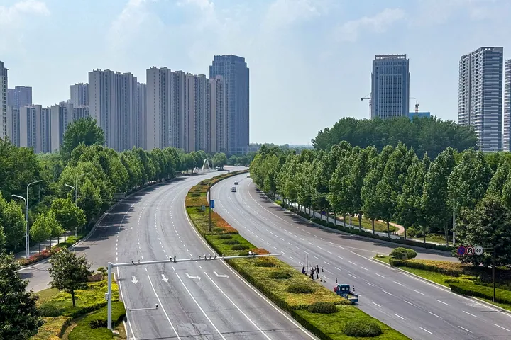
Photo adjustments
Full frame retained; proportionally resized and converted to WebP. No retouching or changes to the photographed subject. Card displays may crop the view.
- Administrative area
- District · 市辖区
- Part of
- Xuchang
- Chinese name
- 建安区
- Local areas
- District guide
Area & population
- Area in the source
- 1,002.00 km²
- Population · 2019
- 793,100
Source: cited geographic source, as of the dates shown.
Getting oriented
The district wraps around urban Xuchang. Yanling County (鄢陵县) lies to the east, Linying County (临颍县) to the south, Xiangcheng County (襄城县) to the south-west, Yuzhou (禹州) to the west and Changge (长葛) to the north. The Beijing–Guangzhou railway, the Shijiazhuang–Wuhan high-speed line and the Beijing–Hong Kong–Macau expressway run north to south through it, and national highway 311 crosses it east to west.
History
Under the Western Zhou the area was the fief of the state of Xu (许国), whose capital stood near Gucheng village in today's Zhangpan Town (张潘镇). In AD 196 Cao Cao (曹操) brought Emperor Xian (汉献帝) of the Han to Xu and made it the capital. In 221 Cao Pi (曹丕) renamed Xu County as Xuchang, reasoning that the Han had ended at Xu and the Wei had flourished there. Xuchang County was abolished and Jian'an District formally set up in its place on 5 February 2017.
What to see
The Lingjing Xuchang Man site (灵井许昌人遗址) in Lingjing Town (灵井镇), about 15 kilometres north-west of Xuchang, was found in 1965 and excavated from 2005. It is a nationally protected site, and a human skull found there is dated to 80,000–100,000 years ago; research on the skulls appeared in the journal Science in March 2017. Nearby are the Lingquan well (灵泉古井), a stone well from the Taiping Xingguo reign of the Northern Song, and the Ming–Qing Qingzhen Temple (清真观).
The Xudu old city (许都故城) at Zhangpan, also called Zhangpan old city, was the Xu state capital and then Emperor Xian's capital from 196; its surroundings include the tombs of Deng Ai (邓艾墓) and Xu Huang (徐晃墓). Hua Tuo's tomb (华佗墓), a well-known Three Kingdoms site, lies 3 kilometres west of the district's administrative centre.
Food and local products
The district government calls Jian'an the birthplace and a production and trading centre of dried tofu skin (腐竹), and Xuchang dried tofu skin is a Chinese geographical-indication product. The district is also a processing and export base for hair products.
Highlights
- Lingjing Xuchang Man site 灵井许昌人遗址: Nationally protected Palaeolithic site in Lingjing Town, found in 1965 and excavated from 2005.
- Xudu old city 许都故城: Ruins at Zhangpan of the Xu state capital and the Han capital from AD 196.
- Hua Tuo's tomb 华佗墓: Three Kingdoms site 3 km west of the district administrative centre.
- Xuchang dried tofu skin 许昌腐竹: Geographical-indication product; Jian'an is named as its birthplace.
Sources for this guide
区域位置_许昌市建安区人民政府 · Jian'an District People's Government, Xuchang
区情概况 · Jian'an District People's Government, Xuchang
历史沿革_许昌市建安区人民政府 · Jian'an District People's Government, Xuchang
名胜旅游_许昌市建安区人民政府 · Jian'an District People's Government, Xuchang
建安区 - 维基百科,自由的百科全书 · Wikipedia (Chinese) · CC BY-SA 4.0
Original English written from the listed sources and checked sentence by sentence against quoted extracts by a separate reviewer. Updated 2026-09-24.
Explore Jian'an District
Core places to explore, with English and Chinese names.
Jian'an District 建安区
Plan your visit
Getting there
Jian'an District is about 10 km in a straight line from central Xuchang. Search for 建安区 in a map app to find stations and your accommodation.
Where to stay →More in Xuchang
Sources & geographic information
Administrative names and parent areas: Official geographic directory · Reference date 2026-09-06.
Some facts checked against 建安区 — Wikipedia contributors, CC BY-SA 4.0.
Map data © OpenStreetMap contributors. Pins mark approximate centres, not entrances or boundaries.