


Get to know Wuxue
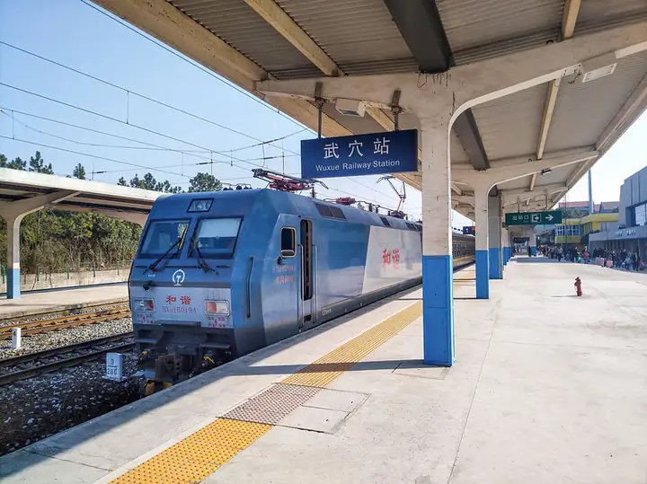
Photo adjustments
EXIF orientation normalized; resized without changing aspect ratio; converted to WebP. No subject edits.
- Administrative area
- County-level city · 县级市
- Part of
- Huanggang
- Chinese name
- 武穴市
- Local areas
- County-level city guide
Area & population
- Area in the source
- 1,241.70 km²
- Population · 2020 census
- 676,264
Source: cited geographic source, as of the dates shown.
History
The county took the name Guangji in the Tianbao era of the Tang, from a Buddhist phrase about spreading the Dharma widely to save all beings, replacing an earlier name, Yongning, that it shared with other counties. The State Council approved abolishing Guangji and creating the county-level city of Wuxue on 23 October 1987, taking the name of the riverside town of Wuxue, the present urban area. The Yantai Convention between China and Britain opened Wuxue port to foreign ships in 1876, and in the Republican period it was one of Hubei's seven main trading ports, known as 'Little Hankou'.
Setting and landscape
The land falls from low mountains in the north through hills in the centre to plains in the south and southeast, where the Yangtze alluvial plain around Tianjiazhen (田家镇), Wuxue and Longping (龙坪) is the main cotton area and a lake plain lies in the south and east. The northern mountains are two spurs of the Dabie range. Taiping Mountain (太平山) peaks at 1,063.4 metres, the city's highest point; white sand exposed on a peak to its east blows like snowflakes in strong wind, the old county view 'Snow on Dongchong'. Hengang Mountain (横岗山), with its main peak Tianzhu (天柱峰), was another of the ten Guangji views. By water the city is 219 kilometres from Wuhan (武汉).
What to see
The city government features Wushan Lake National Wetland Park (武山湖国家湿地公园). Chinese Wikipedia records that Wushan Lake, formerly Qinglin Lake, connects with the Yangtze, which is why Wuxue town was once called Qinglinkou. It also lists Huangya Temple (黄牙寺), an Eastern Jin temple said to have been founded by the Pure Land master Huiyuan (慧远) before he settled on Mount Lu, and a well linked to Daoxin (道信), the Fourth Patriarch of Chan.
Food and local products
Wuxue sesame candy (武穴酥糖), originally called osmanthus Dong candy, is made with sesame, sugar and osmanthus on a base boiled from malt sugar, and is sweet, crumbly and crisp. Foshou yams (佛手山药) have been grown here for more than 300 years and are eaten stewed. Local dishes named by Chinese Wikipedia include cuttlefish stewed with pork, 'straw-cape' meatballs (蓑衣丸子), Dajin pressed duck (大金板鸭) and fermented black beans.
Highlights
- Taiping Mountain 太平山: Highest point in Wuxue at 1,063.4 metres, source of the old view 'Snow on Dongchong'.
- Wushan Lake National Wetland Park 武山湖国家湿地公园: Lake formerly called Qinglin Lake, connected with the Yangtze.
- Wuxue sesame candy 武穴酥糖: Sesame, sugar and osmanthus candy, sweet, crumbly and crisp.
- Foshou yam 佛手山药: Grown in Wuxue for more than 300 years and eaten stewed.
Sources for this guide
武穴简史,关于广济的那些事……_武穴市人民政府 · Wuxue City People's Government
自然地理_武穴市人民政府 · Wuxue City People's Government
武穴市 - 维基百科,自由的百科全书 · Chinese Wikipedia · CC BY-SA 4.0
武山湖国家湿地公园_武穴市人民政府 · Wuxue City People's Government
Original English written from the listed sources and checked sentence by sentence against quoted extracts by a separate reviewer. Updated 2026-09-24.
Explore Wuxue
Core places to explore, with English and Chinese names.
Plan your visit
Getting there
Wuxue is about 95 km in a straight line from central Huanggang. Search for 武穴市 in a map app to find stations and your accommodation.
Where to stay →More in Huanggang
Sources & geographic information
Administrative names and parent areas: Official geographic directory · Reference date 2026-09-06.
Some facts checked against 武穴市 — Wikipedia contributors, CC BY-SA 4.0.
Map data © OpenStreetMap contributors. Pins mark approximate centres, not entrances or boundaries.