


Get to know Daye
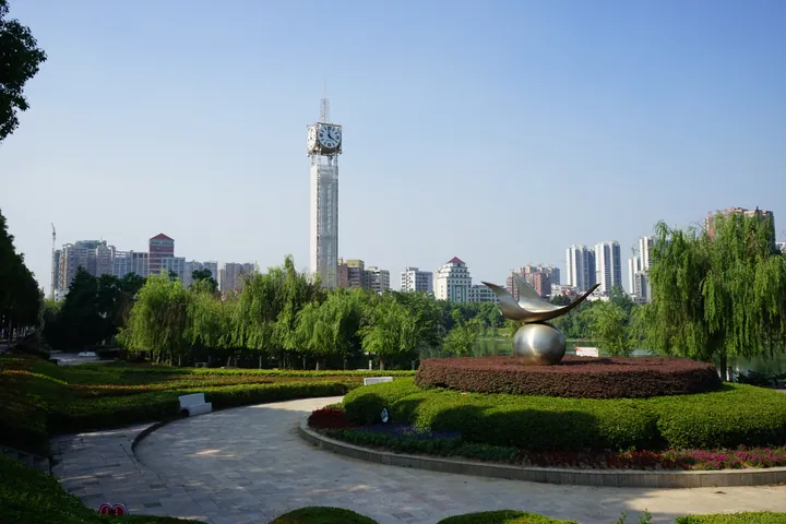
Photo adjustments
Full frame retained; proportionally resized and converted to WebP. No retouching or changes to the photographed subject. Card displays may crop the view.
- Administrative area
- County-level city · 县级市
- Part of
- Huangshi
- Chinese name
- 大冶市
- Local areas
- County-level city guide
Area & population
- Area in the source
- 1,566.00 km²
- Population · 2020
- 871,214
Source: cited geographic source, as of the dates shown.
Setting and landscape
The city government sums up the land as mountains in the south, hills in the north and lakes to east and west. Most of the city lies at 120 to 200 metres, rising to 839 metres at Taipojian (太婆尖), the highest point. The three main lakes are Daye Lake (大冶湖), Bao'an Lake (保安湖) and Sanshan Lake (三山湖). The city government puts Daye 90 kilometres from Wuhan (武汉) and 8 kilometres from Huahu Airport (花湖机场).
History
In 905, at the end of the Tang, Qin Pei (秦裴), a military governor of the Wu kingdom, set up the Qingshan (青山) smelting works here. In 967 the Southern Tang raised the works to a county, joined three townships of Wuchang to it and named it Daye after the phrase 'greatly develop furnaces and smelting'; the city government calls it Hubei's first 'thousand-year-old county'. In the late Qing, Zhang Zhidong (张之洞) opened the Daye Iron Mine, and the Hanyeping Company (汉冶萍公司) he founded is described by the city as China's first combined iron, steel and coal enterprise. Daye County was merged into Huangshi in 1959, restored in 1962 and became a county-level city in 1994.
What to see
Two sites are national key cultural relics: the Tonglüshan ancient copper mine and the Ewangcheng (鄂王城) city site. Tonglüshan was a mine where copper was dug and smelted on the spot; the city's culture and tourism bureau lists it as the earliest, largest and best-preserved ancient copper mine found in China. Discovered in 1973, it was put on the national list in 1982, and a new museum completed in 2023 stands on the north slope of ore body VII, joined to the old one; the Tonglüshan national archaeological park includes Spring and Autumn smelting furnaces, a Ming roasting furnace and a Shang-dynasty mining site. Leishan (雷山) is a national 4A scenic area, and the Nanshantou Revolutionary Memorial Hall (南山头革命纪念馆) is among the red-tourism sites.
Food and local products
Jing Jiu (劲酒) liquor is produced in Daye, and the city lists a Jingpai (劲牌) industrial-tourism area among its national 3A scenic areas.
Highlights
- Tonglüshan Ancient Copper Mine 铜绿山古铜矿遗址: National key cultural relic since 1982, discovered in 1973, with a new museum completed in 2023.
- Ewangcheng city site 鄂王城城址: National key cultural relic.
- Leishan Scenic Area 雷山: National 4A scenic area.
- Nanshantou Revolutionary Memorial Hall 南山头革命纪念馆: One of Daye's red-tourism sites.
Sources for this guide
大冶概况_大冶市人民政府 · Daye City People's Government
历史沿革_大冶市人民政府 · Daye City People's Government
自然地理_大冶市人民政府 · Daye City People's Government
铜绿山古矿遗址_大冶市人民政府 · Daye City Bureau of Culture and Tourism
Original English written from the listed sources and checked sentence by sentence against quoted extracts by a separate reviewer. Updated 2026-09-24.
Explore Daye
Core places to explore, with English and Chinese names.
Places to explore around Daye
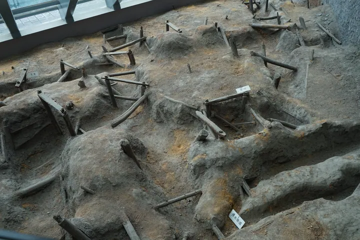 The excavated ancient mining pit at the Tonglüshan copper mine site, Daye, Huangshi ·
 Plan your visit
Getting there
Daye is about 15 km in a straight line from central Huangshi. Search for 大冶市 in a map app to find stations and your accommodation.
Where to stay →Build your route
Start with Tonglushan Ancient Copper Mine Site. The linked place guides have entrance and visit details.
Continue with Huangshi →More in Huangshi
Sources & geographic information
Administrative names and parent areas: Official geographic directory · Reference date 2026-09-06.
Photo: Tonglushan Ancient Copper Mine Site · Amarespeco · CC BY-SA 4.0. Full frame retained; proportionally resized and converted to WebP. No retouching or changes to the photographed subject. Card displays may crop the view.

Map data © OpenStreetMap contributors. Pins mark approximate centres, not entrances or boundaries.