


Get to know Beihu District
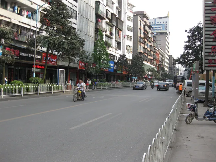
Photo adjustments
Full frame retained; proportionally resized and converted to WebP. No retouching or changes to the photographed subject. Card displays may crop the view.
- Administrative area
- District · 市辖区
- Part of
- Chenzhou
- Chinese name
- 北湖区
- Local areas
- District guide
Area & population
- Area in the source
- 818.53 km²
- Population · 2020 census
- 568,778
- Administrative seat
- Luoxian Subdistrict
Source: cited geographic source, as of the dates shown.
Setting and landscape
Chenzhou lies where Hunan meets Jiangxi and Guangdong, in the middle section of the Nanling Mountains (南岭). In Yangtianhu Yao Township lies the Yangtianhu Grassland (仰天湖大草原), an upland meadow of about 40 square kilometres at an average altitude of 1,314 metres. Hunan's 2023 list of rural leisure-tourism routes, as carried on China Daily's Chinese website, describes it as the southernmost alpine grassland in China, with grass that stays green for up to nine months and an average summer temperature of 20°C.
History
The character for Chen (郴) is used only for this city; it combines the elements for "forest" and "settlement" and means "the city in the forest". It first appears in the Qin dynasty, when Li Si (李斯) adopted it and set up Chen County. Xiang Yu (项羽) is recorded as having banished Emperor Yi of Chu (义帝) to Chen, and the Mausoleum of Emperor Yi (义帝陵), together with its stele, is a Hunan provincial protected site in Beihu.
What to see
Several other provincial protected sites lie in the district. The Wanhuayan cliff inscriptions (万华岩摩崖石刻群) span the Southern Song to the Republican era, and the Tanshanyan stone inscription (坦山岩劝农记事碑刻) is a Southern Song carved record of an exhortation to farming. The Chenzhou section of the old Hunan–Guangdong road (湘粤古道), a Ming and Qing route shared with Suxian District (苏仙区), was listed in 2011; the listing takes in Xiniu Well (犀牛井), old bridges, rock inscriptions and old streets.
In Lutang Town (鲁塘镇), the former residence of General Deng Hua (邓华故居) is a provincial protected site, and the Deng clan hall (邓氏宗祠) was added to the listing. Xiaobu Old Village (小埠古村) in Baohe Yao Township is on the national list of Chinese traditional villages.
Getting oriented
High-speed trains on the Beijing–Guangzhou line stop at Chenzhou West Station (郴州西站), and the conventional Beijing–Guangzhou railway serves Chenzhou Station (郴州站). Chinese Wikipedia lists Wuling Square (五岭广场) in the district as the largest city square in central-south China.
Highlights
- Yangtianhu Grassland 仰天湖大草原: Upland meadow of about 40 km² at an average altitude of 1,314 m, described in Hunan's 2023 rural-tourism route list as the southernmost alpine grassland in China.
- Mausoleum of Emperor Yi 义帝陵: Hunan provincial protected site, with its stele, linked to Xiang Yu banishing Emperor Yi of Chu to Chen.
- Wanhuayan cliff inscriptions 万华岩摩崖石刻群: Provincial protected group of carved inscriptions dating from the Southern Song to the Republican era.
- Former residence of Deng Hua 邓华故居: Provincial protected site in Lutang Town, with the Deng clan hall added to the listing.
- Xiaobu Old Village 小埠古村: Village in Baohe Yao Township on the national list of Chinese traditional villages.
Sources for this guide
北湖区 · Chinese Wikipedia · CC BY-SA 4.0
喜迎双节,湖南推出一批乡村休闲旅游精品景点线路 · China Daily (chinadaily.com.cn)
郴州市 · Chinese Wikipedia · CC BY-SA 4.0
北湖区各级文物保护单位列表 · Chinese Wikipedia · CC BY-SA 4.0
Original English written from the listed sources and checked sentence by sentence against quoted extracts by a separate reviewer. Updated 2026-09-24.
Explore Beihu District
Core places to explore, with English and Chinese names.
Beihu District 北湖区
Plan your visit
Getting there
Beihu District is about 3 km in a straight line from central Chenzhou. Search for 北湖区 in a map app to find stations and your accommodation.
Where to stay →More in Chenzhou
Sources & geographic information
Administrative names and parent areas: Official geographic directory · Reference date 2026-09-06.
Some facts checked against 北湖区 — Wikipedia contributors, CC BY-SA 4.0.
Some facts checked against 郴州市 — Wikipedia contributors, CC BY-SA 4.0.
Some facts checked against 北湖区各级文物保护单位列表 — Wikipedia contributors, CC BY-SA 4.0.
Map data © OpenStreetMap contributors. Pins mark approximate centres, not entrances or boundaries.