


Get to know Suxian District
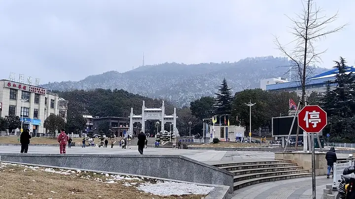
Photo adjustments
Full frame retained; resized proportionally to a maximum dimension of 960 pixels and converted to WebP quality 88. No crop, retouch, generated elements, or subject alteration. Final website rendition: full frame retained, proportionally resized to at most 720 pixels and converted to WebP. No additional retouching or subject alteration. Card displays may crop the view.
- Administrative area
- District · 市辖区
- Part of
- Chenzhou
- Chinese name
- 苏仙区
- Local areas
- District guide
History
The Su Xian legend (苏仙传说), put forward by Suxian District, entered the national intangible-heritage list in 2014. Its stories tell of Su Dan's miraculous birth, a deer that suckled him, his devotion to his mother, the orange trees he planted to drive off an epidemic, and his rise to immortality; the story is written up in the Taiping Guangji (太平广记), and the oldest records go back more than 1,700 years. Four Song emperors granted Su Dan Taoist titles, and the "orange well" (橘井) of the legend became a byword in Chinese medicine.
Later history left other marks. The sites of the 1928 Xiangnan Uprising (湘南起义旧址群) became a national protected site in 2013, and the former 711 uranium mine (核工业711功勋铀矿旧址), worked from 1960 to 1994, is also on the national list. The Xiang–Yue ancient road (湘粤古道), a Ming and Qing route shared with Beihu District (北湖区), is protected at provincial level.
What to see
Suxian Ling (苏仙岭), the hill named after Su Dan, has long been called the "eighteenth blessed land under heaven" (天下第十八福地) and is a national scenic area. Its scenic area holds the Chenzhou Inn (郴州旅舍) of Qin Guan's (秦观) lyric "Treading the Grass" (踏莎行): the poem, a postscript by Su Shi (苏轼) and Mi Fu's (米芾) calligraphy were carved in stone in the Southern Song Xianchun era as the "Three Perfections Stele" (三绝碑). The Suxian Ling cliff inscriptions (苏仙岭摩崖石刻群), dating from the Tang to the Republic, became a national protected site in 2013. The former place of confinement of Zhang Xueliang (张学良), the Qujiang Room (屈将室) on Suxian Ling, is protected at provincial level.
Gaoyiling (高椅岭), on the border with Zixing (资兴), is a Danxia landform area of 50.5 square kilometres rated national 4A. In Feitianshan Town (飞天山镇), Ming cliff inscriptions and an Ouyang family ancestral hall inside the Feitianshan scenic area are provincial protected sites.
Highlights
- Suxian Ling 苏仙岭: National scenic area named after Su Dan, called the eighteenth blessed land under heaven.
- Three Perfections Stele 三绝碑: Qin Guan's lyric with Su Shi's postscript in Mi Fu's calligraphy, carved in the Southern Song.
- Suxian Ling cliff inscriptions 苏仙岭摩崖石刻群: National protected site since 2013.
- Gaoyiling 高椅岭: 50.5 km² Danxia landform area on the Zixing border, rated national 4A.
- Su Xian legend 苏仙传说: National intangible heritage since 2014, about the herbalist Su Dan.
Sources for this guide
苏仙区 - 维基百科,自由的百科全书 · Wikipedia (Chinese) · CC BY-SA 4.0
苏仙传说 - 中国非物质文化遗产网·中国非物质文化遗产数字博物馆 · China Intangible Cultural Heritage Network (National ICH Protection Centre)
苏仙区各级文物保护单位列表 - 维基百科,自由的百科全书 · Wikipedia (Chinese) · CC BY-SA 4.0
高椅岭 - 维基百科,自由的百科全书 · Wikipedia (Chinese) · CC BY-SA 4.0
【郴州市】从“看风景”走向“读文脉” 郴州擦亮苏仙岭文旅融合“金名片”-湖南省人民政府门户网站 · Hunan Provincial People's Government
Original English written from the listed sources and checked sentence by sentence against quoted extracts by a separate reviewer. Updated 2026-09-25.
Explore Suxian District
Core places to explore, with English and Chinese names.
Places to explore around Suxian District
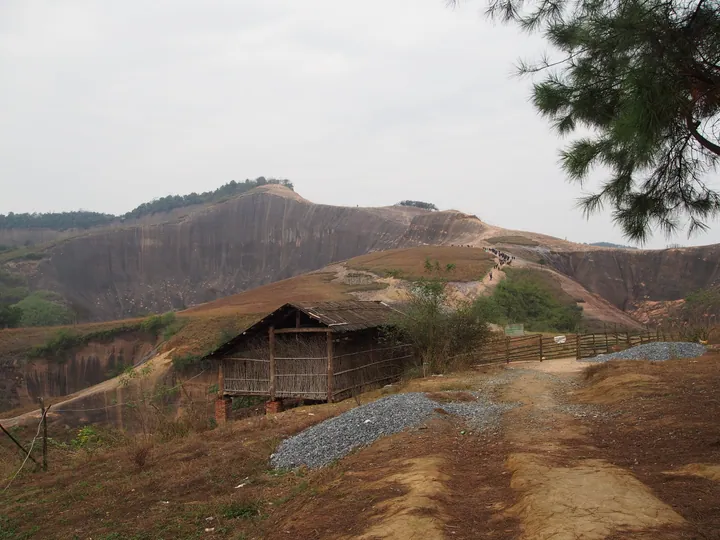 Footpath through the red sandstone Danxia rock formations of Gaoyi Ridge Scenic Area, Suxian District, Chenzhou · 湖南省郴州市苏仙区高椅岭景区丹霞地貌步道 Source-recorded photograph date: Taken on 6 December 2014.
Gaoyiling Scenic Area高椅岭
Gaoyiling (高椅岭) is a Danxia red-rock landscape in Feitianshan Town, Suxian District, about 18 kilometres from the centre of Chenzhou, Hunan. It opened as a managed tourist area in 2021, after gullies that had taken coal ash from a thermal power station were repaired, capped with soil and replanted.
Read the place guide →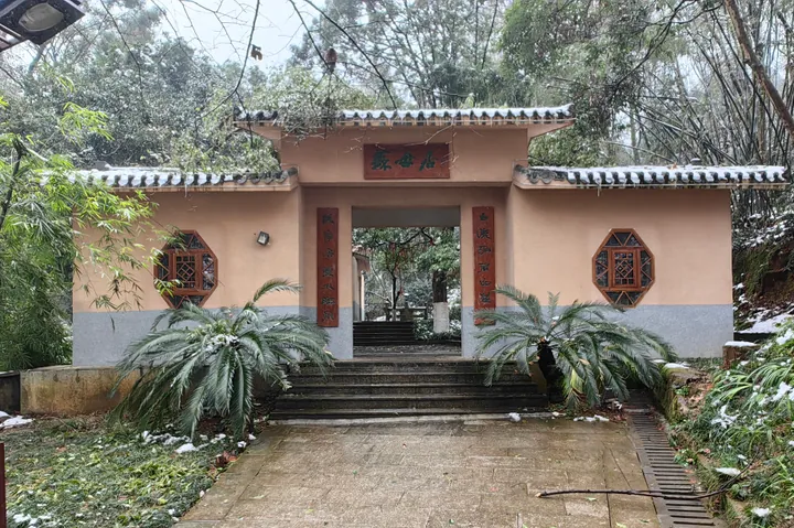 Garden gate of the Su Mu Ju pavilion within Suxian Ridge park, Suxian District, Chenzhou, under light snow · 湖南省郴州市苏仙区苏仙岭景区内苏母居门楼,雪景 Source-recorded photograph date: 2024-01-25 16:11:00.
Suxian Ridge苏仙岭
Suxian Ridge (苏仙岭) rises beside the Chen River in the central urban area of Chenzhou, in Suxian District, Hunan. It is a national-level scenic and historic area whose interest is as much epigraphic and literary as scenic: its cliff face carries a group of inscriptions protected at national level.
Read the place guide →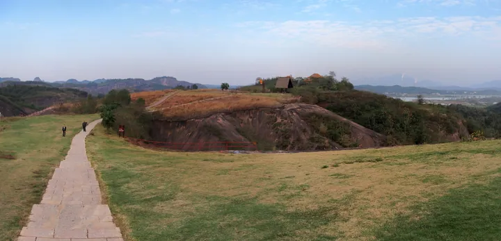 A grassy hilltop with distant sandstone peaks at Feitian Mountain Scenic Area, Suxian District · 苏仙区飞天山风景区山顶草地,远处可见砂岩峰林 Source-recorded photograph date: Taken on 5 December 2014.
Feitian Mountain飞天山
Feitianshan (飞天山) is a national geopark in Suxian District, Chenzhou, Hunan, roughly 25 kilometres from the city. Its subject is the meeting of two rock systems: Danxia red sandstone and the karst caves cut into older limestone beneath it.
Read the place guide →Plan your visit
Getting there
Suxian District is about 8 km in a straight line from central Chenzhou. Search for 苏仙区 in a map app to find stations and your accommodation.
Where to stay →Build your route
Gaoyiling Scenic Area and Suxian Ridge are both listed here. The linked place guides have entrance and visit details.
Continue with Chenzhou →More in Chenzhou
Sources & geographic information
Administrative names and parent areas: Official geographic directory (dmfw.mca.gov.cn) · Reference date 2026-09-06.
Some facts checked against 苏仙区 — Wikipedia contributors, CC BY-SA 4.0.
Some facts checked against 苏仙区各级文物保护单位列表 — Wikipedia contributors, CC BY-SA 4.0.
Some facts checked against 高椅岭 — Wikipedia contributors, CC BY-SA 4.0.
Photo: Gaoyiling Scenic Area · rheins · CC BY 3.0. Full frame retained; proportionally resized and converted to WebP. No retouching or changes to the photographed subject. Card displays may crop the view.

Photo: Suxian Ridge · Uuongkinghe · CC BY-SA 4.0. Full frame retained; proportionally resized and converted to WebP. No retouching or changes to the photographed subject. Card displays may crop the view.

Photo: Feitian Mountain · rheins · CC BY 3.0. Full frame retained; proportionally resized and converted to WebP. No retouching or changes to the photographed subject. Card displays may crop the view.

Map data © OpenStreetMap contributors. Pins mark approximate centres, not entrances or boundaries.