


Get to know Hengshan County
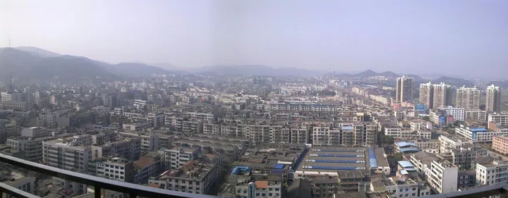
Photo adjustments
Full frame retained; proportionally resized and converted to WebP. No retouching or changes to the photographed subject. Card displays may crop the view.
- Administrative area
- County · 县
- Part of
- Hengyang
- Chinese name
- 衡山县
- Local areas
- County guide
Setting and landscape
The county is mostly hill country with river valleys and some plain. Its ground rises towards Zhurong Peak (祝融峰) in the middle and slopes down to the northwest and southeast, which divides it into a "front mountain" and a "back mountain" area (前山, 后山). Besides the Xiang, the main rivers are the Juan (涓水), the Jingpi (荆陂河) and the Wu (乌江). The Xiang carries a 64-kilometre navigable channel through the county, and the county seat is Kaiyun (开云镇).
History
The name Hengshan first appears in 290, when Emperor Hui of Jin renamed the old Hengyang County. From the Ming to the Qing the county belonged to Hengzhou prefecture (衡州府). Its modern shape comes from two later cuts: in 1966 the land on the east bank of the Xiang became Hengdong County (衡东县), and in 1984 the town and township of Nanyue, with ten villages from three other townships, were taken out to form Nanyue District (南岳区).
What to see
Xuanzhou (萱洲镇), an old town, lies at the southern tip of the county. China National Radio reported on the first Xuanzhou land-art season in March 2024, held among spring peach, plum and rape blossom, with a field design using motifs from Hengshan shadow puppetry (衡山皮影戏) beside the high-speed railway. The Hengshan Xuanzhou National Wetland Park (衡山萱洲国家湿地公园), approved as a national pilot on 31 December 2014, covers 2,740 hectares across Hengshan and Hengdong counties at the meeting point of two bird migration routes; 85 bird species have been recorded, and staff sighted four scaly-sided mergansers there in 2016.
In Huangni village, Xinqiao (新桥镇), the former home of Tang Qunying (唐群英故居) keeps the study she named "Shiwujia" (是吾家, "this is my home"), where she read as a young woman and edited her poems in later life; it became a Hunan provincial protected site in 2001. Other sites in the county include Zijinshan Forest Park (紫金山森林公园), the Dayuandu artificial lake (大源渡人工湖), the Kangwang Temple (康王庙), the site of the Yuebei Peasants' and Workers' Association (岳北农工会旧址) and the martyrs' cemetery of Mao Zejian (毛泽建烈士陵园).
Highlights
- Xuanzhou 萱洲古镇: Old town at the county's southern tip; host of a land-art season among spring blossom first held in March 2024.
- Hengshan Xuanzhou National Wetland Park 衡山萱洲国家湿地公园: 2,740-hectare wetland park approved as a national pilot in 2014; 85 bird species recorded.
- Former Residence of Tang Qunying 唐群英故居: The "Shiwujia" study in Huangni village, Xinqiao; Hunan provincial protected site since 2001.
Sources for this guide
衡山县 - 维基百科,自由的百科全书 · Chinese Wikipedia · CC BY-SA 4.0
衡山萱洲首届大地艺术季正式启动_央广网 · China National Radio (cnr.cn)
衡山萱洲国家湿地公园 - 维基百科,自由的百科全书 · Chinese Wikipedia · CC BY-SA 4.0
唐群英故居 - 维基百科,自由的百科全书 · Chinese Wikipedia · CC BY-SA 4.0
Original English written from the listed sources and checked sentence by sentence against quoted extracts by a separate reviewer. Updated 2026-09-24.
Explore Hengshan County
Core places to explore, with English and Chinese names.
Places to explore around Hengshan County
 Xuanzhou Ancient Town ·
 Plan your visit
Getting there
Hengshan County is about 50 km in a straight line from central Hengyang. Search for 衡山县 in a map app to find stations and your accommodation.
Where to stay →Build your route
Start with Xuanzhou Ancient Town. The linked place guides have entrance and visit details.
Continue with Hengyang →More in Hengyang
Sources & geographic information
Administrative names and parent areas: Official geographic directory · Reference date 2026-09-06.
Some facts checked against 衡山县 — Wikipedia contributors, CC BY-SA 4.0.
Some facts checked against 衡山萱洲国家湿地公园 — Wikipedia contributors, CC BY-SA 4.0.
Some facts checked against 唐群英故居 — Wikipedia contributors, CC BY-SA 4.0.
Photo: Xuanzhou Ancient Town · Source photographer · License not provided. EXIF orientation normalized; resized without changing aspect ratio; converted to WebP. No subject edits.
Map data © OpenStreetMap contributors. Pins mark approximate centres, not entrances or boundaries.