


Get to know Hecheng District
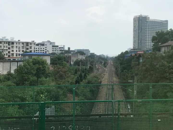
Photo adjustments
Full frame retained; proportionally resized and converted to WebP. No retouching or changes to the photographed subject. Card displays may crop the view.
- Administrative area
- District · 市辖区
- Part of
- Huaihua
- Chinese name
- 鹤城区
- Local areas
- District guide
Area & population
- Area in the source
- 728.81 km²
- Population · 2020 census
- 712,584
- Administrative seat
- Tuoyuan Subdistrict
Source: cited geographic source, as of the dates shown.
History
In 1074, under the Song, a frontier stockade here was renamed Huaihua Stockade (怀化砦). Huaihua County was formed in 1943 from parts of Zhijiang (芷江), Chenxi (辰溪) and Qianyang (黔阳). After the Hunan–Guizhou and Zhicheng–Liuzhou railways were built in the 1970s, Yushuwan (榆树湾) in Huaihua County became an important junction linking east with west and north with south, and in 1978 the offices of Qianyang Prefecture (黔阳地区) moved there. The county became the county-level city of Huaihua in 1979, and when prefecture-level Huaihua was created in 1997, the old city was split into Hecheng District and Zhongfang County (中方县).
What to see
Zhongpo National Forest Park (中坡国家森林公园), on Zhongpo Mountain in the north of the city, was made a national forest park in October 2003 and is the only one in Huaihua. Its summit reaches 636 metres. The park has a butterfly specimen hall and the Wuxi Garden (五溪景园), whose thirteen spots include a Dong wind-and-rain bridge, a Dong drum tower and a Miao totem pole. A grove of large-flowered red camellia, which the district describes as a new plant species found nowhere else in China, flowers from winter into early spring.
The Huangyan Tourist Resort (黄岩旅游度假区), 18 kilometres from the city in the south-east of the district, is a national 4A scenic area on a karst upland averaging 850 metres, known locally for its many linked caves. It holds the Huaihua Grand Canyon (怀化大峡谷) and Baima (白马) scenic areas, and its azalea festival is listed among Hunan's ten major festivals.
The new Huaihua Museum (怀化博物馆) holds more than 16,000 items or sets of valuable relics. Its five permanent displays cover Huaihua's history, Wuxi woodcarving, the Tang poet Wang Changling's exile in the region, painting and calligraphy, and the railways that shaped the city.
Getting oriented
The Shanghai–Kunming, Jiaozhi–Liuzhou and Chongqing–Huaihua railways meet in the district, together with the Shanghai–Kunming, Huaihua–Shaoyang–Hengyang and Zhangjiajie–Jishou–Huaihua high-speed lines. The district government describes it as sitting at the centre of the border region of Hunan, Hubei, Chongqing, Guizhou and Guangxi. Huaihua College (怀化学院) and Hunan University of Medicine (湖南医药学院) are in the district.
Highlights
- Zhongpo National Forest Park 中坡国家森林公园: Huaihua's only national forest park, on Zhongpo Mountain in the north of the city, national status since 2003.
- Huangyan Tourist Resort 黄岩旅游度假区: National 4A scenic area on a karst upland averaging 850 m, with linked caves and an azalea festival.
- Huaihua Museum 怀化博物馆: New museum with over 16,000 items and displays on Wuxi woodcarving, Wang Changling and the railways.
Sources for this guide
鹤城区概况 - 鹤城区人民政府 · Hecheng District People's Government, Huaihua
中坡国家森林公园 - 鹤城区人民政府 · Hecheng District Bureau of Culture, Tourism, Radio, Television and Sports
黄岩旅游度假区 - 鹤城区人民政府 · Hecheng District Bureau of Culture, Tourism, Radio, Television and Sports
怀化博物馆 - 鹤城区人民政府 · Hecheng District Bureau of Culture, Tourism, Radio, Television and Sports
鹤城区 - 维基百科,自由的百科全书 · Wikipedia (Chinese) · CC BY-SA 4.0
Original English written from the listed sources and checked sentence by sentence against quoted extracts by a separate reviewer. Updated 2026-09-24.
Explore Hecheng District
Core places to explore, with English and Chinese names.
Hecheng District 鹤城区
Plan your visit
Getting there
Hecheng District is about 3 km in a straight line from central Huaihua. Search for 鹤城区 in a map app to find stations and your accommodation.
Where to stay →More in Huaihua
Sources & geographic information
Administrative names and parent areas: Official geographic directory · Reference date 2026-09-06.
Some facts checked against 鹤城区 — Wikipedia contributors, CC BY-SA 4.0.
Map data © OpenStreetMap contributors. Pins mark approximate centres, not entrances or boundaries.