


Get to know Yuanling County
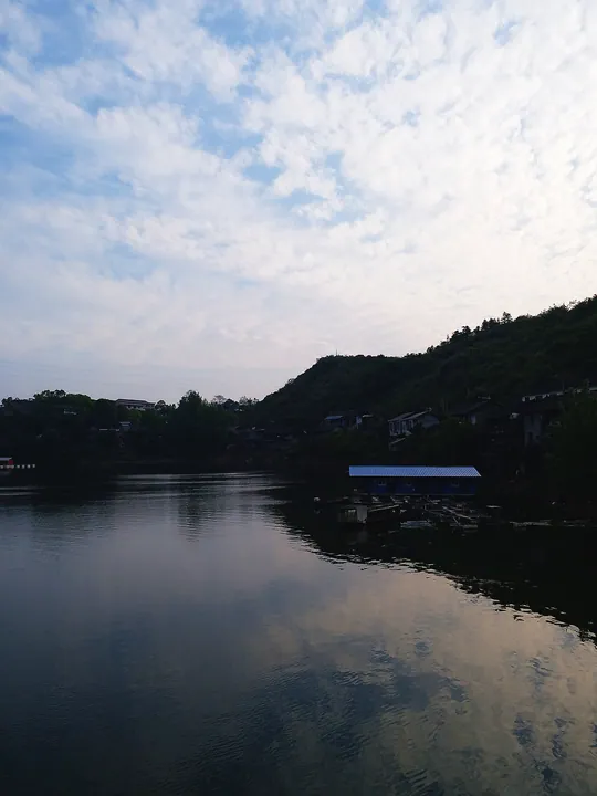
Photo adjustments
Full frame retained; proportionally resized and converted to WebP. No retouching or changes to the photographed subject. Card displays may crop the view.
- Administrative area
- County · 县
- Part of
- Huaihua
- Chinese name
- 沅陵县
- Local areas
- County guide
Area & population
- Area in the source
- 5,825.51 km²
- Population · 2010
- 582,582
Source: cited geographic source, as of the dates shown.
Setting and landscape
Yuanling lies between the Wuling Mountains (武陵山) to the north and the Xuefeng Mountains (雪峰山) to the south. Between them run low hills of 300 to 800 metres with karst caves and sinkholes, and narrow valley plains follow the Yuan. The large Wuqiangxi Reservoir (五强溪水库) fills the southeast of the county. The county government counts 911 streams and rivers in the Yuan and You systems.
History
The Chu state set up Qianzhong commandery (黔中郡) here in the Warring States period, and its site lies at Qianzhongjun village (黔中郡村), once called Yaotou (窑头). Yuanling County was created in 202 BC; the name refers to a high earth mound, called a ling (陵), south of the original town, which had the Yuan on its north side. In 589 the Sui made the town the seat of Chenzhou and moved it to the present site. According to legend, the court scholar Fu Sheng (伏胜) hid over a thousand bamboo-slip books in a cave on Eryou Mountain (二酉山) during the Qin burning of books, the origin of the saying "learning that reaches the two You" (书通二酉).
What to see
The Tang-dynasty Longxing Jiang Temple (龙兴讲寺) is protected at national level, and the Qianzhong commandery site at provincial level. Chenzhou Nuo opera (辰州傩戏) and Yuanling traditional dragon boats (沅陵传统龙舟) are on the national intangible heritage list. The county government also names Jiemuxi National Nature Reserve (借母溪), Wuqiangxi National Wetland Park, Yuanling National Forest Park, the Chenlong Pass (辰龙关) and Wuxi Lake (五溪湖), one of the "New Eight Views of Xiaoxiang".
Food and local products
Jietan tea (碣滩茶), a curled green tea with a clear yellow-green liquor, has been a tribute tea since the Tang and was named a "China–Japan friendship tea" in 1972. Wuqiangxi fish (五强溪鱼) from the reservoir and the Daheping black pig (大合坪黑猪), named after Daheping township, are geographical-indication products. Shailan pork (晒兰肉) is made from lean hind-leg meat of local black pigs, sliced, spiced and dried in bamboo baskets in the sun or over smokeless charcoal. Yuanling sesame candy (沅陵酥糖), best known under the Longxing (龙兴) brand, has by tradition been made since the middle of the Ming, more than 500 years; it pairs a filling of roasted local sesame with maltose pulled by hand several times.
Highlights
- Longxing Jiang Temple 龙兴讲寺: Tang-dynasty temple listed as a national key cultural relic site.
- Eryou Mountain 二酉山: Mountain whose cave, by legend, hid books from the Qin burning.
- Jiemuxi National Nature Reserve 借母溪国家级自然保护区: National nature reserve listed among the county's main scenic areas.
- Jietan tea 碣滩茶: Tribute green tea since the Tang; geographical-indication product from 2011.
- Shailan pork 晒兰肉: Spiced lean black-pig meat dried in bamboo baskets or over charcoal.
Sources for this guide
沅陵概况 - 沅陵县人民政府 · Yuanling County People's Government
历史沿革 - 沅陵县人民政府 · Yuanling County People's Government
十大特产 - 沅陵县人民政府 · Yuanling County People's Government
沅陵县 - 维基百科,自由的百科全书 · Wikipedia (Chinese) · CC BY-SA 4.0
Original English written from the listed sources and checked sentence by sentence against quoted extracts by a separate reviewer. Updated 2026-09-24.
Explore Yuanling County
Core places to explore, with English and Chinese names.
Places to explore around Yuanling County
 Fenghuang Mountain and Longxing Temple ·
 Plan your visit
Getting there
Yuanling County is about 105 km in a straight line from central Huaihua. Search for 沅陵县 in a map app to find stations and your accommodation.
Where to stay →Build your route
Start with Fenghuang Mountain and Longxing Temple. The linked place guides have entrance and visit details.
Continue with Huaihua →More in Huaihua
Sources & geographic information
Administrative names and parent areas: Official geographic directory · Reference date 2026-09-06.
Some facts checked against 沅陵县 — Wikipedia contributors, CC BY-SA 4.0.
Photo: Fenghuang Mountain and Longxing Temple · Source photographer · License not provided. EXIF orientation normalized; resized without changing aspect ratio; converted to WebP. No subject edits.
Map data © OpenStreetMap contributors. Pins mark approximate centres, not entrances or boundaries.