


Get to know Lianyuan
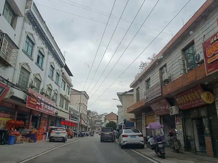
Photo adjustments
EXIF orientation normalized; resized without changing aspect ratio; converted to WebP. No subject edits.
- Administrative area
- County-level city · 县级市
- Part of
- Loudi
- Chinese name
- 涟源市
- Local areas
- County-level city guide
Area & population
- Area in the source
- 1,830.01 km²
- Population · 2017
- 894,000
Source: cited geographic source, as of the dates shown.
Setting and landscape
Mountains close the south, west and north, low hills rise in the middle and the east is lower, giving the city an E-shaped outline; flat land makes up only about a tenth of the area. The highest point is Yuepingfeng (岳平峰), 1,513.6 metres, in the Longshan range, while the Leifeng range (雷峰山) runs east–west across the city and splits it into northern and southern basin corridors. The Sun River flows through the Lantian (蓝田) urban area, the Mei River (湄水) crosses the north and the Lian runs through the eastern townships; all belong to the Xiang River system.
What to see
The Meijiang (湄江) area in the north is karst country of caves, peak forest and gorges, protected as Meijiang National Geopark (湄江国家地质公园). Longshan National Forest Park (龙山国家森林公园) lies in the south-western Longshan range; the city government links the range to the physician Sun Simiao (孙思邈), and a Temple of the King of Medicine (药王殿) still stands there. Sanjia (三甲), about four kilometres south-west of Lantian, became a provincial historic village in 2009; more than 50 of its Ming and Qing grey-brick courtyards survive in good condition, among them the Shiye Hall (世业堂) and the Liang clan ancestral hall (梁氏宗祠).
History and culture
A Liandao county (连道县) was set up at Yangjiatan (杨家滩), today's Yangshi (杨市), in 202 BC. In 1852 the scholar Luo Zenan (罗泽南) raised militia there with Li Xubin (李续宾) and others, the start of what Ta Kung Pao calls the cradle of the Xiang Army (湘军). Yangshi and nearby towns keep 148 old houses, more than 40 of them mansions of Xiang Army commanders, such as Liu Yuezhao's (刘岳昭) Cunyang Hall (存养堂) and Li Xubin's Xisan Hall (锡三堂) in Hetang (荷塘); the Peng clan hall (彭氏祠堂) dates from the early Qing. Lianyuan-style Xiang opera (湘剧), which keeps the four main vocal styles of Xiang opera but blends in Meishan (梅山) folk-song tunes, has been on Hunan's intangible heritage list since 2008; the Qing official Tao Shu (陶澍) gave one troupe a signed plaque in 1826.
Highlights
- Meijiang National Geopark 湄江国家地质公园: Karst caves, peak forest and gorges in the north of the city.
- Longshan National Forest Park 龙山国家森林公园: South-western mountains rising to 1,513.6 m at Yuepingfeng, with a Temple of the King of Medicine.
- Sanjia old village 三甲古村落: Provincial historic village with over 50 surviving Ming–Qing courtyards.
- Xiang Army mansions of Yangshi 杨市: Described by Ta Kung Pao as where the Xiang Army began; more than 40 commanders' residences in the area.
Sources for this guide
自然地理 | 涟源市人民政府 · Lianyuan Municipal People's Government (Culture, Tourism, Radio, TV and Sports Bureau)
涟源古文化圣地和湘军发源地 | 涟源市人民政府 · Ta Kung Pao, reprinted by Lianyuan Municipal People's Government
三甲古村落 | 涟源市人民政府 · Lianyuan Municipal People's Government (Culture, Tourism, Radio, TV and Sports Bureau)
来吧!开启龙山的圆梦之旅 | 涟源市人民政府 · Lianyuan Municipal People's Government
涟源湘剧 | 涟源市人民政府 · Lianyuan Municipal People's Government (Culture, Tourism, Radio, TV and Sports Bureau)
Original English written from the listed sources and checked sentence by sentence against quoted extracts by a separate reviewer. Updated 2026-09-24.
Explore Lianyuan
Core places to explore, with English and Chinese names.
Places to explore around Lianyuan
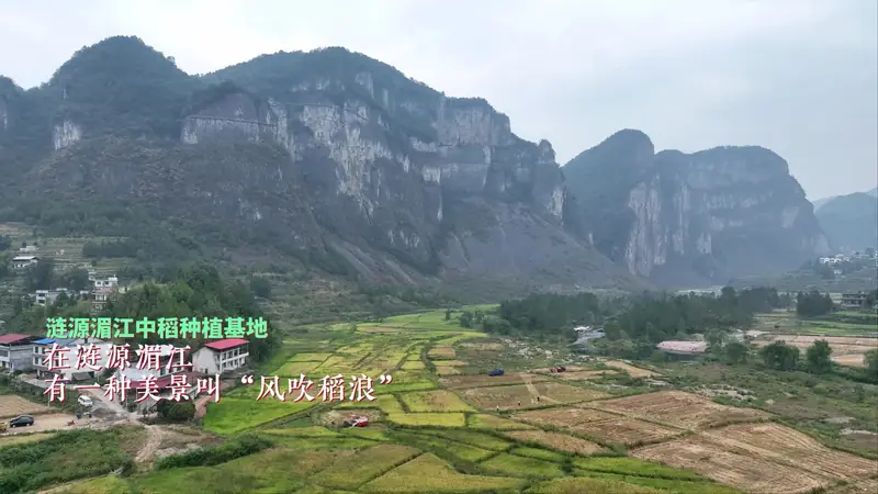 Meijiang Scenic Area ·
 Plan your visit
Getting there
Lianyuan is about 35 km in a straight line from central Loudi. Search for 涟源市 in a map app to find stations and your accommodation.
Where to stay →Build your route
Start with Meijiang Scenic Area. The linked place guides have entrance and visit details.
Continue with Loudi →More in Loudi
Sources & geographic information
Administrative names and parent areas: Official geographic directory · Reference date 2026-09-06.
Photo: Meijiang Scenic Area · Source photographer · License not provided. EXIF orientation normalized; resized without changing aspect ratio; converted to WebP. No subject edits.
Map data © OpenStreetMap contributors. Pins mark approximate centres, not entrances or boundaries.