


Get to know Louxing District
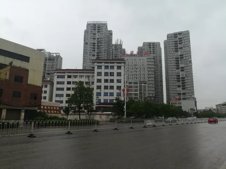
Photo adjustments
Full frame retained; proportionally resized and converted to WebP. No retouching or changes to the photographed subject. Card displays may crop the view.
- Administrative area
- District · 市辖区
- Part of
- Loudi
- Chinese name
- 娄星区
- Local areas
- District guide
Area & population
- Area in the source
- 630.02 km²
- Population · 2020 census
- 752,530
- Administrative seat
- Changqing Subdistrict
Source: cited geographic source, as of the dates shown.
Setting and landscape
The Lian, the Sun River (孙水) and the Bixi (碧溪, also called the Shanshan River 杉山河) come in from the north-west, south-west and north and join in the east, so the district rises on three sides and tilts eastwards in a rough horseshoe. The centre and east are low and open, with valley plains along the rivers. The north is mountain country around Hongjia Mountain (洪家山) and Guanyin Mountain (观音山), cut through by the Bixi; the summit of Hongjia Mountain in Shuangjiang (双江乡) is the highest point at 875.9 metres, against about 85 metres at Jixiang Temple (吉祥寺) in the east.
History
The central city grew from Loudi Old Street (娄底老街). By 1073 a market town known as Loudi (楼底) had formed here as one of the eight market towns of Xiangxiang county (湘乡县), and in the Qianlong reign of the Qing dynasty it was renamed with the present characters (娄底). A street plan of 1935 shows six wharves, seven temples, four ancestral halls and two churches, with the Guanhua Gate (观化门) and Wangxiang Gate (望湘门) at either end; experts cited by the district government count 32 historic sites on the street. The county-level city of Loudi was renamed Louxing District on 20 January 1999, when Loudi became a prefecture-level city.
What to see
Xiannüzhai (仙女寨) in Wanbao town (万宝镇) holds two religious sites. Xuanzhen Temple (玄真观), a Taoist temple on the north side of Xiannü Peak (仙女峰), grew from a hall built in 1276 to honour three women said to have practised self-cultivation there. Tianlai Temple (天籁寺) on Xingshi Mountain (醒石山) was founded in the Chongzhen reign of the Ming dynasty under the name Donglin Temple (东林寺). Tianwang Temple (天王寺), founded in 964, became a municipal protected site in 1995 and has been rebuilt as the Old Tianwang Temple (古天王寺). The Chengqing Pagoda (澄清塔) of 1900 is an eight-sided, three-storey hollow brick-and-stone tower about 12 metres high, protected at municipal level.
Festivals
Dragon boats race on the Lian and Sun rivers at places such as Enkou (恩口) and Songjiang (松江) from late in the fourth lunar month to the Duanwu festival; the races stopped in the 1950s and returned in the 1980s. The district government records a Mid-Autumn custom at the riverside wharves: people build round pointed towers of brick and tile and set fire to them, called "burning the pagoda" (烧宝塔).
Highlights
- Loudi Old Street 娄底老街: The core of the central city, a market town by 1073, with 32 historic sites counted by experts cited by the district government.
- Xuanzhen Temple 玄真观: Taoist temple at Xiannüzhai that grew from a hall built in 1276.
- Tianlai Temple 天籁寺: Temple on Xingshi Mountain in Wanbao, founded in the Ming Chongzhen reign as Donglin Temple.
- Chengqing Pagoda 澄清塔: Eight-sided, three-storey brick-and-stone pagoda of 1900, about 12 metres high.
Sources for this guide
自然地理 | 娄星区人民政府 · Louxing District People's Government
文物胜迹 | 娄星区人民政府 · Louxing District People's Government
民俗风情 | 娄星区人民政府 · Louxing District People's Government
Louxing, Loudi - Wikipedia · Wikipedia · CC BY-SA 4.0
Original English written from the listed sources and checked sentence by sentence against quoted extracts by a separate reviewer. Updated 2026-09-24.
Explore Louxing District
Core places to explore, with English and Chinese names.
Louxing District 娄星区
Plan your visit
Getting there
Louxing District is about 3 km in a straight line from central Loudi. Search for 娄星区 in a map app to find stations and your accommodation.
Where to stay →More in Loudi
Sources & geographic information
Administrative names and parent areas: Official geographic directory · Reference date 2026-09-06.
Some facts checked against Louxing, Loudi — Wikipedia contributors, CC BY-SA 4.0.
Map data © OpenStreetMap contributors. Pins mark approximate centres, not entrances or boundaries.