


Get to know Yuetang District
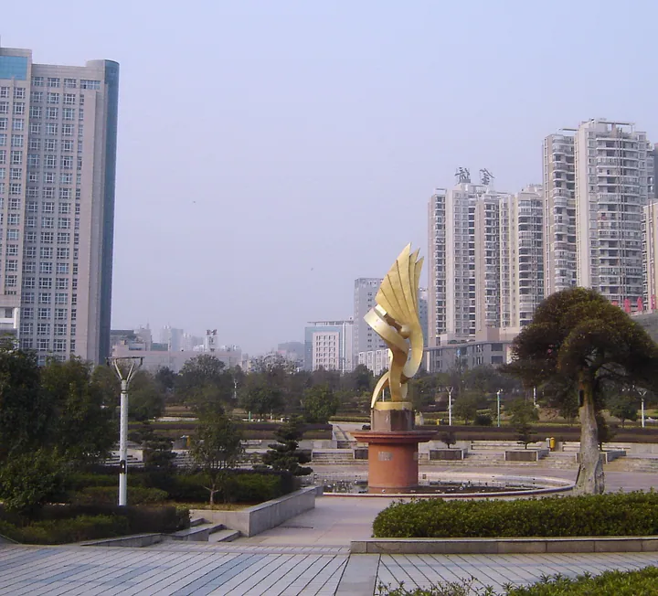
Photo adjustments
Full frame retained; proportionally resized and converted to WebP. No retouching or changes to the photographed subject. Card displays may crop the view.
- Administrative area
- District · 市辖区
- Part of
- Xiangtan
- Chinese name
- 岳塘区
- Local areas
- District guide
Area & population
- Area in the source
- 206.40 km²
- Population · 2020 census
- 483,762
- Administrative seat
- Hetang Subdistrict
Source: cited geographic source, as of the dates shown.
Setting and landscape
Yuetang borders Changsha (长沙) to the north and Zhuzhou (株洲) to the east, faces Yuhu District (雨湖区) across the Xiang, and meets Xiangtan County to the south. The district in its present form was created in June 1992, when Xiangtan's urban districts were redrawn with the river as the boundary.
By the district's count, 102.81 of its 206 square kilometres lie in the Changsha–Zhuzhou–Xiangtan "green heart" (绿心), the ecological green belt between the three cities, making up 19.41 per cent of it. Besides Zhaoshan, its hills include Fengxing Hill (凤形山) and Fahua Mountain (法华山), and Yangtian Lake (仰天湖), about 3,000 mu (some 200 hectares) in area, is covered with lotus.
What to see
Zhaoshan rises to 185 metres on the east bank of the Xiang about 20 kilometres northeast of Xiangtan city. Its name is traced to a southern tour by King Zhao of Zhou (周昭王), and it is also called Mashan (马山) after the Han general Ma Yuan (马援), who is said to have camped here. The Northern Song painter Mi Fu (米芾) painted the hill at sunrise and named the scene "Mountain Market in Clear Mist" (山市晴岚), the name it carries among the Eight Views. The Zhaoshan Chan Temple (昭山禅寺) on the summit was first built in the Tang, and the hill became a provincial scenic area in 1991.
The Xiangtan Museum (湘潭市博物馆), which opened in its new building on Huxiang East Road in December 2015, tells the city's story from prehistory onwards and holds 10,301 items; it was rated a national second-grade museum in 2018. The Xiangtan steelworks culture park (湘钢文化园) on the riverbank covers about 2.31 square kilometres and has 13 stops, among them the works history hall, the No. 1 blast furnace and the five-metre steelmaking and rolling lines.
The district also lists Dongping old town (东坪古镇) and Xiacheng Academy (霞城书院) among its historic sites. Xiangtan University (湘潭大学) and Hunan University of Science and Technology (湖南科技大学) are in or near the district, and its main shopping areas are around Jianshelukou (建设路口) and Banting (板塘).
Getting oriented
The Beijing–Guangzhou and Hunan–Guizhou railways cross the district, the Beijing–Hong Kong–Macau and Shanghai–Kunming expressways meet here, and six bridges cross the Xiang around it.
Highlights
- Zhaoshan 昭山: 185-m hill on the Xiang, "Mountain Market in Clear Mist" of the Eight Views of Xiaoxiang; Tang-founded temple on top.
- Xiangtan Museum 湘潭市博物馆: Opened in 2015 on Huxiang East Road; 10,301 items; national second-grade museum.
- Xiangtan steelworks culture park 湘钢文化园: Riverside steelworks tour of 13 stops including the No. 1 blast furnace.
- Yangtian Lake 仰天湖: Lake of about 3,000 mu now covered with lotus.
Sources for this guide
岳塘概貌-岳塘区人民政府 · Yuetang District People's Government
自然地理-岳塘区人民政府 · Yuetang District People's Government
昭山 · Yuetang District People's Government (district culture and tourism bureau)
湘潭市博物馆 · Yuetang District People's Government (district culture and tourism bureau)
湘钢文化园 · Yuetang District People's Government (district culture and tourism bureau)
岳塘区 - 维基百科,自由的百科全书 · Wikipedia (Chinese) · CC BY-SA 4.0
Original English written from the listed sources and checked sentence by sentence against quoted extracts by a separate reviewer. Updated 2026-09-24.
Explore Yuetang District
Core places to explore, with English and Chinese names.
Yuetang District 岳塘区
Plan your visit
Getting there
Yuetang District is about 5 km in a straight line from central Xiangtan. Search for 岳塘区 in a map app to find stations and your accommodation.
Where to stay →More in Xiangtan
Sources & geographic information
Administrative names and parent areas: Official geographic directory · Reference date 2026-09-06.
Some facts checked against 岳塘区 — Wikipedia contributors, CC BY-SA 4.0.
Map data © OpenStreetMap contributors. Pins mark approximate centres, not entrances or boundaries.