


Get to know Yuhu District
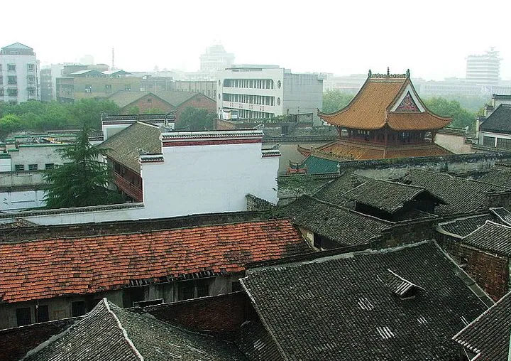
Photo adjustments
Full frame retained; proportionally resized and converted to WebP. No retouching or changes to the photographed subject. Card displays may crop the view.
- Administrative area
- District · 市辖区
- Part of
- Xiangtan
- Chinese name
- 雨湖区
- Local areas
- District guide
Area & population
- Area in the source
- 451.39 km²
- Population · 2015
- 667,000
Source: cited geographic source, as of the dates shown.
Setting and landscape
The district occupies the northwest of Xiangtan city. The Xiang runs along its southern edge, the Lian River (涟水) marks the western boundary with Xiangtan County, and Changsha (长沙) adjoins it to the northeast. Its present shape dates from June 1992, when the city's districts were redrawn with the Xiang as the dividing line and everything west of the river became Yuhu.
What to see
Yuhu Park (雨湖公园), laid out in 1954 on 12 hectares at the west end of the First Xiang River Bridge, is known for its weeping willows. Two bridges, Qixing (七星) and Baxian (八仙), cross the lake, and older features such as the Fayuan Hall (发源殿) and the Xizhao Pavilion (夕照亭) have been restored. One story holds that the lake was named by a Ming prince of Ji (吉王) caught in a spring shower; another says rain simply collected in the low ground.
Old Xiangtan was divided along the river into eighteen numbered quarters, from the first to the eighteenth zong (总), ending at Yaowan (窑湾). The Yaowan historic quarter (窑湾历史文化街区) has stone-paved lanes and Ming and Qing houses, with sites including the Tanbao bus station (潭宝汽车站), Tangxing Bridge (唐兴桥) and the Kuanyu grain store (宽裕粮行); Hunan Daily counts two provincial and seven municipal protected sites there. North along the bank stands Wanlou (万楼), a tower more than 60 metres high with five storeys outside and nine inside; first built in the Ming Wanli reign, it has fallen and been rebuilt six times.
Chengzheng Street (城正街), over 1,500 metres long, was the seat of old Xiangtan County. Walls with six gates were built in the Wanli reign, and remains of Guanxiang Gate (观湘门) and Xichun Gate (熙春门) can still be found. Merchant groups from other provinces gathered here: the Wanshou Palace (万寿宫) at the Tenth Zong was the Jiangxi merchants' guild hall, and the Guansheng Hall (关圣殿) at the Eleventh Zong was built by Shanxi traders.
Getting oriented
Xiangtan railway station, Xiangtan North high-speed station, Xiangtan bus station and a container port at the Fourteenth Zong are all in the district, and the Hunan–Guizhou railway and Shanghai–Kunming expressway cross it. The district government gives the distance from the district centre to Xiangtan North as 12.5 kilometres.
Highlights
- Yuhu Park 雨湖公园: 12-hectare willow park laid out in 1954 at the west end of the First Xiang River Bridge.
- Wanlou 万楼: Riverside tower over 60 m high, first built in the Ming Wanli reign and rebuilt six times.
- Yaowan historic quarter 窑湾历史文化街区: Stone-paved riverside lanes with Ming and Qing houses and nine listed sites.
- Chengzheng Street 城正街: Street of more than 1,500 m that was the seat of old Xiangtan County.
Sources for this guide
雨湖风采-雨湖区人民政府 · Yuhu District People's Government
自然地理-雨湖区人民政府 · Yuhu District People's Government
雨湖区 - 维基百科,自由的百科全书 · Wikipedia (Chinese) · CC BY-SA 4.0
千年雨湖 满城待客(湖南日报 2026年6月25日第15版) · Hunan Daily
Original English written from the listed sources and checked sentence by sentence against quoted extracts by a separate reviewer. Updated 2026-09-24.
Explore Yuhu District
Core places to explore, with English and Chinese names.
Yuhu District 雨湖区
Plan your visit
Getting there
Yuhu District is about 5 km in a straight line from central Xiangtan. Search for 雨湖区 in a map app to find stations and your accommodation.
Where to stay →More in Xiangtan
Sources & geographic information
Administrative names and parent areas: Official geographic directory · Reference date 2026-09-06.
Some facts checked against 雨湖区 — Wikipedia contributors, CC BY-SA 4.0.
Map data © OpenStreetMap contributors. Pins mark approximate centres, not entrances or boundaries.