


Get to know Wulingyuan District
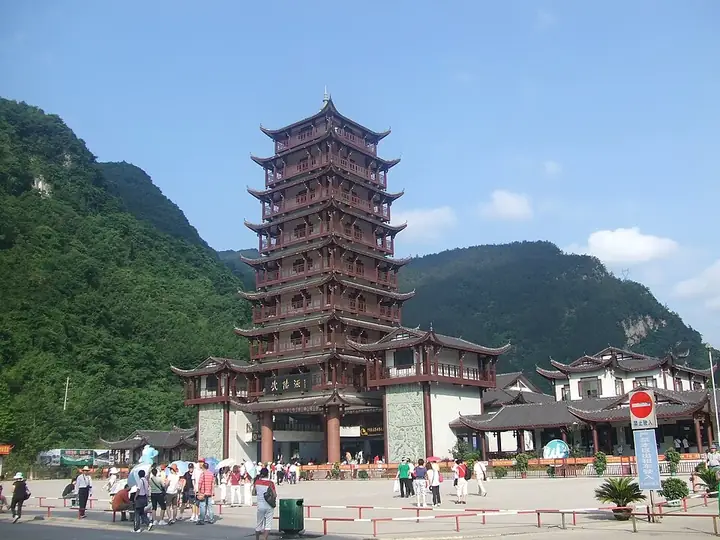
Photo adjustments
Full frame retained; resized proportionally to a maximum dimension of 960 pixels and converted to WebP quality 88. No crop, retouch, generated elements, or subject alteration. Final website rendition: full frame retained, proportionally resized to at most 720 pixels and converted to WebP. No additional retouching or subject alteration. Card displays may crop the view.
- Administrative area
- District · 市辖区
- Part of
- Zhangjiajie
- Chinese name
- 武陵源区
- Local areas
- District guide
Area & population
- Area in the source
- 397.53 km²
- Population · 2020 census
- 60,857
- Administrative seat
- Jundiping Subdistrict
Source: cited geographic source, as of the dates shown.
Setting and landscape
The scenic area counts 3,103 stone peaks standing between 500 and 1,100 m above sea level, from a few tens of metres to 400 m tall. They are cut from Devonian quartz sandstone, 75 to 95 percent quartz, in beds over 520 m thick with dense vertical joints; running water, collapse and weathering shaped the landform. Forest covers 88 percent of the area; the Wuling pine grows only here, alongside dove trees and yews, and the Chinese giant salamander lives here.
History
Zhangjiajie, Suoxiyu (索溪峪) and Tianzi Mountain (天子山) once belonged to three counties. Zhangjiajie became China's first national forest park in 1982, and boundary disputes among the three led Hunan to merge them. Before 1984 "Wulingyuan" was a literary name for the Peach Blossom Spring (桃花源) of poems by Wang Wei and Li Bai; the painter Huang Yongyu (黄永玉) proposed it in the winter of 1984. The State Council approved the district on 18 May 1988 from two townships and a forest farm of Dayong (大庸), Suoxiyu town of Cili (慈利) and Tianzishan town of Sangzhi (桑植). UNESCO inscribed the scenic area as a natural World Heritage site in December 1992; it became a Global Geopark in 2004 and a 5A scenic area in 2007.
Tujia people make up more than 80 percent of the scenic area's minorities. A 2000 district survey found that only 324 people in six villages could still speak or understand some of the Tujia language.
What to see
The World Heritage area joins Zhangjiajie National Forest Park, Suoxiyu, Tianzi Mountain and Yangjiajie. Suoxiyu, a Tujia name meaning "misty mountain village", has more than 2,000 peaks and the Ten-Li Gallery (十里画廊). Tianzi Mountain, in the north, rises to 1,262.5 m and is named after the Tujia leader Xiang Dakun (向大坤), who proclaimed himself emperor at the end of the Southern Song. Yangjiajie, found in 1992, takes its name from the Yang family generals who, by legend, fought him and whose descendants settled here.
Huanglong Cave (黄龙洞) is a karst cave 7.5 km long with two dry and two water levels, visited on foot and by boat on its underground river; its best-known feature is a 20 m stalactite pillar called Dinghai Shenzhen (定海神针). The district government lists smaller relics such as the Ming-built Longfeng Nunnery (龙凤庵) and the Chaotian Temple (朝天观), where only stone walls and a gate survive.
Highlights
- Wulingyuan Scenic and Historic Interest Area 武陵源风景名胜区: World Heritage site since 1992, with 3,103 quartz-sandstone peaks.
- Huanglong Cave 黄龙洞: 7.5 km karst cave with an underground river and a 20 m stalactite pillar.
- Tianzi Mountain 天子山: Northern scenic area rising to 1,262.5 m, named after a self-proclaimed Tujia emperor.
- Suoxiyu 索溪峪: More than 2,000 peaks and the Ten-Li Gallery; the name is Tujia for a misty mountain village.
Sources for this guide
武陵源区 - 维基百科,自由的百科全书 · Wikipedia (Chinese) · CC BY-SA 4.0
武陵源风景名胜区 - 维基百科,自由的百科全书 · Wikipedia (Chinese) · CC BY-SA 4.0
黄龙洞 (张家界) - 维基百科,自由的百科全书 · Wikipedia (Chinese) · CC BY-SA 4.0
武陵源区人民政府门户网站——概况信息 · Wulingyuan District People's Government
Original English written from the listed sources and checked sentence by sentence against quoted extracts by a separate reviewer. Updated 2026-09-25.
Explore Wulingyuan District
Core places to explore, with English and Chinese names.
Places to explore around Wulingyuan District
 Sandstone pillars viewed from Tianzi Mountain in Wulingyuan, Zhangjiajie · 武陵源天子山峰林
Wulingyuan and Zhangjiajie National Forest Park武陵源(张家界国家森林公园等)
Wulingyuan (武陵源) is the collective name for the core protected landscape of Zhangjiajie in northwestern Hunan, a terrain of quartz sandstone pillars and ravines that forms its own county-level district. It covers Zhangjiajie National Forest Park together with the Tianzishan, Suoxiyu and Yangjiajie nature reserves.
Read the place guide →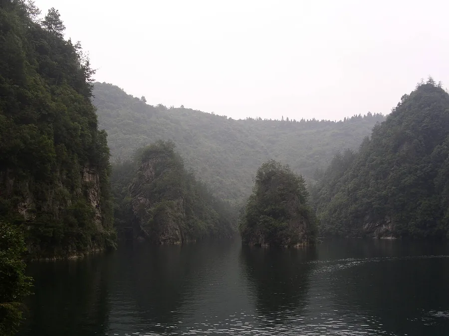 Baofeng Lake between wooded stone cliffs at Zhangjiajie, June 2006.
Baofeng Lake宝峰湖
Baofeng Lake occupies a dammed mountain valley south of Wulingyuan town. Its boat route places visitors close to the reflections of wooded stone peaks, offering a gentler perspective than the high plateau viewpoints. The…
Read the place guide →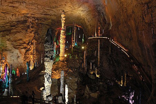 Illuminated stalagmites inside Huanglong Cave, Wulingyuan District, Zhangjiajie · 张家界武陵源区黄龙洞,彩灯照明的钟乳石景观 Source-recorded photograph date: 2008-11.
Yellow Dragon Cave黄龙洞
Huanglong Cave (黄龙洞) is a large karst cave system at Hekou village in Suoxiyu town, Wulingyuan District, Zhangjiajie, Hunan, inside the Wulingyuan world natural heritage area. Its passages run on four levels and combine dry galleries with a flooded underground river.
Read the place guide →Plan your visit
Getting there
Wulingyuan District is about 25 km in a straight line from central Zhangjiajie. Search for 武陵源区 in a map app to find stations and your accommodation.
Where to stay →Build your route
Wulingyuan and Zhangjiajie National Forest Park and Baofeng Lake are both listed here. The linked place guides have entrance and visit details.
Continue with Zhangjiajie →More in Zhangjiajie
Sources & geographic information
Administrative names and parent areas: Official geographic directory · Reference date 2026-09-06.
Some facts checked against 武陵源区 — Wikipedia contributors, CC BY-SA 4.0.
Some facts checked against 武陵源风景名胜区 — Wikipedia contributors, CC BY-SA 4.0.
Some facts checked against 黄龙洞 (张家界) — Wikipedia contributors, CC BY-SA 4.0.
Photo: Wulingyuan and Zhangjiajie National Forest Park · chensiyuan · CC BY-SA 4.0. Full source framing retained; proportionally resized and converted to WebP. No retouching or subject alteration. Card displays may crop the view.

Photo: Baofeng Lake · Yoo Chung · CC BY-SA 2.5. Proportionally resized and converted to WebP without cropping, retouching or changing the photographed subject.

Photo: Yellow Dragon Cave · Brookqi · Public domain. Wikimedia thumbnail; fitted to the ranking-card frame.

Map data © OpenStreetMap contributors. Pins mark approximate centres, not entrances or boundaries.