


Get to know Yongding District
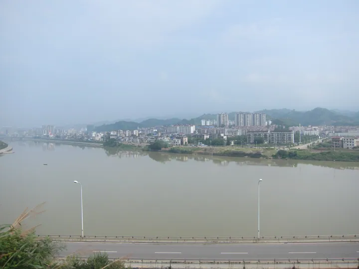
Photo adjustments
Full frame retained; proportionally resized and converted to WebP. No retouching or changes to the photographed subject. Card displays may crop the view.
- Administrative area
- District · 市辖区
- Part of
- Zhangjiajie
- Chinese name
- 永定区
- Local areas
- District guide
Area & population
- Area in the source
- 2,169.03 km²
Source: cited geographic source, as of the dates shown.
Setting and landscape
The Zhangjiajie city government describes the district as rising in two directions from a low, half-ringed basin of hills in the middle. To the north the mountains fall toward the valley of the Li River, whose upper course here cuts the Maoyan River Grand Canyon (茅岩河大峡谷); the main stream of the Li runs 96.8 kilometres through the district. To the south the mountains are higher, with Tianmen Mountain as the landmark, and step down toward the Yuan River (沅水).
History
According to the city's history of the area, in 263 the Wu emperor Sun Xiu (孙休), after seeing a cave on Songliang Mountain (嵩梁山) open like a gate, renamed it Tianmen ("Heaven's Gate") Mountain. Early in the Ming a military garrison, the Dayong Guard (大庸卫), was set up here and renamed Yongding Guard in 1389; Yongding County followed in 1735. It became Dayong County in 1914 to avoid sharing a name with Yongding in Fujian, and in November 1934 Red Army forces under He Long (贺龙) and Ren Bishi (任弼时) took the county. When Dayong became a prefecture-level city in 1988, the former county-level city of Dayong was renamed Yongding District; the city took the name Zhangjiajie in 1994.
Tujia villages and traditions
Minority peoples make up most of the district's population. Tujia stilt-house villages survive intact at Shiyanping (石堰坪村) and Matouxi (马头溪村) in Wangjiaping town (王家坪镇) and at Mudixi (牧笛溪村) in Sidouping township (四都坪乡). The Tujia Lantern Festival and "Sixth of the Sixth Month" (六月六) celebrations are well known, and listed traditions include the Tujia Maogusi (茅古斯) and Zhangjiajie Yang opera (阳戏).
Getting oriented
The district is Zhangjiajie's transport hub, with Zhangjiajie Hehua International Airport (张家界荷花国际机场), Zhangjiajie Station and the high-speed Zhangjiajie West Station. The Zhicheng-Liuzhou railway crosses it, and expressways lead east to Changsha, west to Huayuan (花垣) and north-west to Sangzhi (桑植). Cili (慈利) lies to the east, Yongshun (永顺) to the west and Yuanling (沅陵) to the south.
Highlights
- Tianmen Mountain 天门山: The landmark of the higher southern mountains, named Tianmen in 263.
- Maoyan River Grand Canyon 茅岩河大峡谷: Gorge cut by the upper Li River in the north of the district.
- Shiyanping village 石堰坪村: Tujia village with an intact group of stilt houses.
- Maogusi 茅古斯: Tujia tradition named among the district's intangible heritage.
Sources for this guide
永定区 (张家界市) · Chinese Wikipedia · CC BY-SA 4.0
魅力永定 · Zhangjiajie Municipal People's Government
历史沿革 · Zhangjiajie Municipal People's Government
Original English written from the listed sources and checked sentence by sentence against quoted extracts by a separate reviewer. Updated 2026-09-25.
Explore Yongding District
Core places to explore, with English and Chinese names.
Places to explore around Yongding District
 Tianmen Mountain National Forest Park ·
 Plan your visit
Getting there
Yongding District covers the centre of Zhangjiajie. Search for 永定区 in a map app to find stations and your accommodation.
Where to stay →Build your route
Start with Tianmen Mountain. The linked place guides have entrance and visit details.
Continue with Zhangjiajie →More in Zhangjiajie
Sources & geographic information
Administrative names and parent areas: Official geographic directory · Reference date 2026-09-06.
Some facts checked against 永定区 (张家界市) — Wikipedia contributors, CC BY-SA 4.0.
Photo: Tianmen Mountain · xiquinhosilva · CC BY 2.0. Wikimedia thumbnail; fitted to the ranking-card frame.
.jpg)
Map data © OpenStreetMap contributors. Pins mark approximate centres, not entrances or boundaries.