

Photo adjustments
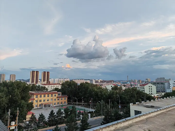
Full frame retained; proportionally resized and converted to WebP. No retouching or changes to the photographed subject. Card displays may crop the view.
Explore the region
About Ulanhot
The May First Meeting Site preserves the modest brick hall associated with that event, while Genghis Khan Temple on Hanshan reflects a different strand of twentieth-century Mongol commemoration. Visiting both gives the city more depth than using it only as a transport stop. Begin with the meeting hall, then climb Hanshan for the temple's distinctive silhouette.
Ulanhot was originally named Wangye Temple (王爷庙), after Puhui Temple (普惠寺), a family temple built in 1691 by Eqi'er (鄂齐尔), the third-generation prince of the Khorchin Right-Wing Front Banner (科尔沁右翼前旗), also known as Zhasaketu Banner (札萨克图旗). The modern name comes from Mongolian, ulan meaning red and hot meaning city, so the city is sometimes called the 'Red City'. After the Inner Mongolia Autonomous Government was founded here on 1 May 1947, the city served as its capital until the government moved to Zhangjiakou in December 1949 and then, in June 1952, to Hohhot, which has remained the regional capital since.
The city lies in eastern Inner Mongolia on the southern foothills of the Greater Khingan Range (大兴安岭), within the Khorchin grassland. It borders Taonan (洮南市) in Jilin province to the south, Zhalaite Banner (扎赉特旗) to the east, and the Khorchin Right-Wing Front Banner to the west and north. The built-up area covers 23 square kilometers, with an urban population of 217,000. The terrain is hilly in the north and an alluvial plain in the south, at an average elevation of 263.6 meters, with a temperate continental monsoon climate and a frost-free period of 134 days.
What to look for
- The brick assembly hall at the May First Meeting Site.
- The domed Genghis Khan Temple on Hanshan above the northern city.
Location & getting there
Getting to Ulanhot
For this urban circuit, start at the May First Meeting Site on Wuyi North Road in Ulanhot.
- Continue by local transport to Hanshan Park on Xing'an North Road for the uphill temple visit.
Combine your visit
Suggested order within this visit:
-
May First Meeting Site
Begin with the city's role in 1947.
-
Genghis Khan Temple乌兰浩特成吉思汗庙
Continue to Hanshan for the contrasting memorial architecture.
This sequence is an editorial suggestion based on the features described in the sources. Access to individual buildings or areas should be checked locally; no travel time or shared admission is implied.
Find Ulanhot overview
乌兰浩特 · 兴安盟
The pin marks the area, not the entrance.
More places nearby
Approximate straight-line distances between map pins, not travel distances.
Ulan Hot Genghis Khan Temple 乌兰浩特成吉思汗庙
4 km awayUlanhot's Genghis Khan Temple crowns Hanshan with a central domed hall and lower side halls, creating a recognisable three-part silhouette. First built in the 1940s and subsequently restored, it is a memorial building rather…
View guide →Arxan National Forest Park 阿尔山国家森林公园
175 km awayArxan Forest Park combines volcanic landforms with the forests of the Greater Khingan Range. At Shitanglin, dark solidified lava breaks into an irregular stone landscape, with plants returning between the rocks. Nearby Dujuan…
View guide →Khan Mountain 可汗山
202 km awayKhan Mountain is a modern monumental sculpture landscape north of Holingol. Large heads of Mongol and Yuan rulers rise on the hillside above ranks of sculpted warriors, turning the slope into an open-air historical tableau. The…
View guide →Sources & visit information
The sources below support the place-specific description and arrival information. Suggested combinations are editorial planning ideas; confirm current opening, entry arrangements and transport services for your date.
- Wikipedia: 乌兰浩特市 ↗
- Xing'an League government: May First Meeting Site and Wuyi North Road ↗
- Ctrip venue profile: Genghis Khan Temple on Hanshan ↗
- English Wikipedia: Ulanhot (revision 1367357772, 2026-08-02) ↗
Visitor information adapted and edited from Wikipedia contributors · CC BY-SA 4.0. Source revision 93903187.
Background paragraphs translated and condensed from Wikipedia contributors, "乌兰浩特市", Chinese Wikipedia · CC BY-SA 4.0. Source revision 93903187.
Background paragraphs condensed from Wikipedia contributors, "Ulanhot", English Wikipedia · CC BY-SA 4.0. Source revision 1367357772.