


Get to know Hanjiang District
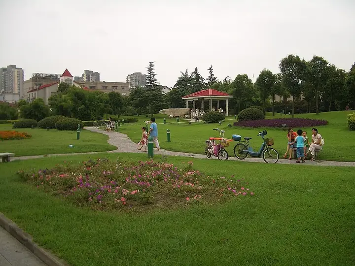
Photo adjustments
Full frame retained; resized proportionally to a maximum dimension of 960 pixels and converted to WebP quality 88. No crop, retouch, generated elements, or subject alteration. Final website rendition: full frame retained, proportionally resized to at most 720 pixels and converted to WebP. No additional retouching or subject alteration. Card displays may crop the view.
- Administrative area
- District · 市辖区
- Part of
- Yangzhou
- Chinese name
- 邗江区
- Local areas
- District guide
Area & population
- Area in the source
- 552.68 km²
- Population · 2018
- 706,800
Source: cited geographic source, as of the dates shown.
History
Fuchai dug the Han Canal and built the walled town of Han (邗城) more than 2,500 years ago, and Chinese Wikipedia calls Hanjiang the birthplace of ancient Yangzhou. The old canal later became the southern section of the Sui and Tang Grand Canal, completed under Emperor Yang of Sui. The character han (邗) is glossed as an old town by the water. The northern part of the city was once the separate Weiyang District (维扬区); it was abolished in late 2011 and merged into Hanjiang.
What to see
Daming Temple (大明寺) stands on the central peak of the Shugang (蜀冈) hills and takes its name from the Daming era (457-464) of the Liu Song dynasty, when it was founded. The monk Jianzhen (鉴真) taught here before he sailed to Japan in 753 after five failed attempts. The Jianzhen Memorial Hall, designed by the architect Liang Sicheng (梁思成), was completed in 1973, and the nine-storey Qiling Pagoda (栖灵塔), first built in 601 and burned in 843, was rebuilt in 1995. Pingshan Hall (平山堂) was built by the Song writer Ouyang Xiu (欧阳修) while he governed Yangzhou; its name, 'level with the hills', refers to the view of the hills south of the Yangtze. The temple, then in Weiyang District, became a national key heritage site in 2006.
The Yangzhou Museum (扬州博物馆) on Wenchang West Road (文昌西路) combines the city museum with the China Block Printing Museum (中国雕版印刷博物馆), both opened in 2005. Its displays centre on the history of printing and shipbuilding and on a Yuan-dynasty dragon vase, a blue-glazed piece with a white dragon of which only three are known.
Getting oriented
The Runyang Yangtze River Bridge (润扬长江公路大桥), which spans about four kilometres of river including an island, is one of the major transport works within the district.
Food and local products
Farm products named for the district include rice, waterfowl, ginkgo, tea and goldfish.
Highlights
- Daming Temple 大明寺: Temple on the Shugang hills founded 457-464, where Jianzhen taught before sailing to Japan; national key site since 2006.
- Jianzhen Memorial Hall 鉴真纪念堂: Designed by Liang Sicheng and completed in 1973.
- Pingshan Hall 平山堂: Built by Ouyang Xiu while he governed Yangzhou.
- Yangzhou Museum 扬州博物馆: City museum and China Block Printing Museum, opened together in 2005.
- Han Canal 邗沟: Canal first dug by King Fuchai of Wu, which gives the district its name.
Sources for this guide
邗江区 - 维基百科,自由的百科全书 · Chinese Wikipedia · CC BY-SA 4.0
扬州大明寺 - 维基百科,自由的百科全书 · Chinese Wikipedia · CC BY-SA 4.0
大明寺 - 维基百科,自由的百科全书 · Chinese Wikipedia · CC BY-SA 4.0
扬州博物馆 - 维基百科,自由的百科全书 · Chinese Wikipedia · CC BY-SA 4.0
Hanjiang District, Yangzhou - Wikipedia · English Wikipedia · CC BY-SA 4.0
Original English written from the listed sources and checked sentence by sentence against quoted extracts by a separate reviewer. Updated 2026-09-25.
Explore Hanjiang District
Core places to explore, with English and Chinese names.
Places to explore around Hanjiang District
 The entrance of Daming Temple in Yangzhou · 大明寺 Photograph date recorded by the source: October 2007.
Daming Temple大明寺
Daming Temple occupies the middle peak of Shugang in Yangzhou. It is closely associated with Jianzhen, the monk who later carried Buddhist teachings to Japan.
Read the place guide → Twenty-Four Bridge at Slender West Lake · 瘦西湖二十四桥 Photograph date recorded by the source: 18 April 2017, 11:02:09.
Slender West Lake瘦西湖
Slender West Lake winds through a restored garden landscape northwest of Yangzhou’s old city. Its narrow waterway developed from earlier moats and canals, later bordered by wealthy merchants’ estates.
Read the place guide → Yangzhou Museum and China Block Printing Museum shared building · 扬州博物馆与中国雕版印刷博物馆馆舍 Photograph date recorded by the source: Capture date not specified on the source file page..
Yangzhou Museum扬州博物馆
Yangzhou Museum shares the western-city Double Museum building with the China Block Printing Museum. Its collection connects the canal city with archaeology and decorative arts, including the celebrated Yuan blue-glazed vase…
Read the place guide →Plan your visit
Getting there
Hanjiang District is about 6 km in a straight line from central Yangzhou. Search for 邗江区 in a map app to find stations and your accommodation.
Where to stay →Build your route
Daming Temple and Slender West Lake are about 2 km apart in a straight line. The linked place guides have entrance and visit details.
Continue with Yangzhou →More in Yangzhou
Sources & geographic information
Administrative names and parent areas: Official geographic directory · Reference date 2026-09-06.
Some facts checked against 邗江区 — Wikipedia contributors, CC BY-SA 4.0.
Some facts checked against 扬州大明寺 — Wikipedia contributors, CC BY-SA 4.0.
Some facts checked against 大明寺 — Wikipedia contributors, CC BY-SA 4.0.
Some facts checked against 扬州博物馆 — Wikipedia contributors, CC BY-SA 4.0.
Some facts checked against Hanjiang District, Yangzhou — Wikipedia contributors, CC BY-SA 4.0.
Photo: Daming Temple · Gisling · CC BY-SA 4.0. Full frame retained; proportionally resized and converted to WebP. No retouching or changes to the photographed subject. Card displays may crop the view.

Photo: Slender West Lake · Amarespeco · CC BY-SA 4.0. Full frame retained; proportionally resized and converted to WebP. No retouching or changes to the photographed subject. Card displays may crop the view.

Photo: Yangzhou Museum · Vmenkov · Vmenkov — Yangzhou-Double-Museum-2869.jpg — CC BY-SA 3.0 · CC BY-SA 3.0. Full frame retained; proportionally resized and converted to WebP. No retouching or changes to the photographed subject. Card displays may crop the view.

Map data © OpenStreetMap contributors. Pins mark approximate centres, not entrances or boundaries.