


Get to know Yushui District

Photo adjustments
Full frame retained; proportionally resized and converted to WebP. No retouching or changes to the photographed subject. Card displays may crop the view.
- Administrative area
- District · 市辖区
- Part of
- Xinyu
- Chinese name
- 渝水区
- Local areas
- District guide
Area & population
- Area in the source
- 1,775.00 km²
- Population · 2018
- 697,100
Source: cited geographic source, as of the dates shown.
Setting and landscape
The district is high to the north and south and low in the middle, where the Yuan River crosses it from west to east. Local people sum up the land as "five parts hills, one part water, three parts fields". Meng Mountain (蒙山) rises on the north side, Liang Mountain (良山) on the south and Baizhang Peak (百丈峰) on the east; the highest point, Baiyun Peak (白云峰) in the Meng Mountain range, reaches 1,004.5 metres. The Yuan River rises on the north slopes of the Wugong Mountains (武功山) and joins the Gan River (赣江) in Zhangshu (樟树). The district history office describes the wollastonite beds around Meng Mountain as the largest wollastonite deposit area in the world.
History
A county was founded here in 267, under the Wu state of the Three Kingdoms, and named Xinyu (新渝) after Yushui, the old name of the middle Yuan River. In 742 the name was rewritten as Xinyu (新喻) with a different second character, and in 773 floods on the Yuan drove the county seat to Hukan Hill (虎瞰山) on the north bank. In May 1930 a county Soviet government was set up at Shangmuyuan village (上木元村) in Liangshan. The State Council changed the written form to Xinyu (新余) in 1957. A Xinyu city created in 1960 for the steel industry was dissolved in 1963, and when Xinyu became a city again in 1983 the former county area was made Yushui District.
What to see
Baizhangfeng Scenic Area (百丈峰景区), a national 3A site and provincial forest park, lies about 35 km southeast of the city where Yushui meets Xingan (新干) and Xiajiang (峡江) counties. The Xiabao Scenic Area (下保景区) in Xiabao village, Liangshan town, 18 km from the city, is a national 3A site with 86 percent forest cover. Queqiao Village (鹊桥村), next to Xiannu Lake (仙女湖), dates from the Ming dynasty and takes its name from the legend of the Cowherd and the Weaver Girl meeting on a bridge of magpies; it holds a Qixi (七夕) festival. The Xiannu Lake scenic area has administered Hexia town and Jiulongshan township since 2000, and more of the district's towns have been placed under it since.
Food and local products
Hushan sweet-and-sour garlic (鹄山糖醋大蒜) from Hushan township is a traditionally made pickle with a translucent look, which the district lists as a well-known Xinyu brand.
Highlights
- Baizhangfeng Scenic Area 百丈峰景区: National 3A scenic area and provincial forest park about 35 km southeast of Xinyu.
- Queqiao Village 鹊桥村: Ming-dynasty village beside Xiannu Lake, named after the Cowherd and Weaver Girl legend.
- Xiannu Lake 仙女湖: Scenic area that has administered Hexia town and Jiulongshan township since 2000.
- Hushan sweet-and-sour garlic 鹄山糖醋大蒜: Traditionally made pickled garlic from Hushan.
Sources for this guide
渝水区 - 维基百科,自由的百科全书 · Chinese Wikipedia · CC BY-SA 4.0
渝水区概况 · Yushui District People's Government (district history office)
历史沿革 · Yushui District People's Government (district history office)
鹄山糖醋大蒜 · Yushui District People's Government
Original English written from the listed sources and checked sentence by sentence against quoted extracts by a separate reviewer. Updated 2026-09-25.
Explore Yushui District
Core places to explore, with English and Chinese names.
Places to explore around Yushui District
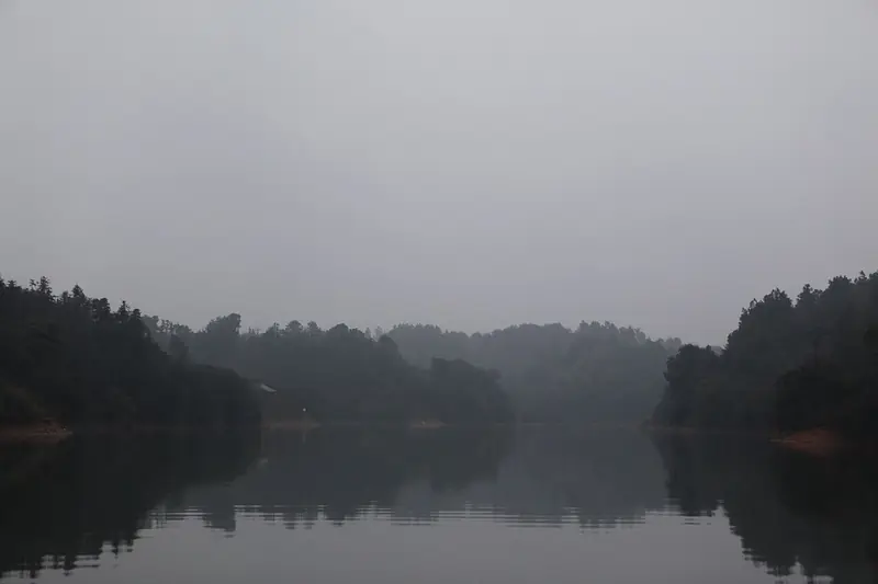 Xiannü Lake ·
 Plan your visit
Getting there
Yushui District is about 8 km in a straight line from central Xinyu. Search for 渝水区 in a map app to find stations and your accommodation.
Where to stay →Build your route
Start with Xiannü Lake. The linked place guides have entrance and visit details.
Continue with Xinyu →More in Xinyu
Sources & geographic information
Administrative names and parent areas: Official geographic directory · Reference date 2026-09-06.
Some facts checked against 渝水区 — Wikipedia contributors, CC BY-SA 4.0.
Photo: Xiannü Lake · 张元柏 · CC BY-SA 3.0. EXIF orientation normalized; resized without changing aspect ratio; converted to WebP. No subject edits.

Map data © OpenStreetMap contributors. Pins mark approximate centres, not entrances or boundaries.