


Get to know Zhenlai County
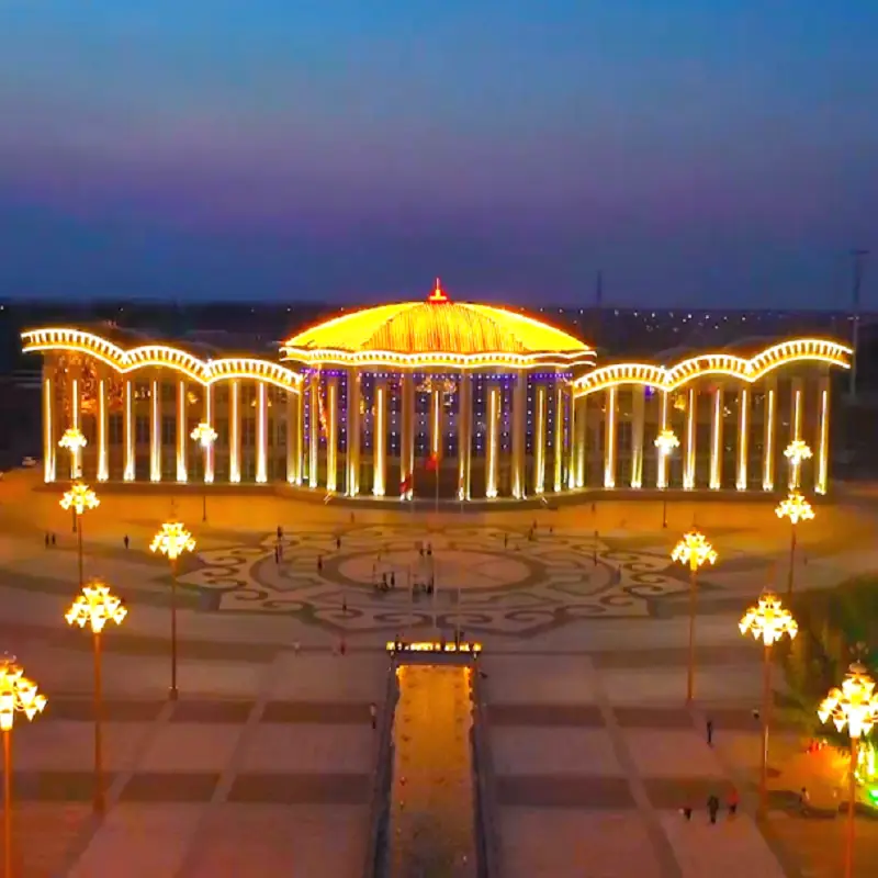
Photo adjustments
EXIF orientation normalized; resized without changing aspect ratio; converted to WebP. No subject edits.
- Administrative area
- County · 县
- Part of
- Baicheng
- Chinese name
- 镇赉县
- Local areas
- County guide
Area & population
- Area in the source
- 5,389.00 km²
- Administrative seat
- Zhenlai Town (镇赉镇)
Source: cited geographic source, as of the dates shown.
Setting and landscape
The Nen River (嫩江) forms the eastern edge of the county, with Dorbod Mongol Autonomous County (杜尔伯特蒙古族自治县) and Zhaoyuan County (肇源县) in Heilongjiang on the far bank. The north of Zhenlai joins the outer terraces of the Greater Khingan range (大兴安岭), the middle is rolling low ridges, and the east and south are wide alluvial plains, and the land descends from northwest to southeast. Elevations stay between 129 and 149 metres.
What to see
The Momoge National Nature Reserve (莫莫格国家级自然保护区), also called the Momoge wetland, lies where the Nen and Taoer rivers meet in the western Songnen Plain. It is an inland saline-alkali wetland whose main purpose is protecting the red-crowned crane (丹顶鹤) and other rare waterbirds. The Jilin provincial government approved the reserve in March 1981, and in 2013 it was added to the Ramsar list of wetlands of international importance. Its vegetation is mainly Leymus (羊草) meadow steppe between dunes and marshes, and the marshes are mainly sedge, reedgrass and reed. Since 2002 water has been diverted from the Nen River to counter the wetland's degradation.
History
The county government points to a mammoth molar found at the Baishatan (白沙滩) pumping station in Dandai township and several Neolithic sites as evidence of settlement more than 5,000 years ago. From the Yuan to the late Qing the area was grazing land for Mongol nobility. After the Mongol lands were opened to settlement in 1902, Han farmers moved in, and in 1910 Zhendong County (镇东县) was created from the eastern part of the fief of the Horqin Right Wing Rear Banner's Zhenguo duke. In August 1947 Zhendong and Laibei (赉北县) counties were merged to form Zhenlai. The county moved to Jilin's Baicheng prefecture in August 1954 and has belonged to Baicheng city since 1993.
Highlights
- Momoge National Nature Reserve 莫莫格国家级自然保护区: Saline-alkali wetland at the meeting of the Nen and Taoer rivers, protecting the red-crowned crane; on the Ramsar list since 2013.
Sources for this guide
地理概况 · Zhenlai County People's Government
历史沿革 · Zhenlai County People's Government
镇赉县 - 维基百科,自由的百科全书 · Wikipedia (Chinese) · CC BY-SA 4.0
莫莫格国家级自然保护区 - 维基百科,自由的百科全书 · Wikipedia (Chinese) · CC BY-SA 4.0
Original English written from the listed sources and checked sentence by sentence against quoted extracts by a separate reviewer. Updated 2026-09-25.
Explore Zhenlai County
Core places to explore, with English and Chinese names.
Places to explore around Zhenlai County
 AI illustration · AI
 Plan your visit
Getting there
Zhenlai County is about 40 km in a straight line from central Baicheng. Search for 镇赉县 in a map app to find stations and your accommodation.
Where to stay →Build your route
Start with Momoge Wetland Birdwatching Areas. The linked place guides have entrance and visit details.
Continue with Baicheng →More in Baicheng
Sources & geographic information
Administrative names and parent areas: Official geographic directory · Reference date 2026-09-06.
Some facts checked against 镇赉县 — Wikipedia contributors, CC BY-SA 4.0.
Some facts checked against 莫莫格国家级自然保护区 — Wikipedia contributors, CC BY-SA 4.0.
Map data © OpenStreetMap contributors. Pins mark approximate centres, not entrances or boundaries.