


Get to know Taobei District
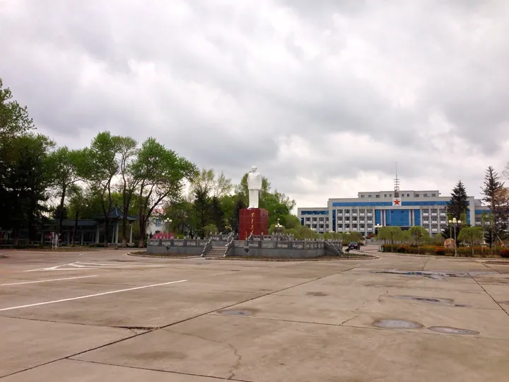
Photo adjustments
Full frame retained; proportionally resized and converted to WebP. No retouching or changes to the photographed subject. Card displays may crop the view.
- Administrative area
- District · 市辖区
- Part of
- Baicheng
- Chinese name
- 洮北区
- Local areas
- District guide
Area & population
- Area in the source
- 2,578.34 km²
- Population · 2020 census
- 356,054
- Administrative seat
- Haiming Subdistrict
Source: cited geographic source, as of the dates shown.
Setting and landscape
The Tao'er River forms the boundary with Taonan (洮南市) to the west and south. Da'an (大安市) and Zhenlai County (镇赉县) lie to the east and northeast, and Horqin Right Front Banner (科尔沁右翼前旗) of Inner Mongolia to the north. The district government describes a continental monsoon climate with dry, windy springs and long, cold winters with little snow: the mean January temperature is −16.3°C, the mean July temperature 23.7°C, and annual rainfall averages 399.8 mm, most of it between June and August.
History
The Jilin local chronicles office places the seat of the Liao dynasty's Changchun prefecture (长春州) at the Chengsijiazi ancient city (城四家子古城) in Deshun Mongolian Ethnic Township (德顺蒙古族乡). It describes Changchun prefecture as a travelling residence of four Liao emperors and the dynasty's political centre in spring. The Jin kept the prefecture until 1150, re-established Taizhou (泰州) prefecture there in 1198, and the Yuan ran Taining (泰宁) from the same walled city.
In modern times, Jing'an County (靖安县) was created in 1904 under Taonan prefecture and renamed Tao'an (洮安县) in 1914. Tao'an station opened when the Taonan–Ang'angxi railway began running in July 1926, and the county was called Baicheng from 1938. The town of Baicheng became a county-level city in 1958; in August 1993, when Baicheng became a prefecture-level city, that city was abolished and replaced by Taobei District.
Highlights
- Chengsijiazi ancient city 城四家子古城: Walled site in Deshun Township identified by the Jilin chronicles office as the seat of Liao Changchun prefecture and Jin Taizhou.
Sources for this guide
地理概况 · Taobei District People's Government, Baicheng
气候特点 · Taobei District People's Government, Baicheng
游遍吉林——白城市 · Jilin Provincial Local Chronicles Compilation Committee
洮北区 - 维基百科,自由的百科全书 · Wikipedia (Chinese) · CC BY-SA 4.0
Original English written from the listed sources and checked sentence by sentence against quoted extracts by a separate reviewer. Updated 2026-09-25.
Explore Taobei District
Core places to explore, with English and Chinese names.
Taobei District 洮北区
Plan your visit
Getting there
Taobei District covers the centre of Baicheng. Search for 洮北区 in a map app to find stations and your accommodation.
Where to stay →More in Baicheng
Sources & geographic information
Administrative names and parent areas: Official geographic directory · Reference date 2026-09-06.
Some facts checked against 洮北区 — Wikipedia contributors, CC BY-SA 4.0.
Map data © OpenStreetMap contributors. Pins mark approximate centres, not entrances or boundaries.