


Get to know Tongyu County
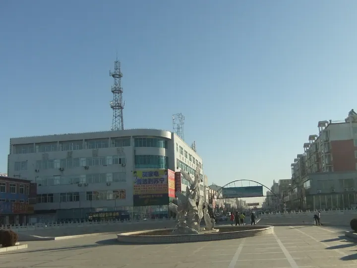
Photo adjustments
Full frame retained; proportionally resized and converted to WebP. No retouching or changes to the photographed subject. Card displays may crop the view.
- Administrative area
- County · 县
- Part of
- Baicheng
- Chinese name
- 通榆县
- Local areas
- County guide
Area & population
- Area in the source
- 8,476.00 km²
- Administrative seat
- Kaitong (开通镇)
Source: cited geographic source, as of the dates shown.
Setting and landscape
Most of the county stands 140 to 180 metres above sea level, rising slightly to the northwest. The county government describes a semi-arid continental monsoon climate with about 350 mm of rain a year. Three seasonal rivers cross it, the Huolin (霍林河), the Emutai (额木太河) and the Wenniugechi (文牛格尺河), and there are more than a hundred natural ponds besides the Xianghai, Xinglong (兴隆) and Shengli (胜利) reservoirs.
History
Kaitong County (开通县) was founded in 1904 under Taonan prefecture, and Zhanyu County (瞻榆县) followed on 1 November 1915. On 16 October 1958 the two were abolished and merged to form Tongyu.
What to see
Xianghai is a national nature reserve and 4A scenic area of 106,700 hectares in the middle of the Horqin grassland. It was placed on the list of wetlands of international importance in 1992. The Jilin local chronicles office records 173 bird species there, including six kinds of crane, and calls it the home of the red-crowned crane. The Xianghai Wetland Birdwatching Areas (向海国家级自然保护区开放观鸟区) lie within the reserve.
The county government also lists a 20,000-mu apricot wood at Baolawendu (包拉温都), a provincial nature reserve, and a wood of Mongolian yellow elm on Xinglong Hill (兴隆山), which it calls the largest in Asia. Heritage sites include Xianghai Temple (香海寺), the Wulantala site (乌兰塔拉遗址), a Qing-dynasty princess's tomb and a Neolithic site at Aobao Hill (敖包山).
Food and local products
Tongyu is known for minor grains and pulses and for dried red chillies; the county government names millet, mung beans, sorghum and quinoa among its crops. The Tongyu Chinese Grassland Red cattle breed (通榆中国草原红牛) was developed in the county and is a protected geographical indication.
Highlights
- Xianghai Wetland Birdwatching Areas 向海国家级自然保护区开放观鸟区: Within a Ramsar-listed reserve with 173 bird species, six of them cranes.
- Xinglong Hill elm wood 兴隆山蒙古黄榆林: Mongolian yellow elm wood the county calls Asia's largest.
- Baolawendu apricot wood 包拉温都杏树林: 20,000-mu provincial nature reserve.
- Tongyu Chinese Grassland Red cattle 通榆中国草原红牛: Cattle breed developed in the county; geographical indication.
Sources for this guide
通榆概况 · Tongyu County People's Government
地理概况 · Tongyu County People's Government
游遍吉林——白城市 · Jilin Provincial Local Chronicles Compilation Committee
Original English written from the listed sources and checked sentence by sentence against quoted extracts by a separate reviewer. Updated 2026-09-25.
Explore Tongyu County
Core places to explore, with English and Chinese names.
Places to explore around Tongyu County
 AI illustration · AI
 Plan your visit
Getting there
Tongyu County is about 90 km in a straight line from central Baicheng. Search for 通榆县 in a map app to find stations and your accommodation.
Where to stay →Build your route
Start with Xianghai Wetland Birdwatching Areas. The linked place guides have entrance and visit details.
Continue with Baicheng →More in Baicheng
Sources & geographic information
Administrative names and parent areas: Official geographic directory · Reference date 2026-09-06.
Map data © OpenStreetMap contributors. Pins mark approximate centres, not entrances or boundaries.