


Get to know Lingyuan
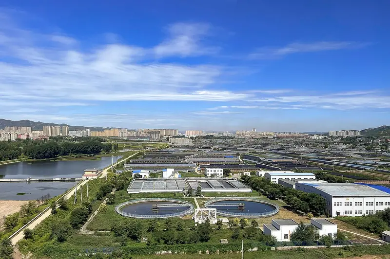
Photo adjustments
Full frame retained; EXIF orientation normalized, proportionally resized to at most 800 pixels and converted to WebP. No generated pixels or subject changes. Cards may crop the display.
- Administrative area
- County-level city · 县级市
- Part of
- Chaoyang
- Chinese name
- 凌源市
- Local areas
- County-level city guide
Area & population
- Area in the source
- 3,263.00 km²
- Population · 2017
- 646,000
Source: cited geographic source, as of the dates shown.
Setting and orientation
Lingyuan borders Jianping (建平县) and Ningcheng (宁城县) in Inner Mongolia to the north, Harqin Left Wing (喀左县) to the east, Pingquan (平泉市) in Hebei to the west, and Jianchang (建昌县) and Qinglong (青龙县) in Hebei to the south. The Lingyuan government describes the Alashan River (阿拉善河), rising at Reshuitang (热水汤), and the Yu River (榆河) as the two branches that meet at a spot called Lianghegui (两河归), in front of Mulan Mountain (木兰山), to form the Daling.
The far west lies at the eastern end of the Yan Mountains (燕山). The Qinglong River (青龙河) area there became a national nature reserve in December 2014, covering 12,045 hectares and protecting a forest ecosystem of the North China flora and wildlife such as the black stork.
History
The Qing set up the Tazigou (塔子沟) sub-prefecture here in 1738 and began building the walled town of Lingyuan in 1742. In 1923 the American geologist Grabau (葛利普) gave the name "Jehol series" (热河系) to the fossil-bearing beds near what was then Lingyuan County in Rehe province, and first used the term "Jehol Biota" (热河生物群). Dazhangzi (大杖子) in Lingyuan is one of the sub-areas of the Liaoning Chaoyang bird-fossil geopark, set up in 2004. Liaoning province named Lingyuan a home of shadow-puppet art (皮影艺术之乡) in 1990.
What to see
The Niuheliang Site Museum (牛河梁遗址博物馆) stands on the border with Jianping. Altars, a goddess temple and groups of stone cairn tombs are laid out across about 50 square kilometres, forming a large Hongshan-culture (红山文化) ritual centre; the ridge takes its name from the Mangniu River (牤牛河), which rises at its eastern foot.
Reshuitang hot springs, 15 km north of the city, have been used since the Tang dynasty; the water comes out at 47.5 to 48°C, and the resort is a 3A scenic area. Jiguan Mountain (鸡冠山), 5 km south of Wafangdian (瓦房店镇), is a 3A scenic area; it is also called Tianma Mountain (天马山) because its peak rises like a horse's head above a saddle-shaped ridge. Jiutoushan (九头山), 5 km from the city on the south bank of a western branch of the Daling, begins at the ruins of the ancient Anzhangzi town (安杖子古城址) and its sights are spread among 12,000 mu of apricot groves.
Highlights
- Niuheliang Site Museum 牛河梁遗址博物馆: Hongshan ritual centre of altars, a goddess temple and cairn tombs over about 50 square kilometres.
- Reshuitang hot springs 热水汤: Springs used since the Tang, water at 47.5 to 48°C, 15 km north of the city.
- Qinglong River National Nature Reserve 青龙河国家级自然保护区: 12,045-hectare reserve at the eastern end of the Yan Mountains, created in 2014.
- Jiutoushan 九头山: Scenic area among apricot groves that begins at the ruins of the ancient Anzhangzi town.
Sources for this guide
凌源概况-凌源市人民政府 · Lingyuan Municipal People's Government
景点介绍-景点推介-凌源市人民政府 · Lingyuan Municipal People's Government
历史文化-历史文化-凌源市人民政府 · Lingyuan Municipal People's Government
朝阳古生物化石文化概述-化石文化-朝阳市人民政府 · Chaoyang Municipal People's Government
Original English written from the listed sources and checked sentence by sentence against quoted extracts by a separate reviewer. Updated 2026-09-25.
Explore Lingyuan
Core places to explore, with English and Chinese names.
Plan your visit
Getting there
Lingyuan is about 95 km in a straight line from central Chaoyang. Search for 凌源市 in a map app to find stations and your accommodation.
Where to stay →More in Chaoyang
Sources & geographic information
Administrative names and parent areas: Official geographic directory · Reference date 2026-09-06.
Map data © OpenStreetMap contributors. Pins mark approximate centres, not entrances or boundaries.