


Get to know Panshan County
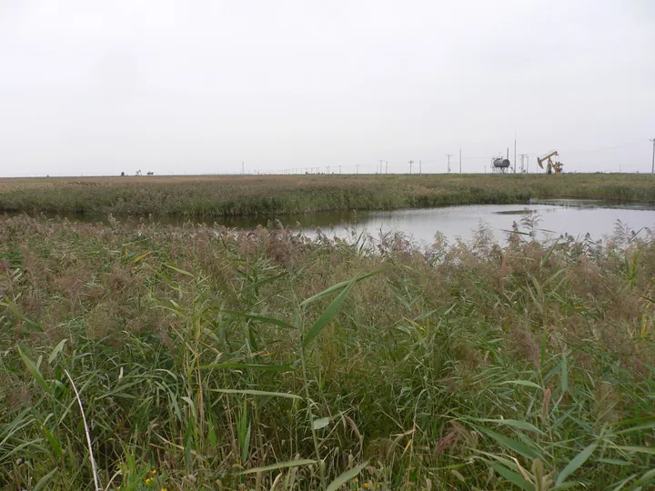
Photo adjustments
Full frame retained; proportionally resized and converted to WebP. No retouching or changes to the photographed subject. Card displays may crop the view.
- Administrative area
- County · 县
- Part of
- Panjin
- Chinese name
- 盘山县
- Local areas
- County guide
Area & population
- Area in the source
- 2,145.00 km²
- Population · 2020 census
- 223,210
Source: cited geographic source, as of the dates shown.
Setting and landscape
Across the river to the east lie Tai'an County (台安县) and Haicheng (海城市); Panjin's urban districts and Dawa District (大洼区) adjoin it to the south, Linghai (凌海市) to the west and Beizhen (北镇市) to the north. The county government claims for Panshan the world's largest reed wetland, and lists Tianshui Lake (甜水湖), Hongqi Lake (红旗湖), Bayi Lake (八一湖) and a forest park among its landscapes. Under the ground are oil, natural gas and well salt; the county is a main production area of the Liaohe Oilfield (辽河油田), and its hot-spring water has a temperature of 76°C.
What to see
The Panshan section of the Ming Great Wall is a provincial protected site. The county's 2019 heritage list records a string of Ming beacon-tower sites in Gaosheng subdistrict (高升街道), among them the Ertaizi beacon tower (二台子烽火台), and the site of Zhenwubu (镇武堡), a Ming fort in Gaosheng village that the Panjin list files under the Ming Great Wall. The Desheng Stele (得胜碑), dated to the late Ming or early Qing, is in Desheng village (得胜村) and is protected at city level. A more recent site is the former First Battalion of the Liaoning May Seventh Cadre School (辽宁省五七干校一营旧址), from the 1960s, in Hongxing village, Hujia town (胡家镇). The county government also points visitors to a Korean ethnic village.
Food and local products
Panshan is a main producer of Panjin rice and Panjin river crab, and its crab industry holds the title 'China's first county of the river-crab industry' (中国河蟹产业第一县). Output of sea cucumber, freshwater fish, livestock and vegetables is also large, and the county has long been called a 'land of fish and rice' (鱼米之乡) and the 'little Jiangnan beyond the pass' (关外小江南).
Getting oriented
The Beijing–Shenyang and Dandong–Xilinhot expressways and the Qinhuangdao–Shenyang and Panjin–Yingkou high-speed railways all cross the county.
Highlights
- Ming Great Wall, Panshan section 明长城-盘山段: Provincial protected site; the county list records many Ming beacon-tower sites in Gaosheng.
- Zhenwubu fort site 镇武堡城址: Ming fort site in Gaosheng village; provincial protected site.
- Desheng Stele 得胜碑: Late Ming or early Qing stele in Desheng village; city-level protected site.
- Panjin river crab 盘锦河蟹: Panshan is a main producing area and calls itself China's first county of the crab industry.
Sources for this guide
盘山简介_盘山县人民政府 · Panshan County People's Government
盘县政发〔2019〕03号 盘山县人民政府关于加强我县域内文物保护单位修复的通知 · Panshan County People's Government
盘锦市文物保护单位名录(2025)_文物保护单位名录_盘锦市文化旅游和广播电视局 · Panjin Culture, Tourism, Radio and Television Bureau
盘山县 - 维基百科,自由的百科全书 · Chinese Wikipedia · CC BY-SA 4.0
Original English written from the listed sources and checked sentence by sentence against quoted extracts by a separate reviewer. Updated 2026-09-26.
Explore Panshan County
Core places to explore, with English and Chinese names.
Places to explore around Panshan County
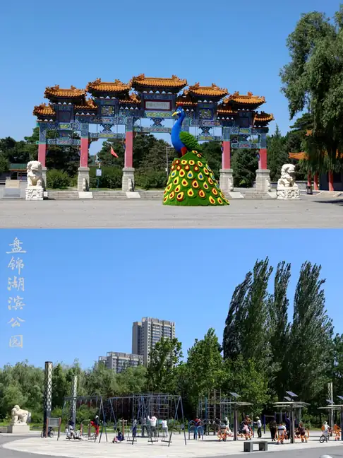 Liaohe Stele Forest ·
 Plan your visit
Getting there
Panshan County is about 15 km in a straight line from central Panjin. Search for 盘山县 in a map app to find stations and your accommodation.
Where to stay →Build your route
Start with Liaohe Stele Forest. The linked place guides have entrance and visit details.
Continue with Panjin →More in Panjin
Sources & geographic information
Administrative names and parent areas: Official geographic directory · Reference date 2026-09-06.
Some facts checked against 盘山县 — Wikipedia contributors, CC BY-SA 4.0.
Photo: Liaohe Stele Forest · Source photographer · License not provided. EXIF orientation normalized; resized without changing aspect ratio; converted to WebP. No subject edits.
Map data © OpenStreetMap contributors. Pins mark approximate centres, not entrances or boundaries.