

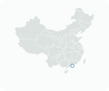
Get to know Pac On e Taipa Grande

- Administrative area
- Statistical area · 統計分區
- Part of
- Macau
- Chinese name
- 北安及大潭山區
- Local areas
- Statistical area guide
Setting and landscape
More than a century ago Taipa was two islets, Taipa Grande and Taipa Pequena (小氹), linked by a sandbar. Reclamation from the early 20th century fused them, and later filling joined Taipa to Coloane (路環) through Cotai (路氹城). The upper half of Taipa Grande is now strictly protected as Taipa Grande Nature Park (大潭山郊野公園).
Pac On is one of Macau's four industrial areas and stands on land reclaimed in 1986; the Pac On pier (北安碼頭) off its shore sits on land reclaimed in 2007. The name already appears on a 1912 map of Taipa for Pac On Bay (Praia de Pac On). Pac On lies south-east of that bay, whose reclaimed land is counted in a different statistical zone, and contains Estrada de Pac On, Avenida Son On, the Taipa landing of the Friendship Bridge (友誼大橋) and the immigration department building.
What to see
Taipa Grande Nature Park covers about 49.31 hectares on the east side of the island near Macau International Airport and is Taipa's only country park. Its main area was a landfill that closed in 1988 once full; the government turned it into parkland from 1999 and opened it in 2001.
The trail network, about 4,000 metres in all, grew out of the 2,200-metre Taipa walking trail opened in 1987, the island's first. A 1,050-metre fitness trail climbs over the summit on several hundred steps, and the 600-metre eco trail, opened in spring 2002, passes a native fish conservation area in a reservoir that once supplied drinking water. The park also has an artificial-turf grass slide, one of two in Macau.
An inclined lift climbs the slope between Estrada Governador Nobre de Carvalho and the viewing platform at the Taipa Grande water tower. On the eastern side of the hill stands the three-storey building of the Macao Meteorological and Geophysical Bureau (地球物理暨氣象局), with a 40-metre weather radar tower on its west side.
Highlights
- Taipa Grande Nature Park 大潭山郊野公園: Taipa's only country park, about 49.31 hectares, opened in 2001 on a former landfill.
- Taipa Grande trails 大潭山環山徑: About 4,000 metres of paths grown from Taipa's first walking trail of 1987.
- Taipa Grande Inclined Lift 大潭山斜行升降機: Links Estrada Governador Nobre de Carvalho with the viewing platform at the water tower.
- Native fish conservation area 澳門原生魚類保育區: Set in a former drinking-water reservoir on the 600-metre eco trail.
Sources for this guide
DSEC statistical zones (CensusGIS layer Zona_Unidade_Zona_2019Q4) · Statistics and Census Service (DSEC), Macao SAR Government
Portuguese Ambiance Tour at Taipa Island · Macao Government Tourism Office
大潭山 · Chinese Wikipedia · CC BY-SA 4.0
大潭山郊野公园 · Chinese Wikipedia · CC BY-SA 4.0
北安 (澳门) · Chinese Wikipedia · CC BY-SA 4.0
Original English written from the listed sources and checked sentence by sentence against quoted extracts by a separate reviewer. Updated 2026-09-23.
Find Pac On e Taipa Grande
A reliable area-level map point is not available in the current sources.
Plan your visit
Getting there
Search for 北安及大潭山區 in a map app to find stations and your accommodation.
Where to stay →More in Macau
Sources & geographic information
Administrative names and parent areas: Official geographic directory · Reference date 2026-09-06.
DSEC statistical-zone directory
MGTO: Taipa Grande Viewing Platform
Government Information Bureau: Macao Yearbook 2025, Culture and Sport
Macao Civil Aviation Authority: Aeronautical Information Publication
Some facts checked against 大潭山 — Wikipedia contributors, CC BY-SA 4.0.
Some facts checked against 大潭山郊野公园 — Wikipedia contributors, CC BY-SA 4.0.
Some facts checked against 北安 (澳门) — Wikipedia contributors, CC BY-SA 4.0.
Map data © OpenStreetMap contributors. Pins mark approximate centres, not entrances or boundaries.