


Get to know Pengyang County
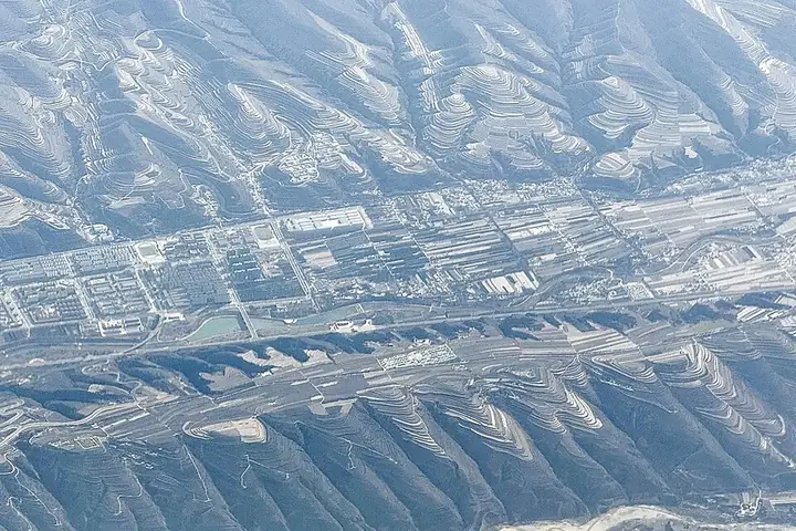
Photo adjustments
Full frame retained; resized proportionally to a maximum dimension of 960 pixels and converted to WebP quality 88. No crop, retouch, generated elements, or subject alteration. Final website rendition: full frame retained, proportionally resized to at most 720 pixels and converted to WebP. No additional retouching or subject alteration. Card displays may crop the view.
- Administrative area
- County · 县
- Part of
- Guyuan
- Chinese name
- 彭阳县
- Local areas
- County guide
Area & population
- Administrative seat
- Baiyang
Source: cited geographic source, as of the dates shown.
Setting and landscape
The county rises from 1,248 to 2,418 metres and has a semi-arid temperate continental monsoon climate, with about 448.5 mm of rain a year. The county government credits its Terrace Hua'er Festival (梯田花儿节) with making Pengyang famous online across China, and reports that the Pengyang terraces are known as "China's most beautiful dry-farming terraces"; the Guyuan terraces, with Pengyang's as the prime example, are one of the "21 Scenes of Ningxia" (宁夏二十一景). A mountain-flower festival (山花节) draws visitors every spring. Tree cover has grown from 3% when the county was founded to 23.97%, and cash-crop trees, mostly apricot, cover about 484,000 mu.
History
People lived along the Honghe (红河) and Ruhe (茹河) rivers some 30,000 years ago. Before the Qin the area was Chaona County (朝那县), and its Chaona pool (朝那湫) was a state sacrificial site ranked with the Yangtze, the Yellow River and the Han. About 62 km of the Warring States Qin Great Wall survive in the county, and the northern route of the eastern Silk Road passed through. The physician Huangfu Mi (皇甫谧), who compiled the acupuncture classic Zhenjiu Jiayi Jing (针灸甲乙经), was born here. Pengyang town was built in 1003 under the Northern Song, and the present county was split from eastern Guyuan County on 29 July 1983, with its seat at Baiyang (白阳镇). In October 1935 Mao Zedong's Central Red Army camped at Xiaochagou (小岔沟) and Qiaojiaqu (乔家渠) on the Long March.
What to see
The Yaoheyuan Shang-Zhou site (姚河塬商周遗址) sits on a tableland cut by the Li'er River (李儿河) and two other streams. Archaeological drilling has located tombs, horse and chariot pits, sacrificial pits and a bronze-casting workshop dating from the late Shang to the middle Western Zhou; the county government notes that the knife-handle-shaped layout of its horse pit and tombs has so far been found at no other Western Zhou cemetery. Chinese Wikipedia also lists the Wuliangshan Grottoes (无量山石窟) and the Warring States Qin wall ruins among the county's sights.
Food and local products
The county promotes Pengyang chillies (彭阳辣椒), Hongmei apricots (红梅杏) and Chaona chicken (朝那鸡) as its branded farm products.
Highlights
- Pengyang terraces 彭阳梯田: The prime example of the Guyuan terraces listed among the 21 Scenes of Ningxia.
- Yaoheyuan Shang-Zhou site 姚河塬商周遗址: Late Shang to middle Western Zhou site with tombs, chariot pits and a bronze-casting workshop.
- Warring States Qin Great Wall 战国秦长城遗址: About 62 km of the wall survive in the county.
- Wuliangshan Grottoes 无量山石窟: Listed by Chinese Wikipedia among the county's sights.
Sources for this guide
彭阳县 - 维基百科,自由的百科全书 · Wikipedia (Chinese) · CC BY-SA 4.0
彭阳县情概况_彭阳县人民政府 · Pengyang County People's Government
姚河塬商周遗址_彭阳县人民政府 · Pengyang County People's Government
Original English written from the listed sources and checked sentence by sentence against quoted extracts by a separate reviewer. Updated 2026-09-26.
Explore Pengyang County
Core places to explore, with English and Chinese names.
Places to explore around Pengyang County
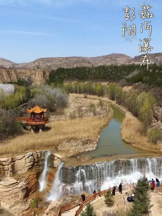 Ru River Waterfall ·
 Plan your visit
Getting there
Pengyang County is about 40 km in a straight line from central Guyuan. Search for 彭阳县 in a map app to find stations and your accommodation.
Where to stay →Build your route
Start with Ru River Waterfall. The linked place guides have entrance and visit details.
Continue with Guyuan →More in Guyuan
Sources & geographic information
Administrative names and parent areas: Official geographic directory · Reference date 2026-09-06.
Some facts checked against 彭阳县 — Wikipedia contributors, CC BY-SA 4.0.
Photo: Ru River Waterfall · Source photographer · License not provided. EXIF orientation normalized; resized without changing aspect ratio; converted to WebP. No subject edits.
Map data © OpenStreetMap contributors. Pins mark approximate centres, not entrances or boundaries.