

Photo adjustments
Wikimedia thumbnail; fitted to the ranking-card frame.
Explore the region
About The Peak
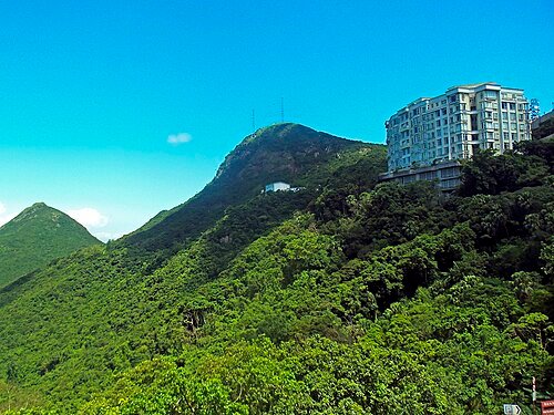
Around the Peak Tower, the experience is lively and built-up; the Lugard Road section of the Peak Circle Walk offers a quieter, tree-lined perspective on the skyline. The Sky Terrace 428 is a separately ticketed observation deck. Choose between a deck visit and an outdoor circuit according to the weather, allowing for slopes and changing visibility rather than expecting an uninterrupted panorama.
The hill is also known as Che Kung Shan (扯旗山), its official Chinese name on government maps, as well as Lo Fung (炉峰); early colonial names included Mount Possession and Mount Austin, the latter preserved in Mount Austin Road and Mount Austin Playground, before the British settled on Victoria Peak. According to local tradition, it was renamed Tai Ping Shan, meaning 'peaceful mountain', after fishermen believed peace had returned once the pirate Cheung Po Tsai (张保仔) surrendered in 1809.
Early European residents reached their hillside homes by sedan chair, and only around 40 households lived there in the 1880s, until the Peak Tram funicular opened in 1888 and eased access. In 1867 Governor Richard MacDonnell had already chosen the summit for a summer residence, the Governor's Mountain Lodge, which was rebuilt in 1902, fell out of use in the 1930s, was damaged during the Japanese occupation, and was demolished in 1946; the site became Peak Garden.
The Peak Hotel opened in 1873; its operator, Alexander Findlay Smith, later proposed building the Peak Tram, but the hotel burned down in 1938 and was never rebuilt. Its site became a bus terminus and, after redevelopment tendered in 1989, reopened in 1993 as the Peak Galleria (山顶广场), with the bus terminus moved to its ground floor.
What to look for
- The Peak Tower’s Sky Terrace 428 looks over the harbour and urban skyline.
- Lugard Road frames city views between trees along the hillside.
Location & getting there
Getting to The Peak
The Peak Tram lower terminus is at 33 Garden Road; it arrives at the Peak Tower, 128 Peak Road. The Peak Circle Walk begins on Lugard Road near the tower. Check tram operations and the separate observation-deck ticket before choosing the journey.
Combine your visit
Suggested order for the visit:
-
Peak Tower area
Orient yourself at the upper arrival point.
-
Sky Terrace 428
Add the separately ticketed panorama if visibility is suitable.
-
Lugard Road
Continue to the tree-lined section of the Peak Circle Walk.
This is an editorial sequence of named spaces or places. It does not imply a verified walking connection or promise opening, ticket availability or a journey time.
Find The Peak
太平山頂 · 中西区
The pin marks the area, not the entrance.
More places nearby
Approximate straight-line distances between map pins, not travel distances.
Dr Sun Yat-sen Museum 孙中山纪念馆
1 km awayDr Sun Yat-sen Museum occupies Kom Tong Hall on Castle Road. The museum connects Sun’s education and revolutionary activity with Hong Kong, while the house offers a separate architectural subject. Red brick, granite window and…
View guide →Man Mo Temple 文武庙
1 km awayThe Man Mo Temple compound on Hollywood Road brings together three related buildings. The main temple honours the civil deity Man Cheong and the martial deity Kwan Tai; Lit Shing Kung serves a broader group of deities, while…
View guide →PMQ 元创方
1 km awayPMQ places independent design studios and shops inside two former police married-quarters blocks. Repeated doorways and open corridors preserve the rhythm of the residential buildings, while the central courtyard provides a…
View guide →Sources & visit information
The sources below support the place-specific description and arrival information. Suggested combinations are editorial planning ideas; confirm current opening, entry arrangements and transport services for your date.
- Peak Tram and Peak Tower: visitor information ↗
- Hong Kong Tourism Board: Peak Circle Walk ↗
- Chinese Wikipedia: 太平山 (香港) (revision 93768570, 2026-08-04) ↗
- English Wikipedia: Victoria Peak (revision 1369985336, 2026-08-18) ↗
Background paragraphs translated and condensed from Wikipedia contributors, "太平山 (香港)", Chinese Wikipedia · CC BY-SA 4.0. Source revision 93768570.
Background paragraphs condensed from Wikipedia contributors, "Victoria Peak", English Wikipedia · CC BY-SA 4.0. Source revision 1369985336.