


Get to know Darlag County
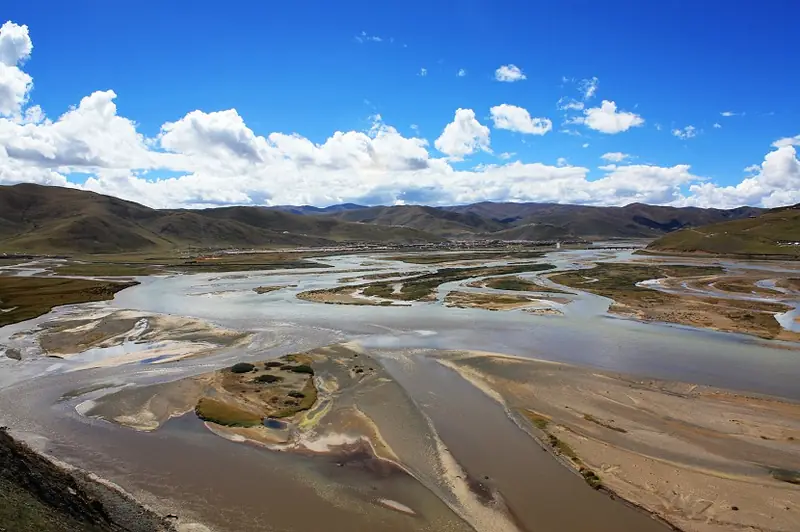
Photo adjustments
EXIF orientation normalized; resized without changing aspect ratio; converted to WebP. No subject edits.
- Administrative area
- County · 县
- Part of
- Golog Tibetan Autonomous Prefecture
- Chinese name
- 达日县
- Local areas
- County guide
Area & population
- Area in the source
- 14,800.00 km²
- Population · 2020
- 40,197
- Administrative seat
- Gyümai
Source: cited geographic source, as of the dates shown.
Setting and landscape
The county lies on the Bayan Har (巴颜喀拉山) upland, whose range runs across it from north-west to south-east and splits its waters between the Yangtze and Yellow River systems. The Yellow River runs along the north of the county and separates it from Maqên (玛沁) and Gadê (甘德) counties. The ground, shaped like a butterfly on the map, falls from the north-west to the south-east, and the average elevation is above 4,200 metres. The county government describes a climate with no clear four seasons, only a cold and a warm period, an annual mean temperature of -0.5°C and a daily swing of 15 to 25°C.
Darlag sits in the core zone of the Three-River-Source (三江源) nature reserve. Snow leopards, brown bears, golden eagles and black-necked cranes live here, and the county yields large harvests of rhubarb, fritillary and caterpillar fungus (冬虫夏草).
History and heritage
Darlag is where the first flag of the People's Republic was raised on the Golog grassland and where Golog's peaceful liberation and first government took place. The sites kept from that period include the Golog peaceful liberation monument, the government-founding monument, former office cave dwellings and the red boat in which the Golog work team of the Northwest Military and Political Committee crossed the river.
Of the county's ten Tibetan Buddhist monasteries, eight belong to the Nyingma school and two to the Gelug. Charang Monastery (查朗寺), a Nyingma house built in the Qing dynasty, is on the eighth list of national key cultural relics protection units.
The county government calls Darlag an important birthplace of Gesar (格萨尔) epic culture. The Gesar King Lion-Dragon Palace (格萨尔王狮龙宫殿) is a national intangible-heritage training base, De'ang Sazhi calligraphy (德昂洒智书法) is on the national intangible-heritage list, and Zhuoma Tibetan incense (卓玛藏香) on the prefecture list.
Getting oriented
Darlag is about 600 kilometres from the provincial capital, Xining (西宁). Jigzhi (久治) lies to the east, Banma (班玛) to the south-east, Sêrtar (色达) and Sêrxü (石渠) in Sichuan to the south and south-west, and Madoi (玛多) to the north-west. National highways G345 and G227 cross the county from east to west.
Highlights
- Charang Monastery 查朗寺: Qing-dynasty Nyingma monastery on the eighth list of national key cultural relics protection units.
- Gesar King Lion-Dragon Palace 格萨尔王狮龙宫殿: National intangible-heritage training base for Gesar epic culture.
- Golog peaceful liberation monument 果洛和平解放纪念碑: One of several sites marking Golog's liberation and first government in Darlag.
- Zhuoma Tibetan incense 卓玛藏香: On the Golog prefecture intangible-heritage list.
Sources for this guide
达日县 - 维基百科,自由的百科全书 · Chinese Wikipedia · CC BY-SA 4.0
达日县县域概览 · Darlag County People's Government
达日县基本情况 · Darlag County People's Government
Original English written from the listed sources and checked sentence by sentence against quoted extracts by a separate reviewer. Updated 2026-09-26.
Explore Darlag County
Core places to explore, with English and Chinese names.
Darlag County 达日县
Plan your visit
Getting there
Darlag County is about 80 km in a straight line from central Golog Tibetan Autonomous Prefecture. Search for 达日县 in a map app to find stations and your accommodation.
Where to stay →More in Golog Tibetan Autonomous Prefecture
Sources & geographic information
Administrative names and parent areas: Official geographic directory · Reference date 2026-09-06.
Some facts checked against 达日县 — Wikipedia contributors, CC BY-SA 4.0.
Map data © OpenStreetMap contributors. Pins mark approximate centres, not entrances or boundaries.