


Get to know Qilian County
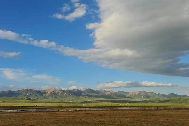
Photo adjustments
Full frame retained; proportionally resized and converted to WebP. No retouching or changes to the photographed subject. Card displays may crop the view.
- Administrative area
- County · 县
- Part of
- Haibei Tibetan Autonomous Prefecture
- Chinese name
- 祁连县
- Local areas
- County guide
Area & population
- Area in the source
- 13,886.00 km²
- Population · 2020
- 48,538
- Administrative seat
- Babao Town
Source: cited geographic source, as of the dates shown.
Setting and landscape
The county is the largest in Haibei by area, and China Tibet Online counts eleven typical landforms within it, including snow mountains, glaciers, Danxia landforms, forest, grassland, gorges and wetlands. The Heihe River, called the mother river of the Hexi Corridor (河西走廊), flows through the county town. The Heihe Grand Canyon (黑河大峡谷), which Qinghai Daily gives as more than 800 kilometres long with an average elevation above 4,200 metres, holds about 800 glaciers and a 70-kilometre uninhabited stretch.
History
In 1938 a Qilian administrative office was split off from Menyuan (亹源县); it became Qilian Autonomous District in 1952 and Qilian County in 1953. Qinghai Daily notes that since the Yuan dynasty Qilian has been known for its "eight treasures": gold, silver, copper, iron, musk, deer antler, rhubarb and yellow mushrooms.
What to see
Zhuoer Mountain (卓尔山), on the north bank of the Babao River (八宝河), is a Danxia landform of red sandstone and conglomerate; its Tibetan name, rendered in Chinese as "Zongmu Mayouma" (宗姆玛釉玛), means "beautiful rosy queen". Amye Dongsuo (阿咪东索), also called Niuxin Mountain (牛心山), rises two kilometres southeast of the town. Its name means "god of all mountains", and its slopes climb from grain and rapeseed fields through pasture and scrub to a summit under snow all year. China Tibet Online describes the Amye Dongsuo scenic area as a national 5A site. The two mountains face each other from a distance, and local legend makes Zhuoer a dragon princess who stayed among mortals to marry the mountain god Amye Dongsuo.
Food and local products
Qilian is a known source of grassland yellow mushrooms (黄蘑菇), which received a geographical-indication certification in 2008; in 2015 the China Edible Fungi Association named the county the home of the yellow mushroom. Locals cook freshly picked mushrooms into "mushroom noodle slices" (蘑菇面片) for guests. Summer outings and picnics bring mixed-flour cuoyu (杂面搓鱼), handmade highland-barley noodles, alongside stir-fried mushrooms and hand-held mutton (手抓羊肉).
Highlights
- Zhuoer Mountain 卓尔山: Danxia landform of red sandstone and conglomerate on the north bank of the Babao River.
- Amye Dongsuo 阿咪东索: Sacred mountain two kilometres southeast of the county town, snow-capped all year; a national 5A scenic area.
- Heihe Grand Canyon 黑河大峡谷: Canyon averaging over 4,200 metres, with about 800 glaciers.
- Qilian yellow mushrooms 祁连黄蘑菇: Grassland mushrooms with geographical-indication status since 2008.
Sources for this guide
祁连县 - 维基百科,自由的百科全书 · Chinese Wikipedia · CC BY-SA 4.0
天境祁连打开草原全域旅游新模式 - 中国网 · China.com.cn (Qinghai Daily)
壮阔祁连- 古道新风 - 中国西藏网 · China Tibet Online (tibet.cn)
【海北州】环绕着卓尔山的旅游扶贫--政务公开 · Qinghai Provincial People's Government
Original English written from the listed sources and checked sentence by sentence against quoted extracts by a separate reviewer. Updated 2026-09-25.
Explore Qilian County
Core places to explore, with English and Chinese names.
Places to explore around Qilian County
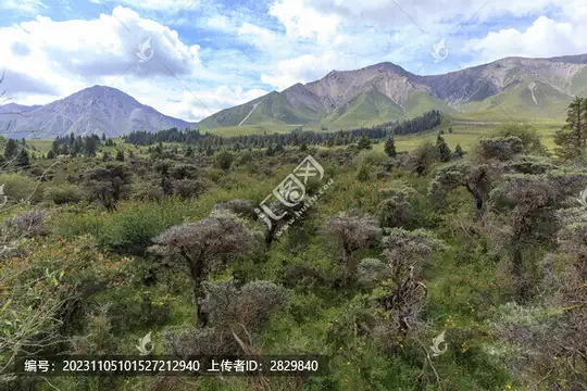 Ami Dongsuo Scenic Area · 阿咪东索景区
Ami Dongsuo Scenic Area阿咪东索景区
Ami Dongsuo is a highland landscape destination in Qilian County, with pasture, forest and mountain viewpoints.
Read the place guide →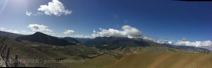 A wide mountain panorama: rounded green and dry-gold slopes with terracing sweeping down in the foreground, a valley floor with a small town, fields and a road in the middle distance, darker forested ridges beyond and a snow-streaked range on the horizon; a deep blue sky with cumulus and cirrus, a dark hill at the left, a fence post at the left edge, a small white structure on the right ridge and a white watermark © 郭泽泽泽泽泽 / guozzzzz.lofter.com at the lower left.
Zhuo'er Mountain卓尔山
Zhuo'er Mountain (卓尔山) is a mountain spur of the Qilian range standing on the north bank of the Babao River in Qilian County, Haibei Tibetan Autonomous Prefecture, Qinghai, whose Tibetan name Zongmu Mayouma (宗穆玛釉玛) is given as meaning the beautiful rosy queen.
Read the place guide → Qilian Grassland · 祁连大草原
Qilian Grassland祁连大草原
The Qilian grassland (祁连大草原) is the high pasture country of Qilian County in Haibei Tibetan Autonomous Prefecture, Qinghai, in a county the provincial portal places in the middle section of the Qilian range, where a provincial research team has spent more than a decade restoring degraded alpine pasture.
Read the place guide →Plan your visit
Getting there
Qilian County is about 165 km in a straight line from central Haibei Tibetan Autonomous Prefecture. Search for 祁连县 in a map app to find stations and your accommodation.
Where to stay →Build your route
Ami Dongsuo Scenic Area and Zhuo'er Mountain are both listed here. The linked place guides have entrance and visit details.
Continue with Haibei Tibetan Autonomous Prefecture →More in Haibei Tibetan Autonomous Prefecture
Sources & geographic information
Administrative names and parent areas: Official geographic directory · Reference date 2026-09-06.
Some facts checked against 祁连县 — Wikipedia contributors, CC BY-SA 4.0.
Photo: Ami Dongsuo Scenic Area · Source photographer · License not provided. EXIF orientation normalized; resized without changing aspect ratio; converted to WebP. No subject edits.
Photo: Zhuo'er Mountain · 郭泽泽泽泽泽真 · CC BY 2.5. Full frame retained; proportionally resized and converted to WebP. No retouching or changes to the photographed subject. Card displays may crop the view.

Photo: Qilian Grassland · Source photographer · License not provided. EXIF orientation normalized; resized without changing aspect ratio; converted to WebP. No subject edits.
Map data © OpenStreetMap contributors. Pins mark approximate centres, not entrances or boundaries.