


Photo adjustments
Wikimedia thumbnail; fitted to the ranking-card frame.
Explore the region
About Kanbula
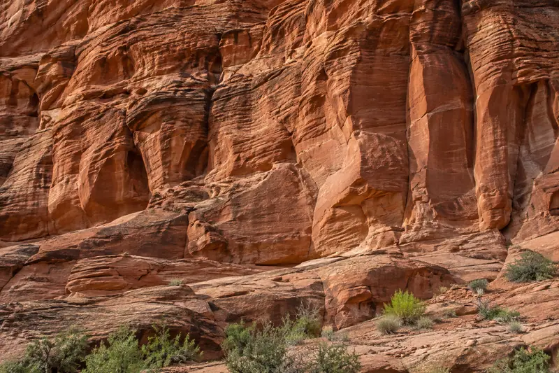
The contrast between rock, vegetation and water is more distinctive than any single viewpoint. The wider UNESCO Global Geopark covers a much larger geological and cultural region than the ticketed scenic area, so do not treat all features listed for the geopark as stops inside one park entrance.
Kanbula lies in the northwest of Jianzha County (尖扎县), within Huangnan Tibetan Autonomous Prefecture (黄南藏族自治州), on the southern side of Lijiaxia Reservoir (李家峡水库). It has been designated a scenic area at the provincial level in Qinghai (青海省级风景名胜区). The area also contains two parks established at the national level, with separate designations: Jianzha Kanbula National Geopark (尖扎坎布拉国家地质公园) and Kanbula National Forest Park (坎布拉国家森林公园). The area is described as a landscape of Danxia landforms.
What to look for
- Red sandstone formations create the principal landform scenery.
- Forest softens the slopes around the rock formations.
- Lijiaxia Reservoir adds a broad water setting below the hills.
Location & getting there
Getting to Kanbula
The 2026 trial-opening notice advises visitors approaching from Jianzha to use the eastern visitor service centre in Kanbula town. It recommends the Guide approach for self-driving visitors. Confirm the current route and internal transport arrangements before choosing an entrance.
Combine your visit
Choose from these complementary stops when planning your visit.
-
Confirmed visitor entrance已确认的游客入口
Check the current operating route.
-
Open red-rock viewpoints开放丹霞观景点
Study the shape and layering of the sandstone.
-
Reservoir outlook李家峡水库眺望点
Add the water-and-mountain perspective on the authorised route.
This is a suggested combination, not a timed route; confirm the opening and transport arrangements for your date.
Find Kanbula
坎布拉 · 黄南州
The pin marks the area, not the entrance.
More places nearby
Approximate straight-line distances between map pins, not travel distances.
Guide National Geopark 贵德国家地质公园
15 km awayGuide National Geopark’s Ashigong visitor area is known for red and multicoloured rock peaks. Its eroded ridges and exposed layers record changes in the plateau landscape and the development of the Yellow River system. The…
View guide →Guide Jade Emperor Pavilion 贵德玉皇阁
28 km awayGuide’s Jade Emperor Pavilion belongs to a larger historic complex combining the Confucian temple, Guanyue Temple and Wanshou Temple. Their different dedications make the visit more than a climb to one tower. The group…
View guide →Kumbum / Ta'er Monastery 塔尔寺
44 km awayKumbum, known in Chinese as Ta’er Temple, grew around a memorial to Tsongkhapa, founder of the Gelug school of Tibetan Buddhism. Its buildings follow the folds of the valley rather than a single straight axis. The Great Golden…
View guide →Sources & visit information
The sources below support the place-specific description and arrival information. Suggested combinations are editorial planning ideas; confirm current opening, entry arrangements and transport services for your date.
- UNESCO: Kanbula Global Geopark scope and geology ↗
- Qinghai broadcaster: operator’s 2026 trial-opening and entrance notice ↗
- 坎布拉 — Wikipedia geographic and historical reference ↗
- Chinese Wikipedia: 坎布拉 (revision 71386426, 2022-04-29) ↗
Geographic and historical facts selectively adapted from Wikipedia contributors, 坎布拉 · CC BY-SA 4.0. Source revision 71386426.
Background paragraphs translated and condensed from Wikipedia contributors, "坎布拉", Chinese Wikipedia · CC BY-SA 4.0. Source revision 71386426.