


Get to know Zadoi County
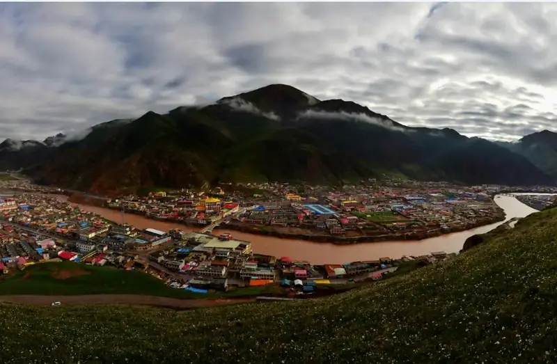
Photo adjustments
EXIF orientation normalized; resized without changing aspect ratio; converted to WebP. No subject edits.
- Administrative area
- County · 县
- Part of
- Yushu Tibetan Autonomous Prefecture
- Chinese name
- 杂多县
- Local areas
- County guide
Area & population
- Area in the source
- 35,000.00 km²
- Population · 2020
- 68,759
- Administrative seat
- Qapugtang
Source: cited geographic source, as of the dates shown.
Setting and landscape
The county averages 4,290 metres above sea level. The entire Lancang sector of Sanjiangyuan National Park (三江源国家公园) falls within Zadoi County. This is also a producing area for cordyceps (冬虫夏草).
What to see
Angsai Township (昂赛乡) has grasslands, Danxia landforms, forests and river gorges. Eye Lakes (眼睛湖), beside the Tohuqu River (托乎曲) in Hongse Village (红色村), change shape with the water level: the two lakes join in summer and separate in the lower waters of winter and spring. Lama Nuola Sacred Mountain (喇嘛诺拉神山) has a landscape of snowy peaks, glaciers, rivers and valleys, with lakes, waterfalls and hot springs around the mountain.
Sources for this guide
杂多:从遍地“黑土”到满山青绿_国家林业和草原局政府网 · National Forestry and Grassland Administration
杂多旅游攻略 · Zadoi County Government
Original English written from the listed sources and checked sentence by sentence against quoted extracts by a separate reviewer. Updated 2026-09-26.
Explore Zadoi County
Core places to explore, with English and Chinese names.
Zadoi County 杂多县
Plan your visit
Getting there
Zadoi County is about 160 km in a straight line from central Yushu Tibetan Autonomous Prefecture. Search for 杂多县 in a map app to find stations and your accommodation.
Where to stay →More in Yushu Tibetan Autonomous Prefecture
Sources & geographic information
Administrative names and parent areas: Official geographic directory · Reference date 2026-09-06.
Map data © OpenStreetMap contributors. Pins mark approximate centres, not entrances or boundaries.