


Get to know Yushu City
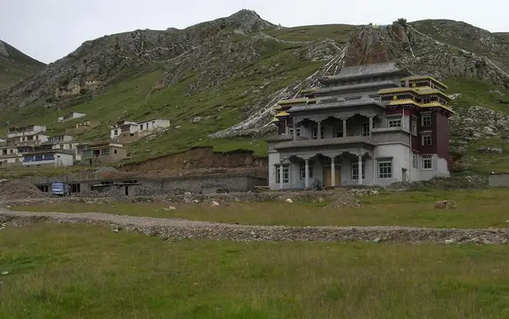
Photo adjustments
Full frame retained; resized proportionally to a maximum dimension of 960 pixels and converted to WebP quality 88. No crop, retouch, generated elements, or subject alteration. Final website rendition: full frame retained, proportionally resized to at most 720 pixels and converted to WebP. No additional retouching or subject alteration. Card displays may crop the view.
- Administrative area
- County-level city · 县级市
- Part of
- Yushu Tibetan Autonomous Prefecture
- Chinese name
- 玉树市
- Local areas
- County-level city guide
Area & population
- Area in the source
- 13,462.00 km²
- Population · 2020
- 141,308
- Administrative seat
- Gyêgu
Source: cited geographic source, as of the dates shown.
History
The Tibetan name Jiegudo (结古多) means a place where goods are collected and distributed, and Jiegu long served as a trading centre between Xining (西宁), Kangding (康定) and Lhasa (拉萨). People's Daily describes it as a market town where Qinghai, Sichuan and Tibet meet.
On the morning of 14 April 2010 a magnitude 7.1 earthquake struck what was then Yushu County, and more than nine in ten houses in Jiegu collapsed; 2,698 people died. In July 2013 the State Council approved turning Yushu County into Yushu City, and in 2014 Jiegu town was replaced by four urban subdistricts.
What to see
Jiegu Monastery (结古寺) stands on Jiegu Hill east of the town and belongs to the Sakya (萨迦派) school of Tibetan Buddhism. Its large mani heap, stones carved with the six-syllable mantra, forms a mani-stone city with a red stupa in the middle, and the Ninth Panchen Lama, Choekyi Nyima (曲吉尼玛), died there in 1937.
The Princess Wencheng Temple (文成公主庙) stands in Beina Gully (贝纳沟); a People's Daily suggested route pairs it with Leba Gully (勒巴沟), Jiegu Monastery and the Xinzhai Gyanak Mani stone city (新寨嘉那嘛呢石经城), a mani-stone pile well known among religious believers. About 7 km from Jiegu, Thrangu Monastery (禅古寺) is a Kagyu (噶举派) house founded in the 12th century and added to the provincial list of protected sites on 10 April 2008. In town, Jiegu also holds the Yushu Prefecture Museum (玉树州博物馆) and the Kangba Style Street (康巴风情街).
Getting oriented
National highways G214, G215 and G345 pass through the city, the northern section of the Xining-Lijiang Expressway (西丽高速) currently ends at Yushu, and the city is served by Yushu Batang Airport (玉树巴塘机场).
Highlights
- Jiegu Monastery 结古寺: Sakya monastery on Jiegu Hill with a mani-stone city around a red stupa; the Ninth Panchen Lama died here in 1937.
- Princess Wencheng Temple 文成公主庙: Temple in Beina Gully, on a People's Daily suggested route with Leba Gully.
- Xinzhai Gyanak Mani Stone City 新寨嘉那嘛呢石经城: Mani-stone pile at Xinzhai, well known among religious believers.
- Thrangu Monastery 禅古寺: Kagyu monastery about 7 km from Jiegu, founded in the 12th century.
Sources for this guide
玉树市 - 维基百科,自由的百科全书 · Wikipedia (Chinese) · CC BY-SA 4.0
结古街道 - 维基百科,自由的百科全书 · Wikipedia (Chinese) · CC BY-SA 4.0
结古寺 - 维基百科,自由的百科全书 · Wikipedia (Chinese) · CC BY-SA 4.0
【中國旅游日】青海在行動——玉樹對你說 · People's Daily Online (Qinghai)
Original English written from the listed sources and checked sentence by sentence against quoted extracts by a separate reviewer. Updated 2026-09-25.
Explore Yushu City
Core places to explore, with English and Chinese names.
Places to explore around Yushu City
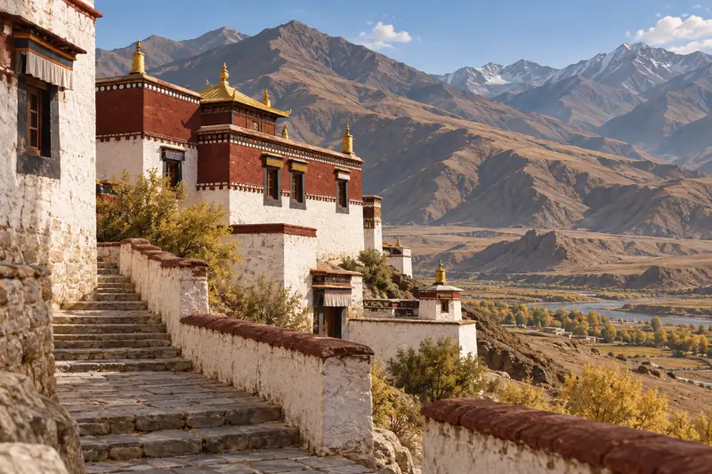 AI illustration · AI 示意图(仅供参考,非该地点实拍)
Princess Wencheng Temple and Leba Valley文成公主庙与勒巴沟
Princess Wencheng Temple and Leba Valley (文成公主庙与勒巴沟) covers two linked sites in Yushu City, Yushu Tibetan Autonomous Prefecture, Qinghai: the Princess Wencheng Temple (文成公主庙), a Buddhist hall built against a cliff and also known as 加萨公主庙, and 勒巴沟, the valley whose rock walls carry Tibetan religious carvings.
Read the place guide →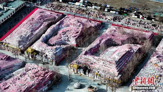 Xinzhai Gyanak Mani Stone City · 新寨嘉那玛尼石经城
Xinzhai Gyanak Mani Stone City新寨嘉那玛尼石经城
Xinzhai Gyanak Mani Stone City (新寨嘉那玛尼石经城), also written 新寨嘉那嘛呢石经城, is a mani-stone complex at 新寨村 in Yushu City, Yushu Tibetan Autonomous Prefecture, Qinghai. The first Jiana Rinpoche of 结古寺 began carving and piling stones here in 1715 and the mound has been growing ever since; in 2006 it was listed in the sixth batch of national key cultural relic protection units.
Read the place guide → Döndrub Ling Monastery (Jyekundo Monastery) on its hillside site, Yushu · 青海玉树结古寺(顿珠林寺)山坡全景 Source-recorded photograph date: 2013-06-16.
Jyekundo Monastery结古寺
Jyekundo Monastery, known locally as Jiegu Temple, rises on the hill above the eastern part of Yushu. It belongs to the Sakya school of Tibetan Buddhism. Assembly halls and monastic residences occupy the hillside, giving the…
Read the place guide →Plan your visit
Getting there
Yushu City covers the centre of Yushu Tibetan Autonomous Prefecture. Search for 玉树市 in a map app to find stations and your accommodation.
Where to stay →Build your route
Princess Wencheng Temple and Leba Valley and Xinzhai Gyanak Mani Stone City are both listed here. The linked place guides have entrance and visit details.
Continue with Yushu Tibetan Autonomous Prefecture →More in Yushu Tibetan Autonomous Prefecture
Sources & geographic information
Administrative names and parent areas: Official geographic directory · Reference date 2026-09-06.
Some facts checked against 玉树市 — Wikipedia contributors, CC BY-SA 4.0.
Some facts checked against 结古街道 — Wikipedia contributors, CC BY-SA 4.0.
Some facts checked against 结古寺 — Wikipedia contributors, CC BY-SA 4.0.
Photo: Xinzhai Gyanak Mani Stone City · Source photographer · License not provided. EXIF orientation normalized; resized without changing aspect ratio; converted to WebP. No subject edits.
Photo: Jyekundo Monastery · Gruschke · CC BY-SA 3.0. Full frame retained; proportionally resized and converted to WebP. No retouching or changes to the photographed subject. Card displays may crop the view.

Map data © OpenStreetMap contributors. Pins mark approximate centres, not entrances or boundaries.