


Get to know Kenli District

Photo adjustments
Full frame retained; proportionally resized and converted to WebP. No retouching or changes to the photographed subject. Card displays may crop the view.
- Administrative area
- District · 市辖区
- Part of
- Dongying
- Chinese name
- 垦利区
- Local areas
- District guide
Area & population
- Area in the source
- 2,331.00 km²
- Population · 2019
- 238,900
Source: cited geographic source, as of the dates shown.
Setting and history
Kenli formed as Yellow River sediment pushed back the sea: its western half took shape at the end of the Yuan and start of the Ming, and its eastern half only in the 20th century. The river mouth still adds, on average, more than 20,000 mu of new land a year. Organised government began in September 1941, when the Communist side set up an anti-Japanese administration for the "reclamation area" (垦区); Kenli County followed in 1943 and became a district in 2016.
What to see
The Yellow River Delta National Nature Reserve (黄河三角洲国家级自然保护区), set up in October 1992 at the river mouth, covers 153,000 hectares of new wetland that the Shandong Department of Ecology and Environment calls the largest, most complete and youngest in China's warm-temperate zone. It entered the list of wetlands of international importance in 2013. The department counts 371 bird species there and names it the world's largest breeding ground of the Oriental stork (东方白鹳), the second-largest of Saunders's gull (黑嘴鸥), the second-largest wintering ground of the Siberian crane (白鹤) and the southern limit of wild breeding for the red-crowned crane (丹顶鹤). CCTV reports that more than six million birds migrate through or winter there each year.
The Yellow River Mouth Ecological Tourism Area (黄河口生态旅游区) became a national 5A scenic area in January 2020, the only Shandong site among the 22 named in that announcement. In Kenli a road junction is called "One Tree" (一棵树): during the Gudong (孤东) campaign of the Shengli Oilfield (胜利油田), people found a lone willow on the white salt flats, and it became a place name and landmark. The original died, and the tree there now is the third generation.
Highlights
- Yellow River Delta National Nature Reserve 黄河三角洲国家级自然保护区: Set up in 1992 at the river mouth; 371 bird species, including the world's largest Oriental stork breeding ground.
- Yellow River Mouth Ecological Tourism Area 黄河口生态旅游区: National 5A scenic area since January 2020.
- One Tree 一棵树: Road junction named after a lone willow found on the salt flats during the Shengli Oilfield's Gudong campaign; the current tree is the third generation.
Sources for this guide
垦利区 - 维基百科,自由的百科全书 · Wikipedia (Chinese) · CC BY-SA 4.0
黄河口生态旅游区晋升为国家5A级旅游景区 · China.com.cn (Dazhong Daily report)
习近平山东行丨黄河在这里入海!首站来到东营黄河入海口 · People's Daily Online (CCTV report)
跟着总书记的脚步丨总书记考察黄河入海口,这里有几个“最” · Shandong Provincial Department of Ecology and Environment (Dazhong Daily report)
Original English written from the listed sources and checked sentence by sentence against quoted extracts by a separate reviewer. Updated 2026-09-26.
Explore Kenli District
Core places to explore, with English and Chinese names.
Places to explore around Kenli District
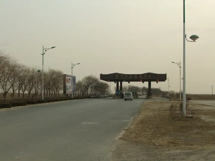 Entrance gate of the Yellow River Estuary Eco-Tourism Area, Kenli District, Dongying ·
 Plan your visit
Getting there
Kenli District is about 20 km in a straight line from central Dongying. Search for 垦利区 in a map app to find stations and your accommodation.
Where to stay →Build your route
Start with Yellow River Estuary Eco-Tourism Area. The linked place guides have entrance and visit details.
Continue with Dongying →More in Dongying
Sources & geographic information
Administrative names and parent areas: Official geographic directory · Reference date 2026-09-06.
Some facts checked against 垦利区 — Wikipedia contributors, CC BY-SA 4.0.
Photo: Yellow River Estuary Eco-Tourism Area · rheins · CC BY 3.0. Full frame retained; proportionally resized and converted to WebP. No retouching or changes to the photographed subject. Card displays may crop the view.

Map data © OpenStreetMap contributors. Pins mark approximate centres, not entrances or boundaries.