


Get to know Dongying
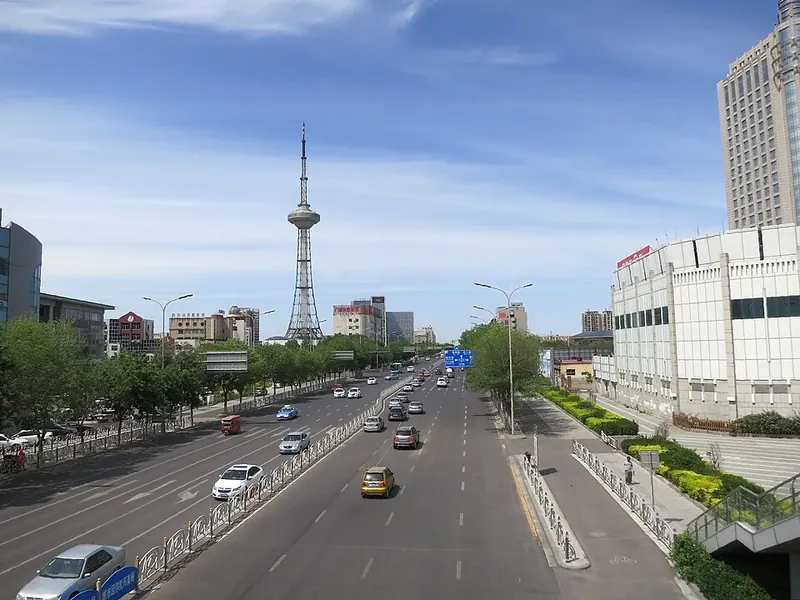
Photo adjustments
Full frame retained; proportionally resized and converted to WebP. No retouching or changes to the photographed subject. Card displays may crop the view.
- Administrative area
- Prefecture-level city · 地级市
- Part of
- Shandong
- Chinese name
- 东营市
- Local areas
- 5 local areas
Area & population
- Area in the source
- 7,923.26 km²
- Population · 2020 census
- 2,193,518
- Administrative seat
- Dongying District
Source: cited geographic source, as of the dates shown.
Culture
Dongying History Museum (Guangrao County History Museum) is a comprehensive museum of geography established in May 1993. It is a national second level museum and AAA level tourist attraction, including a comprehensive building and Sun Wu Temple. It covers a total area of 42763 square meters and currently has more than 12000 collections, including 417 precious cultural relics above the national third level (pieces/sets).
The Sun Tzu Cultural Tourism Area is located in the Chengdong New District of Guangrao County, Dongying City. Based on the standards of national level ecological tourism demonstration areas and tourist resorts, it is a cultural experiential tourism and vacation project with Sun Tzu culture as its theme, created according to the functional positioning of ecology, tourism, culture, and city. In August 2012, it was rated as a national 4A level tourist attraction.
Transportation
Zibo–Dongying railway (Dongying railway station) Dongying South Railway Station Dezhou–Dajiawa railway (passenger service available at Dongying South railway station) Dongying Port railway (freight only) Dongying Shengli Airport
A new bus station was built between the east and west sides of the city, on Huanghe Road. Connections to Beijing, Qingdao and Jinan, among many other cities are available on a daily basis.
Explore Dongying
Core places to explore, with English and Chinese names.
Places to explore around Dongying
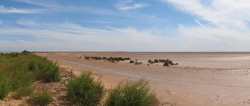 Tidal mudflats in the Yellow River Delta nature reserve. Photograph date recorded by the source: Taken on 18 September 2012.
Yellow River Delta National Nature Reserve黄河口
The Yellow River delta is a changing landscape of river channels, reed beds, salt-tolerant vegetation and coastal mudflats. Its wetlands support migrating birds and breeding species such as the Oriental stork. Public visits use…
Read the place guide →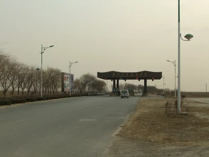 Entrance gate of the Yellow River Estuary Eco-Tourism Area, Kenli District, Dongying · 东营市垦利区黄河口生态旅游区入口 Source-recorded photograph date: Taken on 24 March 2011.
Yellow River Estuary Eco-Tourism Area黄河口生态旅游区
The Yellow River Estuary Eco-Tourism Area (黄河口生态旅游区) occupies the present mouth of the Yellow River in Kenli District, Dongying, and is the visitor zone of the Shandong Yellow River Delta National Nature Reserve.
Read the place guide → AI illustration · AI 示意图(仅供参考,非该地点实拍)
Sunzi Culture Park孙子文化园
Sunzi Culture Park (孙子文化园) is a modern theme park and leisure complex in the eastern new district of Guangrao county town, Dongying, built around the figure of the military strategist Sun Wu and forming the core of the wider Sunzi Culture Tourism Area.
Read the place guide →Local life & food
Dongying local specialties
东营市特色美食 · 10 specialties to discover
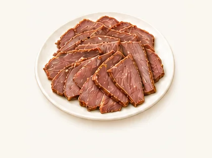 Guangrao seasoned donkey meat 广饶肴驴肉AI dish illustration / AI 菜品示意图
Expect firm, fine-grained meat with concentrated savoury seasoning. Its texture is different from a soft pork-belly braise.
Source ↗Read the dish guide → Damatou hutou chicken 大码头虎头鸡AI dish illustration / AI 菜品示意图
The result is tender chicken with a soft, savoury coating. Bone-in pieces need care when eating.
Source ↗Read the dish guide →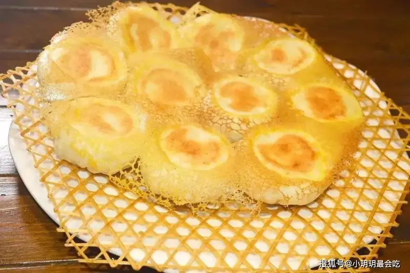 Lijin Pan-Fried Pork Buns 利津水煎包
Lijin Pan-Fried Pork Buns (利津水煎包) combine a soft fermented wrapper with pork and vegetables and a crisp fried crust. The name refers to cooking with water and oil, a method developed in Lijin (利津).
Read the dish guide →Photo adjustments
EXIF orientation normalized; resized without changing aspect ratio; converted to WebP. No subject edits.
 Yellow River Estuary Hairy Crabs 黄河口大闸蟹AI illustration · AI 示意图(仅供参考,非实拍)
Yellow River Estuary Hairy Crabs (黄河口大闸蟹) come from Dongying (东营), where the Yellow River enters the Bohai Sea. Kenli District (垦利区) is the main production area, with crab farming developed on the estuary’s saline-alkali land.
Read the dish guide → Shikou Braised and Smoked Chicken 史口烧鸡Reference photo of a similar dish · 同类菜品参考照片
Shikou Braised and Smoked Chicken (史口烧鸡) is a Shikou (史口) speciality with firm, chewy meat and a savoury, salty flavour. Haibao News describes it as combining traditional Shandong (山东) cooking techniques with local seasoning.
Read the dish guide →
Photo adjustments
Full frame retained; EXIF orientation normalized, proportionally resized to at most 800 pixels and converted to WebP. No generated pixels or subject changes. Cards may crop the display.
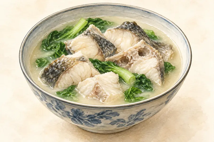 Gudao Fresh Fish Soup 孤岛鲜鱼汤AI illustration · AI 示意图(仅供参考,非实拍)
Gudao Fresh Fish Soup (孤岛鲜鱼汤) is a fish soup named after Gudao (孤岛), a town of Hekou District (河口区) in the northeast of Dongying (东营), Shandong.
Read the dish guide →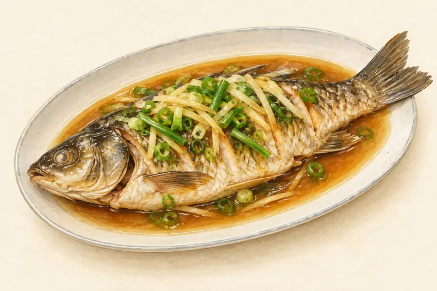 Yellow River Knife Fish 黄河刀鱼AI illustration · AI 示意图(仅供参考,非实拍)
Yellow River Knife Fish (黄河刀鱼) appears among the estuary specialties described by Dongying News (东营网). Its narrow, blade-like shape gives it its name.
Read the dish guide →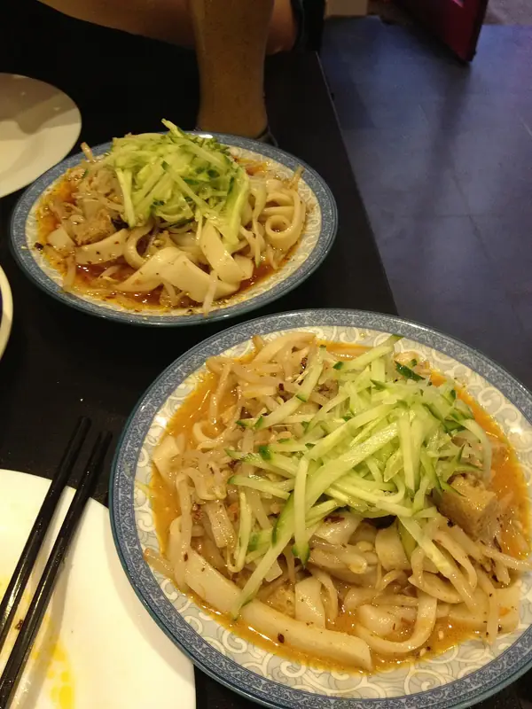 Hekou Cold Skin Noodles 河口凉皮
Hekou Cold Skin Noodles (河口凉皮) are the cold dressed sheets sold at shops and street stalls all over Hekou District (河口区) in Dongying (东营), Shandong.
Read the dish guide →
Photo adjustments
EXIF orientation normalized; resized without changing aspect ratio; converted to WebP. No subject edits.
All dish names · 全部菜名 (10)
- Guangrao seasoned donkey meat · 广饶肴驴肉
- Damatou hutou chicken · 大码头虎头鸡
- Lijin Pan-Fried Pork Buns · 利津水煎包
- Yellow River Estuary Hairy Crabs · 黄河口大闸蟹
- Shikou Braised and Smoked Chicken · 史口烧鸡
- Gudao Fresh Fish Soup · 孤岛鲜鱼汤
- Yellow River Knife Fish · 黄河刀鱼
- Hekou Cold Skin Noodles · 河口凉皮
- Yanwo Mutton Soup · 盐窝羊汤
- Yellow River Estuary Hard Clams · 黄河口文蛤
More dishes from across Shandong are in the Shandong food guide.
Counties & districts in Dongying
5 areas belong directly to Dongying.
5 areas
Dongying District 东营区
Dongying (simplified Chinese: 东营区; traditional Chinese: 東營區; pinyin: Dōngyíng Qū) is a district and the seat of Dongying in the Chinese province of Shandong.
Explore the area →DistrictHekou District 河口区
Hekou is a district of the city of Dongying, Shandong province, China. As of the census of 2010, there were 247,595 people, and 90,092 families residing in Hekou.
Explore the area →DistrictKenli District 垦利区
Kenli District (simplified Chinese: 垦利区; traditional Chinese: 墾利區; pinyin: Kěnlì Qū) is a district of the city of Dongying, in northern Shandong province. The district includes the mouth of the Yellow River.
Explore the area →CountyLijin County 利津县
Lijin County (simplified Chinese: 利津县; traditional Chinese: 利津縣; pinyin: Lìjīn Xiàn) is a county of Shandong province, People's Republic of China, situated on the northwestern (left) bank of the Yellow River.
Explore the area →No areas match this name.
Plan your visit
Getting there
Search for 东营市 in a map app to find stations and your accommodation.
Where to stay →Build your route
Yellow River Delta National Nature Reserve and Yellow River Estuary Eco-Tourism Area are both listed here. The linked place guides have entrance and visit details.
Continue with Shandong →More in Shandong
Sources & geographic information
Administrative names and parent areas: Official geographic directory · Reference date 2026-09-06.
Background text adapted from Dongying — Wikipedia contributors, under CC BY-SA 4.0. Text has been shortened and reorganized; source revision 1372047829.
Photo: Yellow River Delta National Nature Reserve · rheins · CC BY 3.0. Full frame retained; proportionally resized and converted to WebP. No retouching or changes to the photographed subject. Card displays may crop the view.

Photo: Yellow River Estuary Eco-Tourism Area · rheins · CC BY 3.0. Full frame retained; proportionally resized and converted to WebP. No retouching or changes to the photographed subject. Card displays may crop the view.

Map data © OpenStreetMap contributors. Pins mark approximate centres, not entrances or boundaries.