


Get to know Dong'e County
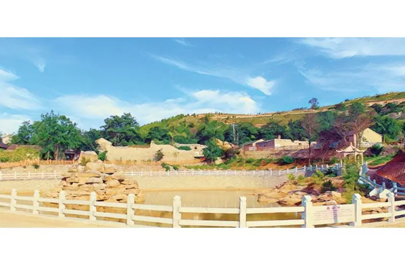
Photo adjustments
EXIF orientation normalized; resized without changing aspect ratio; converted to WebP. No subject edits.
- Administrative area
- County · 县
- Part of
- Liaocheng
- Chinese name
- 东阿县
- Local areas
- County guide
Area & population
- Area in the source
- 729.00 km²
- Population · 2019
- 386,200
Source: cited geographic source, as of the dates shown.
Setting and landscape
The county sits on the alluvial plain of the lower Yellow River, which runs for 57 kilometres along its southeastern side. Across the river are Pingyin (平阴县), part of Jinan (济南), to the east and Dongping (东平县) in Tai'an (泰安) to the southeast; Dongchangfu District (东昌府区) borders it on the west. The eastern route of the South–North Water Diversion passes under the river here in a tunnel. Southeast of the county town rises Mount Yu (鱼山), described as a western outlier of Mount Tai (泰山) and listed as a provincial geopark.
History
The settlement first appears in the Spring and Autumn Annals (春秋) under the name Ke (柯), belonging first to the state of Wei (卫国) and later to Qi (齐国). In the Warring States period it was called E (阿), and under the Qin it was first named Dong'e. Repeated shifts in the course of the Yellow River were one reason its jurisdiction changed. The county offices moved to Tongcheng (铜城) in the winter of 1947.
What to see
Cao Zhi (曹植), a leading writer of the Three Kingdoms state of Wei and the third son of Cao Cao (曹操), is buried at the western foot of Mount Yu. His tomb has an entrance passage, a front chamber and a rear chamber; a clearance in 1951 recovered 132 objects, and the State Council listed it as a nationally protected monument in November 1996. Tradition holds that while Cao Zhi was Prince of Dong'e he heard Buddhist chanting in the air on Mount Yu and copied its cadences to compose a chant; Yushan Buddhist chant (鱼山梵呗) is now national intangible heritage, and the Yushan Cao Zhi scenic area is rated 4A.
Other heritage sites in the county include the Tomb of Cangjie (仓颉墓), the Dengmiao stone carvings (邓庙石刻造像) and Jingjue Temple (净觉寺). Along the river are the Yellow River National Forest Park (黄河国家森林公园) and Weishan Yellow River Park (位山黄河公园).
Food and local products
Li Shizhen's Compendium of Materia Medica (本草纲目) records that ejiao is named after Dong'e, where it came from, and the county calls itself China's home of ejiao. The Dong'e Traditional Chinese Medicine Culture Tourism Area, rated 4A, brings together the Dong'e Ejiao City (东阿阿胶城), the China Ejiao Museum (中国阿胶博物馆), Luoshen Lake Wetland Park (洛神湖湿地公园) and the 1953 Industrial Heritage Park (1953工业遗产博览园). Dong'e also styles itself China's home of donkey-meat cuisine and of Yellow River carp, and the Dong'e black donkey was selected for a national agricultural-brand programme in 2024.
Highlights
- Tomb of Cao Zhi 曹植墓: Three-chamber tomb of the Wei writer at the western foot of Mount Yu; national protected monument since 1996.
- Yushan Buddhist chant 鱼山梵呗: Chant traditionally traced to Cao Zhi's time on Mount Yu; national intangible heritage.
- Ejiao 阿胶: Traditional tonic medicine named after Dong'e in the Compendium of Materia Medica.
- China Ejiao Museum 中国阿胶博物馆: Part of the 4A Dong'e Traditional Chinese Medicine Culture Tourism Area.
Sources for this guide
东阿县 - 维基百科,自由的百科全书 · Wikipedia (Chinese) · CC BY-SA 4.0
聊城市人民政府 - 县市区风采 - 东阿县 · Liaocheng Municipal People's Government
Original English written from the listed sources and checked sentence by sentence against quoted extracts by a separate reviewer. Updated 2026-09-23.
Explore Dong'e County
Core places to explore, with English and Chinese names.
Dong'e County 东阿县
Plan your visit
Getting there
Dong'e County is about 25 km in a straight line from central Liaocheng. Search for 东阿县 in a map app to find stations and your accommodation.
Where to stay →More in Liaocheng
Sources & geographic information
Administrative names and parent areas: Official geographic directory · Reference date 2026-09-06.
Some facts checked against 东阿县 — Wikipedia contributors, CC BY-SA 4.0.
Map data © OpenStreetMap contributors. Pins mark approximate centres, not entrances or boundaries.