


Get to know Anqiu
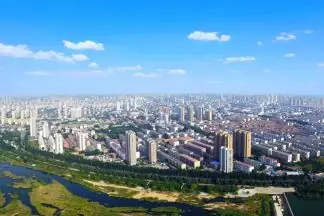
Photo adjustments
EXIF orientation normalized; resized without changing aspect ratio; converted to WebP. No subject edits.
- Administrative area
- County-level city · 县级市
- Part of
- Weifang
- Chinese name
- 安丘市
- Local areas
- County-level city guide
Area & population
- Area in the source
- 1,760.00 km²
- Population · 2019
- 962,000
Source: cited geographic source, as of the dates shown.
Setting and landscape
The city measures about 64.5 kilometres from north to south and 65.3 kilometres from east to west. Its longest river is the Wen (汶河), and its largest body of water is Mushan Reservoir (牟山水库), built in 1960 in the south-west of the city on the middle and lower Weiwen River (潍汶河). The reservoir's dam runs for 5,870 metres; the lake controls floods, irrigates farmland, supports fish farming and is the only water source for the urban area.
History
Local history is traced to the Spring and Autumn state of Ju (莒), when the area was the fief of a noble called Quqiu Fu (渠丘父). In 199 BC the first Han emperor made the general Zhang Yue (张说) Marquis of Anqiu on this old Quqiu land, and in 148 BC the county was formally set up under the marquisate's name. It was later called Zhuzhi (诛郅), Moushan (牟山), Futang (辅唐) and Jiaoxi (胶西) before the name Anqiu returned in 971. The county became a county-level city on 18 January 1994.
Food and local products
The town of Jingzhi (景芝镇) is known for baijiu. In 1948, 72 distilling workshops in the town merged into the Shandong Jingzhi Distillery. Specialists found a sesame note in Jingzhi liquor in 1957, and in 1965 the distillery began research on a sesame-aroma style of baijiu. The traditional brewing technique of Jingzhi liquor (景芝酒传统酿造技艺) was added to the national intangible cultural heritage list in 2021, and the distillery grounds, called Jingzhi Liquor City (景芝酒之城), are a national 4A tourist attraction.
Getting oriented
Fangzi District (坊子区) lies to the east and north, Changle (昌乐县) and Linqu (临朐县) to the west, and Zhucheng (诸城市) and Yishui (沂水县) to the south. The city government is about 29 kilometres by road from the Weifang city government, 170 kilometres from Qingdao and 238 kilometres from Jinan, and National Highway 206 crosses the city.
Highlights
- Mushan Reservoir 牟山水库: Large reservoir completed in 1960 on the Weiwen River, with a 5,870-metre dam; the urban area's only water source.
- Jingzhi Liquor City 景芝酒之城: Distillery grounds in Jingzhi town, a national 4A tourist attraction.
- Jingzhi liquor brewing technique 景芝酒传统酿造技艺: Listed as national intangible cultural heritage in 2021; research on sesame-aroma baijiu began here in 1965.
Sources for this guide
安丘市 - 维基百科,自由的百科全书 · Wikipedia (Chinese) · CC BY-SA 4.0
牟山水库 - 维基百科,自由的百科全书 · Wikipedia (Chinese) · CC BY-SA 4.0
景芝酒业 - 维基百科,自由的百科全书 · Wikipedia (Chinese) · CC BY-SA 4.0
Original English written from the listed sources and checked sentence by sentence against quoted extracts by a separate reviewer. Updated 2026-09-23.
Explore Anqiu
Core places to explore, with English and Chinese names.
Places to explore around Anqiu
 Qingyunshan Folk Amusement Park ·
 Plan your visit
Getting there
Anqiu is about 25 km in a straight line from central Weifang. Search for 安丘市 in a map app to find stations and your accommodation.
Where to stay →Build your route
Start with Qingyunshan Folk Amusement Park. The linked place guides have entrance and visit details.
Continue with Weifang →More in Weifang
Sources & geographic information
Administrative names and parent areas: Official geographic directory · Reference date 2026-09-06.
Some facts checked against 安丘市 — Wikipedia contributors, CC BY-SA 4.0.
Some facts checked against 牟山水库 — Wikipedia contributors, CC BY-SA 4.0.
Some facts checked against 景芝酒业 — Wikipedia contributors, CC BY-SA 4.0.
Photo: Qingyunshan Folk Amusement Park · Source photographer · License not provided. EXIF orientation normalized; resized without changing aspect ratio; converted to WebP. No subject edits.
Map data © OpenStreetMap contributors. Pins mark approximate centres, not entrances or boundaries.