


Get to know Fangzi District
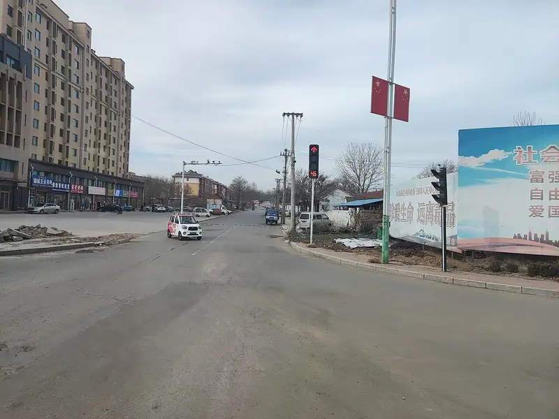
Photo adjustments
Full frame retained; EXIF orientation normalized, proportionally resized to at most 800 pixels and converted to WebP. No generated pixels or subject changes. Cards may crop the display.
- Administrative area
- District · 市辖区
- Part of
- Weifang
- Chinese name
- 坊子区
- Local areas
- District guide
Area & population
- Population · 2018
- 325,000
Source: cited geographic source, as of the dates shown.
Setting and landscape
The Weiwen (潍汶河) and Bailang (白浪河) river systems flow through the district, and the Yu (虞河), Baisha (白沙河), Fengxiang (凤翔河) and Zhangmian (张面河) rivers cross its urban area. The climate is warm-temperate and semi-humid, with about 598 millimetres of rain a year.
History
According to local tradition, in the Tang dynasty a well and a square earth mound were set up to mark the point 30 li south of Wei County (潍县) on the post road to Anqiu and Zhucheng. In the late Qing a father and son named Liu opened an inn beside the mound and called it Fangzi Inn (坊子店); when an administrative office was set up here in 1904, the place became Fangzi Town. After Germany and the Qing signed the 1898 Jiaozhou Bay (胶澳) lease treaty, Germany began its first shaft here, the Fangzi Shaft (坊子竖坑), in September 1898, moved it 1 kilometre east under the same name in September 1901 and started mining coal in 1902; a German-built station on the Qingdao–Jinan railway opened in June 1902. During the German-Japanese fighting of 1914, Japan seized the mine that September and returned it to China in 1922, then occupied Fangzi again from 1938 to 1945.
What to see
The Fangzi German-Japanese Building Group (坊子德日建筑群), a national key cultural relics protection unit since 2013, keeps 166 buildings from the German and Japanese periods, 103 of them German, along with the German station and railway facilities, old mine shafts and Republic-era buildings such as the Wanhe Building (万和楼). Since 2014 the district has restored 68 of them, including the mine shaft, the German army headquarters and military hospital, a Japanese consular branch office, a priest's house, the nuns' house, the electric-light company, the railway locomotive depot and the Japanese military police building.
Jiulongjian Natural Scenic Area (九龙涧), in Jiulong Subdistrict (九龙街道) 20 kilometres east of Weifang, is a landscape of cliffs, gullies and scattered lakes. Local legend says Jiang Taigong (姜太公) fished here, and Taigongtang Mountain (太公堂山), 4 kilometres to the south, is named after a shrine to him.
Getting oriented
Weifang airport is 3 kilometres from the district. The Jinan–Qingdao high-speed railway, the Qingdao–Jinan railway and the Qingdao–Yinchuan and Weifang–Laixi expressways cross it, together with National Highways 206, 308 and 309.
Highlights
- Fangzi German-Japanese Building Group 坊子德日建筑群: National key protected site since 2013, with 166 German and Japanese buildings, 103 of them German.
- Fangzi Shaft 坊子竖坑: Germany's first shaft here, begun in 1898, re-sunk 1 km east in 1901 and since restored.
- Jiulongjian Natural Scenic Area 九龙涧: Gorge of cliffs and lakes 20 km east of Weifang, tied to legends of Jiang Taigong.
Sources for this guide
坊子概况 — 坊子区人民政府 · Fangzi District People's Government, Weifang
区位交通 — 坊子区人民政府 · Fangzi District People's Government, Weifang
坊子德日建筑群文物保护项目 — 坊子区人民政府 · Fangzi District People's Government, Weifang
姜太公垂钓九龙涧 — 坊子区人民政府 · Fangzi District People's Government, Weifang
坊子区 - 维基百科,自由的百科全书 · Wikipedia (Chinese) · CC BY-SA 4.0
坊子德日建筑群 - 维基百科,自由的百科全书 · Wikipedia (Chinese) · CC BY-SA 4.0
Original English written from the listed sources and checked sentence by sentence against quoted extracts by a separate reviewer. Updated 2026-09-23.
Explore Fangzi District
Core places to explore, with English and Chinese names.
Fangzi District 坊子区
Plan your visit
Getting there
Fangzi District is about 6 km in a straight line from central Weifang. Search for 坊子区 in a map app to find stations and your accommodation.
Where to stay →More in Weifang
Sources & geographic information
Administrative names and parent areas: Official geographic directory · Reference date 2026-09-06.
Some facts checked against 坊子区 — Wikipedia contributors, CC BY-SA 4.0.
Some facts checked against 坊子德日建筑群 — Wikipedia contributors, CC BY-SA 4.0.
Map data © OpenStreetMap contributors. Pins mark approximate centres, not entrances or boundaries.