


Get to know Wendeng District
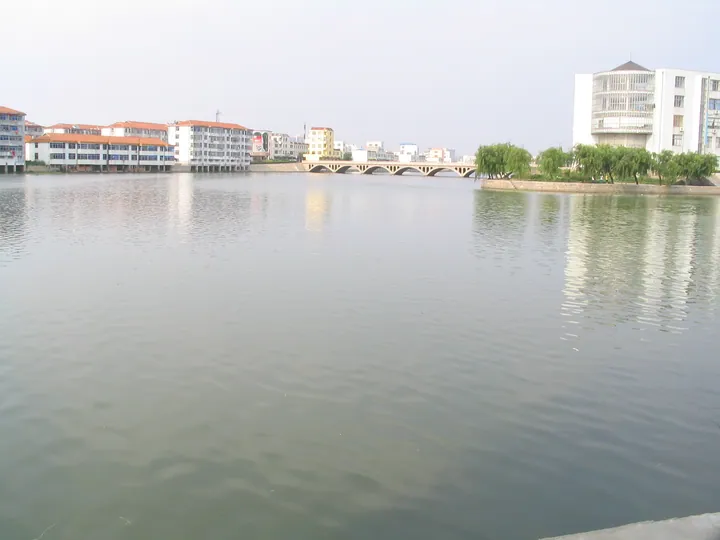
Photo adjustments
Full frame retained; proportionally resized and converted to WebP. No retouching or changes to the photographed subject. Card displays may crop the view.
- Administrative area
- District · 市辖区
- Part of
- Weihai
- Chinese name
- 文登区
- Local areas
- District guide
Area & population
- Area in the source
- 1,616.00 km²
- Population · 2019
- 593,100
Source: cited geographic source, as of the dates shown.
Setting and landscape
Most of the district is low mountains and hills, with 155.88 kilometres of coastline. It borders Muping (牟平区) in Yantai and Rushan (乳山市) to the west, Huancui District (环翠区) to the north and Rongcheng (荣成市) to the east. The mean annual temperature is about 11°C and annual rainfall about 827 millimetres, and the ground holds large deposits of china clay.
History
Wendeng County was created in 568, under the Northern Qi (北齐), from parts of two older counties. The name comes from a local hill: according to the geography Taiping Huanyu Ji (太平寰宇记), Qin Shi Huang (秦始皇) on his eastern tour called scholars to climb the hill east of the town and praise his deeds, so it became Wendeng, "where the scholars climbed". The early county covered all of present-day Weihai; in 1735 its eastern part became Rongcheng County, and in 1898 Britain leased Weihaiwei (威海卫), which lay within it. Wendeng became a county-level city in 1988 and a district of Weihai in 2014.
What to see
Kunyu Mountain, shared with Muping, rises to 923 metres at its main peak, Taibo Ding (泰礴顶). Its fame is Taoist. The Jin-dynasty teacher Wang Chongyang (王重阳) gathered his seven leading followers, the Seven Perfected (全真七子), on this mountain, and the Quanzhen school (全真道) began here. Shenqing Temple (神清观), the school's ancestral temple, dates back more than 800 years and has been rebuilt. Carved texts include Laozi's Daodejing (道德经) cut into a cliff face, a Han-dynasty Yongkang inscription (永康石刻) and Jin and Yuan steles recording imperial edicts; the historic Zhaoyang Cave (朝阳洞) and Donghua Cave (东华洞) also remain.
Food and local products
Wendeng American ginseng (文登西洋参) began in 1981, when the herb grower Wang Jizhen (王继振) and his son-in-law sowed 11 seeds on Shuangding Mountain (双顶山); eight seedlings came up, and Kouzili Village (口子李村) was the only one of nine Shandong trial sites to succeed. After six years of trials the plant was grown in open fields. The district agriculture bureau says local ginseng comes up more than a month earlier in spring and dies back more than a month later than in other growing regions, and the product holds a geographical indication. Farms also produce wheat, maize, peanuts and apples, and the sea yields fish, prawns and shellfish.
Highlights
- Kunyu Mountain 昆嵛山: 923-metre Taoist mountain where Wang Chongyang founded the Quanzhen school; shared with Muping.
- Shenqing Temple 神清观: Ancestral temple of the Quanzhen school on Kunyu Mountain, first built over 800 years ago and since rebuilt.
- Wendeng American ginseng 文登西洋参: Grown locally since trials with 11 seeds in 1981; a geographical-indication product.
Sources for this guide
文登区 - 维基百科,自由的百科全书 · Wikipedia (Chinese) · CC BY-SA 4.0
昆嵛山 - 维基百科,自由的百科全书 · Wikipedia (Chinese) · CC BY-SA 4.0
威海市文登区人民政府 文登西洋参专题 栽培起源 · Wendeng District People's Government, Weihai (source: Wendeng District Agriculture and Rural Affairs Bureau)
威海市文登区人民政府 文登西洋参专题 生长习性 · Wendeng District People's Government, Weihai (source: Wendeng District Agriculture and Rural Affairs Bureau)
Original English written from the listed sources and checked sentence by sentence against quoted extracts by a separate reviewer. Updated 2026-09-23.
Explore Wendeng District
Core places to explore, with English and Chinese names.
Wendeng District 文登区
Plan your visit
Getting there
Wendeng District is about 35 km in a straight line from central Weihai. Search for 文登区 in a map app to find stations and your accommodation.
Where to stay →More in Weihai
Sources & geographic information
Administrative names and parent areas: Official geographic directory · Reference date 2026-09-06.
Some facts checked against 文登区 — Wikipedia contributors, CC BY-SA 4.0.
Some facts checked against 昆嵛山 — Wikipedia contributors, CC BY-SA 4.0.
Map data © OpenStreetMap contributors. Pins mark approximate centres, not entrances or boundaries.