


Get to know Rongcheng
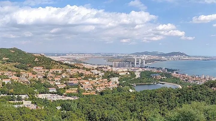
Photo adjustments
Full frame retained; resized proportionally to a maximum dimension of 960 pixels and converted to WebP quality 88. No crop, retouch, generated elements, or subject alteration. Final website rendition: full frame retained, proportionally resized to at most 720 pixels and converted to WebP. No additional retouching or subject alteration. Card displays may crop the view.
- Administrative area
- County-level city · 县级市
- Part of
- Weihai
- Chinese name
- 荣成市
- Local areas
- County-level city guide
Area & population
- Area in the source
- 1,526.00 km²
- Population · 2019
- 738,600
Source: cited geographic source, as of the dates shown.
Setting and landscape
The land is the eastern end of the Jiaodong hill country: hills make up about half the area, mountains a third and plain the rest, and most ranges run east to west. The sea moderates the climate, so winters are rarely severe and summers not extremely hot, and spring warms slowly along the coast. Granite is Rongcheng's leading mineral resource, with varieties such as Shidao Red (石岛红), and its shallow seas and tidal flats hold flounder, prawns, abalone, sea cucumber, sea urchin, scallops, oysters, kelp and wakame.
History
In 201 BC the Western Han created Buye County (不夜县), whose ruins lie south of Buye village in Buliu town (埠柳镇), about 30 kilometres west of Chengshantou. In 1380 the Ming set up the Chengshan and Jinghai garrisons against pirates. When Chengshan garrison became a county in 1735, the Yongzheng Emperor chose the name Rongcheng, recalling that the First Emperor had shot a great fish at Rongcheng Mountain. Rongcheng became a county-level city in December 1988. In the Tang period the Silla commander Jang Bogo (张保皋) founded the Chishan Fahua Temple (赤山法华院) at the foot of Mount Chishan (赤山) in the north of Shidao town (石岛镇), and the Japanese monk Ennin (圆仁) studied there.
What to see
Chengshantou is surrounded by sea on three sides and was approved by the State Council as a national scenic area in 1988. In ancient times it was held to be the dwelling of the sun god. The First Emperor of Qin came here twice between 219 and 210 BC; in 219 BC he had Li Si (李斯) write words calling it the end of the sky and the eastern gate of Qin, and had them carved on a stone. His former travelling palace became the Shihuang Temple (始皇庙), which also has a shrine to Deng Shichang (邓世昌). Hailü Island (海驴岛), a 0.07-square-kilometre islet in the sea north of the cape, has sea stacks and sea caves and many gulls. Japanese troops landed at Chengshantou in 1895 before taking Weihaiwei.
At Yuankuang village (院夼村), fishermen hold a sea sacrifice on the Guyu solar term in spring, when fish and shrimp migrate into the waters south of the village; the festival is on the national intangible heritage list (2008) as part of the fishermen's sea-going and thanksgiving festivals (渔民开洋、谢洋节).
Highlights
- Chengshantou 成山头: Easternmost point of the Shandong Peninsula, a national scenic area since 1988.
- Shihuang Temple 始皇庙: Former travelling palace of the First Emperor of Qin at Chengshantou.
- Hailü Island 海驴岛: Islet of 0.07 square kilometres off Chengshantou with sea stacks and many gulls.
- Chishan Fahua Temple 赤山法华院: Founded in the Tang by the Silla commander Jang Bogo at the foot of Mount Chishan.
- Yuankuang sea sacrifice 渔民开洋、谢洋节: Fishermen's festival on the Guyu solar term, on the national intangible heritage list since 2008.
Sources for this guide
荣成市 - 维基百科,自由的百科全书 · Wikipedia (Chinese) · CC BY-SA 4.0
渔民开洋、谢洋节 - 中国非物质文化遗产网·中国非物质文化遗产数字博物馆 · China Intangible Cultural Heritage Network (Chinese National Academy of Arts)
成山头 - 维基百科,自由的百科全书 · Wikipedia (Chinese) · CC BY-SA 4.0
Original English written from the listed sources and checked sentence by sentence against quoted extracts by a separate reviewer. Updated 2026-09-25.
Explore Rongcheng
Core places to explore, with English and Chinese names.
Places to explore around Rongcheng
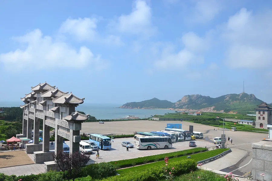 The entrance and coach-parking area at Chengshantou, with the coast beyond. Photographed on 4 August 2011.
Chengshantou成山头
Chengshantou is the eastern headland of the Shandong Peninsula in Rongcheng. Sea surrounds the promontory on three sides.
Read the place guide →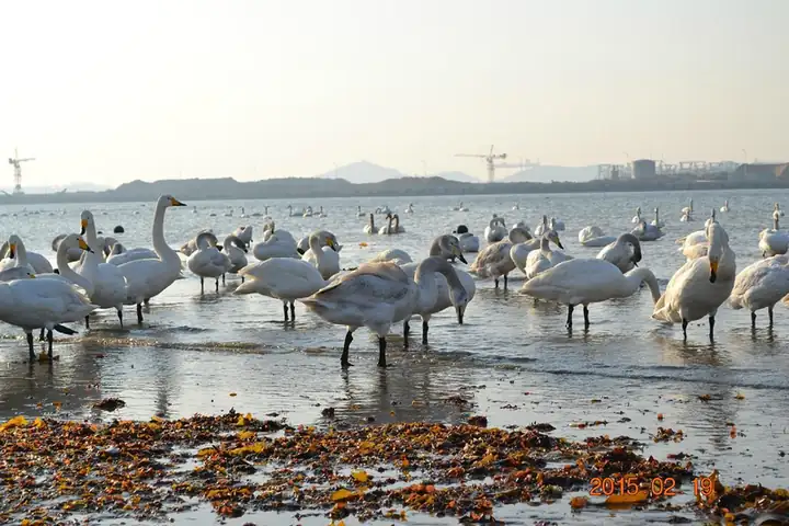 Yandunjiao Village · 烟墩角
Yandunjiao Village烟墩角
Yandunjiao (烟墩角) is a coastal village in Lidao town, Rongcheng, Weihai, Shandong. It is one of the places where whooper swans spend the winter, and the birds are the reason most people go there.
Read the place guide →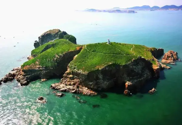 Hailu Island · 海驴岛
Hailu Island海驴岛
Hailvdao (海驴岛) is a small island off Rongcheng in Weihai, Shandong, inside the Haoyunjiao tourist resort area. It is a spring breeding ground for black-tailed gulls.
Read the place guide → AI illustration · AI 示意图(仅供参考,非该地点实拍)
Chishan Scenic Area赤山
Chishan (赤山) is a coastal hill at Shidao in Rongcheng, in the southeastern part of Weihai, Shandong, and gives its name to the Shidao Chishan scenic area facing the Yellow Sea. Its centrepiece is Fahuayuan, a monastery first founded in 824 with links to Korea and Japan.
Read the place guide →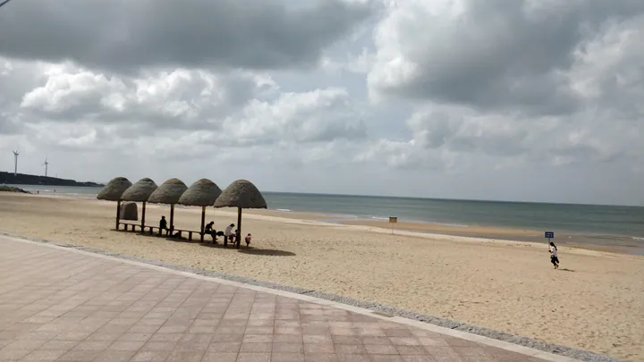 Thatched sun shelters on the beach at Naxianghai resort, Rongcheng · 荣成市那香海度假区沙滩茅草凉亭 Source-recorded photograph date: 2018-07-11 14:57:47.
Naxianghai Coastal Resort那香海
Naxianghai (那香海) is a purpose-built coastal resort area on the northern shore of Rongcheng, Weihai, Shandong, with the Yellow Sea to the north and the Buliu River to the south. Construction began in 2012 and it was rated a national 4A scenic area in 2017.
Read the place guide →Plan your visit
Getting there
Rongcheng is about 50 km in a straight line from central Weihai. Search for 荣成市 in a map app to find stations and your accommodation.
Where to stay →Build your route
Chengshantou and Yandunjiao Village are both listed here. The linked place guides have entrance and visit details.
Continue with Weihai →More in Weihai
Sources & geographic information
Administrative names and parent areas: Official geographic directory · Reference date 2026-09-06.
Some facts checked against 荣成市 — Wikipedia contributors, CC BY-SA 4.0.
Some facts checked against 成山头 — Wikipedia contributors, CC BY-SA 4.0.
Photo: Chengshantou · guan · CC BY 3.0. Proportionally resized and converted to WebP without cropping, retouching or changing the photographed subject.
.jpg)
Photo: Yandunjiao Village · Source photographer · License not provided. EXIF orientation normalized; resized without changing aspect ratio; converted to WebP. No subject edits.
Photo: Hailu Island · Source photographer · License not provided. EXIF orientation normalized; resized without changing aspect ratio; converted to WebP. No subject edits.
Photo: Naxianghai Coastal Resort · Sunyiming · CC BY-SA 4.0. Full frame retained; proportionally resized and converted to WebP. No retouching or changes to the photographed subject. Card displays may crop the view.

Map data © OpenStreetMap contributors. Pins mark approximate centres, not entrances or boundaries.