


Get to know Shanting District
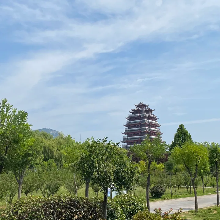
Photo adjustments
Full frame retained; proportionally resized and converted to WebP. No retouching or changes to the photographed subject. Card displays may crop the view.
- Administrative area
- District · 市辖区
- Part of
- Zaozhuang
- Chinese name
- 山亭区
- Local areas
- District guide
Area & population
- Area in the source
- 1,019.20 km²
- Population · 2016
- 528,600
Source: cited geographic source, as of the dates shown.
Setting and landscape
The land tilts from east to west: low hills and mountains of around 500 metres in the east give way to an alluvial plain below 100 metres in the west. Limestone is the dominant rock, the district counts more than 5,000 hilltops, and mountains and hills make up 88.6 percent of its area. Yiyun Mountain (翼云山), Motianling (摩天岭) and Baodugu (抱犊崮), the three highest summits in Zaozhuang, all stand here.
History
People lived here in the Neolithic about 7,300 years ago, and Dawenkou (大汶口文化) and Longshan (龙山文化) culture remains have been found at the Dongjiang site (东江遗址) and the Jianxin site (建新遗址) in Xiji (西集). In the Western Zhou the area was the small state of Ni (倪国), later renamed Xiao Zhu (小邾国); its capital was at the Dongjiang site, where the ruins of Ni city survive. Chu conquered Xiao Zhu under King Xuan, who reigned from 369 to 340 BC.
On 20–21 November 1939 the Yi County Anti-Japanese Democratic Government (峄县抗日民主政府), the first such government in southern Shandong, was founded at Wangjiawan village (王家湾村). The founding site became a provincial protected site in June 2015.
What to see
Baodugu rises to 584 metres and is called the highest peak of the southern Shandong hills; it was known as Loushan (楼山) under the Han and took its present name in the Tang and Song. In the 1923 Lincheng train robbery (临城劫车案), the passengers were taken to Baodugu. The Baodugu National Forest Park has four scenic areas and was named one of the first national agricultural tourism demonstration sites in 2004.
Xiong'er Mountain National Geopark (熊耳山国家地质公园), approved in December 2001, lies in Beizhuang town (北庄镇) and combines Xiong'er Mountain with the Shuanglong Great Rift (双龙大裂谷) and groups of karst caves. The Dongjiang site covers about 900 by 500 metres on two terraces.
Highlights
- Baodugu 抱犊崮: 584-metre peak, one of Zaozhuang's three highest, with a national forest park.
- Xiong'er Mountain National Geopark 熊耳山国家地质公园: Geopark in Beizhuang town with the Shuanglong Great Rift and cave groups, approved 2001.
- Dongjiang site 东江遗址: Neolithic remains and the capital of the Zhou-era state of Ni.
- Wangjiawan founding site 王家湾峄县抗日民主政府成立地旧址: Where southern Shandong's first anti-Japanese democratic government was founded in 1939.
Sources for this guide
枣庄市山亭区人民政府-- 区情概况 · Shanting District People's Government, Zaozhuang
枣庄市山亭区人民政府-- 历史沿革 · Shanting District People's Government, Zaozhuang
枣庄市山亭区人民政府-- 自然地理 · Shanting District People's Government, Zaozhuang
山亭区 - 维基百科,自由的百科全书 · Wikipedia (Chinese) · CC BY-SA 4.0
抱犊崮 - 维基百科,自由的百科全书 · Wikipedia (Chinese) · CC BY-SA 4.0
Original English written from the listed sources and checked sentence by sentence against quoted extracts by a separate reviewer. Updated 2026-09-23.
Explore Shanting District
Core places to explore, with English and Chinese names.
Places to explore around Shanting District
 AI illustration · AI
 Plan your visit
Getting there
Shanting District is about 35 km in a straight line from central Zaozhuang. Search for 山亭区 in a map app to find stations and your accommodation.
Where to stay →Build your route
Start with Baodugu Mountain. The linked place guides have entrance and visit details.
Continue with Zaozhuang →More in Zaozhuang
Sources & geographic information
Administrative names and parent areas: Official geographic directory · Reference date 2026-09-06.
Some facts checked against 山亭区 — Wikipedia contributors, CC BY-SA 4.0.
Some facts checked against 抱犊崮 — Wikipedia contributors, CC BY-SA 4.0.
Map data © OpenStreetMap contributors. Pins mark approximate centres, not entrances or boundaries.