


Get to know Tai'erzhuang District
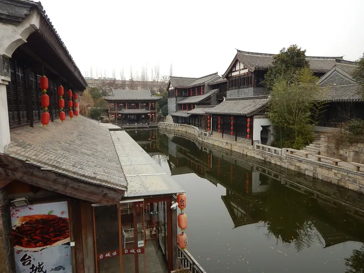
Photo adjustments
Full frame retained; proportionally resized and converted to WebP. No retouching or changes to the photographed subject. Card displays may crop the view.
- Administrative area
- District · 市辖区
- Part of
- Zaozhuang
- Chinese name
- 台儿庄区
- Local areas
- District guide
Area & population
- Area in the source
- 538.50 km²
- Population · 2014
- 321,900
Source: cited geographic source, as of the dates shown.
Setting and landscape
Jiangsu lies to the east and south, Xuzhou and Jining (济宁) to the southwest and west, and Yicheng District (峄城区) to the north; the district has long been called the southern gate of Shandong. The ground is higher in the south and north and lower in the middle, and it falls gradually from west to east: low hills roll across the southwest, the north is plain, and the centre and east are low-lying. In the town, a moat and the old canal, known as the Yuehe (月河), cross each other.
History
Under the Ming Wanli emperor, the canal's director-general Cao Shipin (曹时聘) petitioned for a post station and offices along the Tai'erzhuang stretch of the canal, and the place grew into a regional trading town. An earth-walled town was begun in 1647, with the canal along its south side, and the walls were rebuilt in brick in 1857. The fighting of March 1938 left the old town badly damaged. In 2009 the district was named the first Cross-Strait Exchange Base by the Taiwan Affairs Office.
What to see
The Tai'erzhuang old town (台儿庄古城) was rebuilt between August 2009 and August 2013 and now covers two square kilometres; it is a national 5A scenic area. Running through the town is a 3-kilometre stretch of Ming and Qing canal that the World Tourism Organization has called a "living canal".
The Tai'erzhuang Battle Memorial Hall (台儿庄大战纪念馆), built to commemorate the 1938 battle, opened on 8 April 1993 and is a 4A scenic area. The town also has the Li Zongren Historical Materials Museum (李宗仁史料馆), the He Jingzhi Literature Museum (贺敬之文学馆), a mosque and a war-history exhibition hall.
Getting oriented
The Beijing–Fuzhou Expressway, National Highway 206 and the Beijing–Shanghai high-speed railway all cross the district.
Highlights
- Tai'erzhuang old town 台儿庄古城: Walled canal town badly damaged in 1938 and rebuilt 2009–2013; national 5A scenic area.
- Tai'erzhuang Battle Memorial Hall 台儿庄大战纪念馆: Memorial to the 1938 battle, opened in April 1993.
- Li Zongren Historical Materials Museum 李宗仁史料馆: Museum in the district's urban area, alongside the battle memorial and the old town.
Sources for this guide
台儿庄区 - 维基百科,自由的百科全书 · Wikipedia (Chinese) · CC BY-SA 4.0
台儿庄古城 - 维基百科,自由的百科全书 · Wikipedia (Chinese) · CC BY-SA 4.0
台儿庄大战纪念馆 - 维基百科,自由的百科全书 · Wikipedia (Chinese) · CC BY-SA 4.0
Original English written from the listed sources and checked sentence by sentence against quoted extracts by a separate reviewer. Updated 2026-09-23.
Explore Tai'erzhuang District
Core places to explore, with English and Chinese names.
Places to explore around Tai'erzhuang District
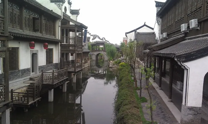 A canal lined with traditional buildings and an arched bridge in Tai'erzhuang Ancient City (Taierzhuang Ancient Town), Zaozhuang · 枣庄市台儿庄古城运河及拱桥沿岸建筑 Source-recorded photograph date: 2013-09-16 15:10:02.
Tai'erzhuang Ancient City台儿庄古城
Grand Canal town ruined in the 1938 battle and rebuilt in 2009-2013 around 53 war sites and 3 km of original canal banks and wharves.
Read the place guide →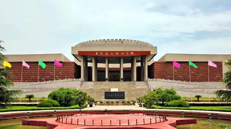 Tai'erzhuang Battle Memorial Hall · 台儿庄大战纪念馆
Tai'erzhuang Battle Memorial Hall台儿庄大战纪念馆
The Tai'erzhuang Battle Memorial Hall (台儿庄大战纪念馆) stands on the bank of the old Grand Canal in Tai'erzhuang District, Zaozhuang, and commemorates the spring 1938 battle in which Chinese forces defeated two elite Japanese divisions.
Read the place guide →Plan your visit
Getting there
Tai'erzhuang District is about 45 km in a straight line from central Zaozhuang. Search for 台儿庄区 in a map app to find stations and your accommodation.
Where to stay →Build your route
Tai'erzhuang Ancient City and Tai'erzhuang Battle Memorial Hall are both listed here. The linked place guides have entrance and visit details.
Continue with Zaozhuang →More in Zaozhuang
Sources & geographic information
Administrative names and parent areas: Official geographic directory · Reference date 2026-09-06.
Some facts checked against 台儿庄区 — Wikipedia contributors, CC BY-SA 4.0.
Some facts checked against 台儿庄古城 — Wikipedia contributors, CC BY-SA 4.0.
Some facts checked against 台儿庄大战纪念馆 — Wikipedia contributors, CC BY-SA 4.0.
Photo: Tai'erzhuang Ancient City · 蟋有的蟀 · CC BY-SA 3.0. Full frame retained; proportionally resized and converted to WebP. No retouching or changes to the photographed subject. Card displays may crop the view.

Photo: Tai'erzhuang Battle Memorial Hall · Source photographer · License not provided. EXIF orientation normalized; resized without changing aspect ratio; converted to WebP. No subject edits.
Map data © OpenStreetMap contributors. Pins mark approximate centres, not entrances or boundaries.