


Get to know Xuecheng District
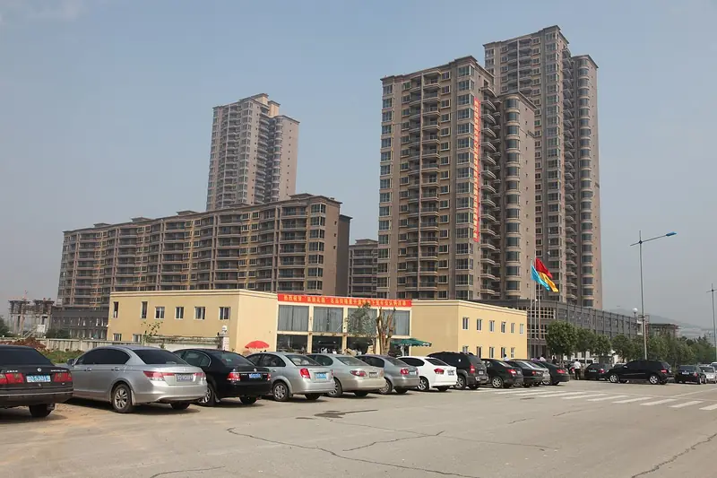
Photo adjustments
EXIF orientation normalized; resized without changing aspect ratio; converted to WebP. No subject edits.
- Administrative area
- District · 市辖区
- Part of
- Zaozhuang
- Chinese name
- 薛城区
- Local areas
- District guide
Area & population
- Population · 2016
- 462,500
Source: cited geographic source, as of the dates shown.
Setting and landscape
The district sits where the hills of southern Shandong meet the Jianghuai plain, higher in the east and lower in the west. Plains line the Panlong River (蟠龙河), the longest of seventeen rivers draining south-west into Weishan Lake and the Grand Canal (京杭大运河). The hills are mostly limestone. The highest, Shengtu Mountain (圣土山) at 374.3 metres, has cliffs tens of metres high on its south side, forming the flat-topped "half gu" (半崮) landform of southern Shandong. Neighbours are Shizhong and Yicheng (峄城) to the east, Weishan County (微山县) to the south-west, and Tengzhou (滕州) and Shanting (山亭) to the north.
History
People lived here more than 4,000 years ago, and in the Xia and Shang periods the area belonged to the state of Xue (薛国). Tian Wen (田文), Lord Mengchang (孟尝君), later held Xue as a fief and greatly enlarged its walled town, which gave Xuecheng its name. The district also claims Xi Zhong (奚仲), the Xia official whom legend credits with inventing the cart, and the Railway Guerrillas (铁道游击队).
In the Republican era the area was Lincheng County (临城县). It became Xuecheng County in September 1952, was abolished in March 1956, and Xuecheng District of Zaozhuang was set up on 30 June 1962. Shandong kuaishu (山东快书), a fast-talk storytelling form, originated with a performer from Qizhuang village (戚庄村) in Shagou town (沙沟镇).
What to see
Xi Zhong Mountain (奚仲山), 233.5 metres, in Taozhuang town (陶庄镇) has a tomb of Xi Zhong on Xiuqiu Hill (绣球山) to its west and, at the spot said to be his cart workshop, the remains of the Chefu Shrine (车服祠). The Railway Guerrillas Memorial Park (铁道游击队纪念公园) in the district seat combines a monument and stele corridor with a Republican-era film set. Lincheng Old Street (临城老街) is on Shandong's recommended list of intangible-heritage streets.
The Zhongchenhao kiln site (中陈郝瓷窑遗址) in Zouwu town (邹坞镇) has kilns dating from the Northern and Southern dynasties through to the Yuan. The Sun family ancestral hall at Niushan (牛山孙氏宗祠) was begun as a thatched hall in 1488. Luofang clay figures (洛房泥塑), first made in the early Republic as fired clay whistles, have been provincial intangible heritage since 2005. In Shagou, Shiliu Shanzhuang (石榴山庄) is the western gateway to a ten-thousand-mu pomegranate orchard.
Getting oriented
Zaozhuang Station on the Beijing–Shanghai high-speed railway and Zaozhuang West Station on the older Beijing–Shanghai railway both serve the district.
Highlights
- Xi Zhong Mountain 奚仲山: 233.5-metre hill with a tomb of Xi Zhong, the legendary inventor of the cart, and the remains of the Chefu Shrine.
- Railway Guerrillas Memorial Park 铁道游击队纪念公园: City park in the district seat with a monument, stele corridor and a Republican-era film set.
- Zhongchenhao kiln site 中陈郝瓷窑遗址: Kilns in Zouwu town in use from the Northern and Southern dynasties to the Yuan, with green-glazed shards on the ground.
- Luofang clay figures 洛房泥塑: Fired clay toys and figures begun in the early Republic; provincial intangible heritage since 2005.
- Shandong kuaishu 山东快书: Fast-talk storytelling that originated with a performer from Qizhuang village, Shagou town.
Sources for this guide
薛城简介 · Xuecheng District People's Government, Zaozhuang
薛城区 - 维基百科,自由的百科全书 · Wikipedia (Chinese) · CC BY-SA 4.0
Original English written from the listed sources and checked sentence by sentence against quoted extracts by a separate reviewer. Updated 2026-09-23.
Explore Xuecheng District
Core places to explore, with English and Chinese names.
Xuecheng District 薛城区
Plan your visit
Getting there
Xuecheng District is about 8 km in a straight line from central Zaozhuang. Search for 薛城区 in a map app to find stations and your accommodation.
Where to stay →More in Zaozhuang
Sources & geographic information
Administrative names and parent areas: Official geographic directory · Reference date 2026-09-06.
Some facts checked against 薛城区 — Wikipedia contributors, CC BY-SA 4.0.
Map data © OpenStreetMap contributors. Pins mark approximate centres, not entrances or boundaries.