


Get to know Juguang Township
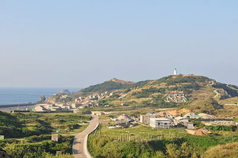
Photo adjustments
Full frame retained; EXIF orientation normalized, proportionally resized to at most 800 pixels and converted to WebP. No generated pixels or subject changes. Cards may crop the display.
- Administrative area
- Rural township · 鄉
- Part of
- Lienchiang County
- Chinese name
- 莒光鄉
- Local areas
- Rural township guide
Area & population
- Area in the source
- 5.26 km²
Source: cited geographic source, as of the dates shown.
Lighthouse and inscription
Built in 1872, the granite lighthouse rises about 19.5 metres. A low, white wall runs for 30 metres across the grass between the tower and office, built to shelter the keeper’s kerosene lamp from the strong wind. On Dongju (東莒), Dapu Inscription (大埔石刻) records the capture of 69 pirates by Shen Yourong (沈有容) during the Ming dynasty’s Wanli reign (明萬曆).
Xiju’s northeast coast
Caipuao (菜浦澳) lies in northeastern Xiju. Before Qingfan deep-water harbour (青帆深水碼頭) was completed, it served as the island’s principal summer landing bay. Its steep, uneven coast has cone-shaped granite formations, with radiating granite veins extending into the sea and forming bays of different sizes.
Sources for this guide
經典路線一(南北竿、莒光) | 馬祖國家風景區觀光資訊網 · Matsu National Scenic Area Administration
戰史巡禮四日遊 | 馬祖國家風景區觀光資訊網 · Matsu National Scenic Area Administration
Original English written from the listed sources and checked sentence by sentence against quoted extracts by a separate reviewer. Updated 2026-09-27.
Explore Juguang Township
Core places to explore, with English and Chinese names.
Juguang Township 莒光鄉
Plan your visit
Getting there
Juguang Township is about 20 km in a straight line from central Lienchiang County. Search for 莒光鄉 in a map app to find stations and your accommodation.
Where to stay →More in Lienchiang County
Sources & geographic information
Administrative names and parent areas: Official geographic directory · Reference date 2026-09-06.
Map data © OpenStreetMap contributors. Pins mark approximate centres, not entrances or boundaries.