

Photo adjustments
Full-frame source proportionally resized and converted to WebP for display. No subject alteration. Source-supplied marks and edits remain; cards may crop the view.
Explore the region
About Wulai
Food gives a clear sense of place: bamboo-tube rice, mountain vegetables, millet products and dishes seasoned with maqaw appear among the local offerings. The district also has strong Atayal cultural connections.
The small Wulai trolley began as a logging railway before carrying visitors towards the waterfall area. Combining the old street with that corridor explains both the settlement and its forest-industry past. Choose a hot-spring venue separately if you want to bathe; a visit to the town does not include access to every bath.
What to look for
- Wulai Street introduces local foods and the mountain settlement.
- The trolley route preserves part of the former logging transport corridor.
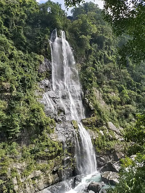
- The waterfall area adds the valley’s landscape to the town visit.
Location & getting there
Getting to Wulai
Xindian MRT station is the onward bus transfer point for Wulai. The official forestry visitor record identifies the Wulai terminus by the old street. For the trolley, use its Wulai station at 2, Lane 86, Wenquan Street and check the current operating notice.
Combine your visit
Build the visit around these complementary stops.
-
Wulai old street烏來老街
Start with the settlement and a local food stop.
-
Wulai trolley烏來台車
Use the former logging corridor if the service is running.
-
Waterfall area烏來瀑布
Continue to the valley viewpoint within the available visitor access.
Use the current visitor programme and local conditions to choose which stops to include.

Find Wulai
烏來 · 新北市
The pin marks the area, not the entrance.
More places nearby
Approximate straight-line distances between map pins, not travel distances.
Maokong Gondola 貓空纜車
15 km awayThe Maokong Gondola links the Taipei Zoo area with the tea-growing hills of Wenshan. The ride passes wooded slopes and the Zhinan Temple stop before reaching Maokong, where tea houses look back towards the city. It works best as…
View guide →Xiangshan Hiking Trail, Xinyi 象山亲山步道(信义区)
18 km awayXiangshan’s stepped paths climb through wooded slopes above Xinyi, bringing Taipei 101 into the foreground of the skyline. Sandstone outcrops and large boulders give the trail its shape. The Six Giant Rocks are a familiar…
View guide →Taipei 101 臺北101
19 km awayTaipei 101 rises above the Xinyi district in stacked sections that evoke bamboo. From the 89th-floor observatory, the city’s dense blocks, mountain edges and river basin become easier to understand. Visibility makes a real…
View guide →Sources & visit information
The sources below support the place-specific description and arrival information. Suggested combinations are editorial planning ideas; confirm current opening, entry arrangements and transport services for your date.
Selected visitor facts translated and adapted from Tourism Administration and contributing local tourism authorities, 2026 Tourism Information Database v2.1 — 烏來老街 (Attraction_382000000A_110660) · Open Government Data License 1.0.
Selected visitor facts translated and adapted from Tourism Administration and contributing local tourism authorities, 2026 Tourism Information Database v2.1 — 烏來台車 (Attraction_345040000G_110036) · Open Government Data License 1.0.