


Get to know Wulai District
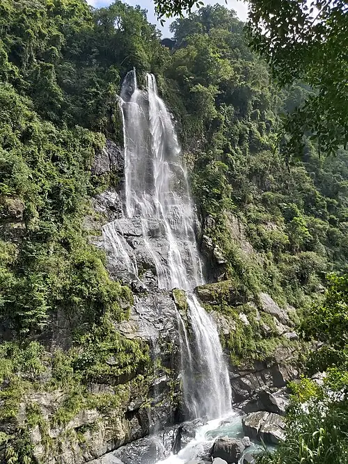
Photo adjustments
Full-frame source proportionally resized and converted to WebP for display. No subject alteration. Source-supplied marks and edits remain; cards may crop the view.
- Administrative area
- District · 區
- Part of
- New Taipei City
- Chinese name
- 烏來區
- Local areas
- District guide
Area & population
- Area in the source
- 321.13 km²
Source: cited geographic source, as of the dates shown.
Food and weaving traditions
Wulai Old Street (烏來老街) encompasses Wulai Street (烏來街), Pubu Road (瀑布路) and the Huanshan Road (環山道路) area. Food includes bamboo-tube rice, charcoal-grilled wild-boar meat, millet wine and millet mochi. The Wulai Atayal Museum (泰雅民族博物館) introduces weaving, architecture and beliefs.
A waterfall and timber railway
Wulai Waterfall (烏來瀑布) can divide into two streams after abundant rainfall, with cherry blossoms beside it in spring. The Wulai Scenic Train (烏來台車) began as a timber railway and shifted to tourism in 1963. Its terminal is by the waterfall; a cable car continues upwards to Yun Hsien Resort (雲仙樂園), giving an aerial view of the falls.
Sources for this guide
烏來老街 | 新北市觀光旅遊網 · Tourism and Travel Department, New Taipei City Government
烏來瀑布 | 新北市觀光旅遊網 · Tourism and Travel Department, New Taipei City Government
Original English written from the listed sources and checked sentence by sentence against quoted extracts by a separate reviewer. Updated 2026-09-27.
Explore Wulai District
Core places to explore, with English and Chinese names.
Places to explore around Wulai District
Wulai Waterfall in Wulai District, New Taipei · 新北市乌来区乌来瀑布 Source-recorded photograph date: 2023-09-12 13:44:40.Wulai烏來
Wulai’s old street follows the mountain settlement around Wulai Street, Waterfall Road and the surrounding slopes. Food gives a clear sense of place: bamboo-tube rice, mountain vegetables, millet products and dishes seasoned…
Read the place guide →Wulai Waterfall in Wulai District, New Taipei · 新北市乌来区乌来瀑布 Source-recorded photograph date: 2023-09-12 13:44:40.Wulai Waterfall and Atayal Culture乌来瀑布与泰雅文化
Wulai combines a forested river valley, a prominent waterfall and a community closely associated with Atayal culture.
Read the place guide →Plan your visit
Getting there
Wulai District is about 20 km in a straight line from central New Taipei City. Search for 烏來區 in a map app to find stations and your accommodation.
Where to stay →Build your route
Wulai and Wulai Waterfall and Atayal Culture are both listed here. The linked place guides have entrance and visit details.
Continue with New Taipei City →More in New Taipei City
Sources & geographic information
Administrative names and parent areas: Official geographic directory · Reference date 2026-09-06.
Photo: Wulai · 阿道 · CC BY-SA 4.0. Full-frame source proportionally resized and converted to WebP for display. No subject alteration. Source-supplied marks and edits remain; cards may crop the view.

Photo: Wulai Waterfall and Atayal Culture · 阿道 · CC BY-SA 4.0. Full-frame source proportionally resized and converted to WebP for display. No subject alteration. Source-supplied marks and edits remain; cards may crop the view.
Map data © OpenStreetMap contributors. Pins mark approximate centres, not entrances or boundaries.