

Explore the region
A protected “horizontal valley”
Kuerdening is a scenic area and protected landscape in the southeastern mountains of Gongliu County (巩留县), within Ili Kazakh Autonomous Prefecture. It is not Gongliu town, nor a synonym for the whole West Tianshan reserve: the county government places it 88 km from the county seat. The name is explained locally as “horizontal valley”; the valley runs roughly north–south, with a broad section about 14 km long and up to 1 km wide, and a valley floor averaging about 1,500 m.
Its importance is ecological rather than architectural. The county records its designation as an autonomous-region Schrenk spruce reserve in 1984, approval as the West Tianshan National Nature Reserve in 2000 and a national 4A tourist rating in 2012. UNESCO’s Xinjiang Tianshan property includes the Kalajun–Kuerdening component, inscribed in 2013 for its outstanding mountain scenery and continuing ecological processes; the Xinjiang tourism authority’s list dated 3 June 2025 also includes Kuerdening among the region’s 4A attractions.
What to look for
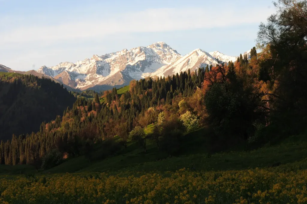
The main reason to come is the transition between forest, meadow, water and snow mountains over a single mountain valley. Look for tall Schrenk spruce and the Central Asian wild-fruit habitat that local conservation material identifies as central to Kuerdening’s value. The broad valley is a better subject for noticing scale than for ticking off a single viewpoint: compare the open grassland with the darker forested slopes, and listen for streams where the route follows the valley floor. After spring rain, mist can gather and move through the valley; this is a weather-dependent sight, not a daily performance.
Treat the reserve as a living ecosystem. Do not pick plants, collect fruit, approach wildlife or leave managed paths for a better photograph. The species figures published by the county describe a biodiversity-rich protected area, not a promise that visitors will see rare animals.
How to plan the visit
Opening, admission and the internal route
Current platform listings give a useful planning range but do not replace the day’s notice at the entrance. Qunar lists 09:30–20:00 from 1 May to 30 September, with last admission at 19:00, and 09:30–19:00 from 1 October to 30 April, with last admission at 18:00. Trip.com’s current listing also shows 09:30–19:00 with admission ending at 18:00. Qunar marks the attraction as requiring advance reservation and lists the visitor numbers 0999-7758590 and 0999-7758580.
The current ticket price, the validity of any concession and the reservation process for a passport holder are not stated consistently in the official pages checked for this guide. Confirm those items with the scenic area before setting out; do not assume a rule written for a Chinese ID card also applies to a foreign passport. A 2020 county notice describes the internal shuttle from the visitor centre to the Heritage Centre as 21 km and set the fare at CNY 15 one way or CNY 30 return at that time. Because that notice is old, treat the amount as a historical reference, not a current price.
The visitor itinerary currently shown by Qunar starts with the scenic-area visitor centre and an internal shuttle to the Heritage Centre, then continues on foot to an exhibition hall and viewpoints of Mount Kabanbay and the “Tianshan Sleeping Buddha”. It describes a sightseeing bus toward the King Spruce, a wooden-boardwalk descent through Cloud Grassland and a walk back to the Heritage Centre parking area before the return shuttle. Walking surfaces, vehicle sections and viewpoint access can change with weather or operations, so allow roughly half a day rather than planning a timed connection immediately afterward.
Getting there and getting back
The dependable geography is simple but the last leg is not: reach Gongliu County first, then arrange road transport for the 88 km onward journey to the scenic-area visitor centre. A coach that reaches Gongliu town does not, by itself, put you at the park entrance. From Yining, whether you arrive by air or rail, treat this as a road transfer into the county and then a separate final leg; no direct airport-or-rail service to the scenic-area gate or current fixed public timetable was established in the sources checked here.
A 2025 report says construction began on Provincial Road S345 from Kuerdening through Qiaxi and Tarim to Kalajun. The 2026 Gongliu government work report still describes the Kuerdening–Kalajun road and related works as projects to be advanced or completed during the year. Do not plan a through-route on that tourism loop as if it were already an alternative entrance. Arrange the return before entering the mountains, keep the scenic area’s Chinese name (库尔德宁景区游客中心) for map and driver searches, and confirm the final vehicle’s pickup point and last departure on the day.
Find Kuerdening Scenic Area
库尔德宁 · 巩留县
The pin marks the area, not the entrance.
Sources & visit information
Sources checked on 31 October 2026. Hours, tickets, reservations and transport can change; confirm with the operator before you go.
Image credits & notes (1)
- A mountain valley in Kuerdening, with conifer forest, meadow and snow-covered Tianshan peaks, photographed in May 2007. Photo: George LuPhoto: CC BY 2.0