

Explore the region
Tap any red Chinese text to hear it in Mandarin.
Why Cangshan is different
The range rises on the west side of Erhai and reaches 4,122 metres at Malong Peak. UNESCO describes the geopark as a place where cliffs, valleys and canyons create several ecological zones, from subtropical forests to temperate-boreal forest, grassland and savanna. Its geological interest is unusually legible on a visit: Cangshan preserves glacial deposits and glaciated landforms associated with the “Dali Glacial Period”, while its metamorphic rocks gave China’s marble its local name.
You do not need to treat every view as a race for the highest point. Streams descend between the nineteen peaks, and the mountain’s changing vegetation is part of the experience. The Jade Belt Road is a contour route on the middle slopes; it is a different experience from the summit-area boardwalk around Ximatan and from the separate cableway approaches below.
Choose an access route
- Ximatan Cableway (洗马潭索道, also called the Cangshan Grand Cableway) starts beside the west side of Tianlong Babu Film Studio (天龙八部影视城). Its three stations are the film-city lower station, Qilongnvchi (七龙女池) in the middle, and Ximatan (洗马潭) near the high mountain top. This is the route for the highest viewpoint and the alpine lake, but altitude, wind, cloud and maintenance can affect the upper section.
- Gantong Cableway (感通索道) is beside Gantong Temple (感通寺), at the foothill access described by the operator as about 3 km west of Guanyintang in Qiliqiao (大理古城七里桥观音塘以西3公里). It is the more natural choice for connecting with Qingbixi (清碧溪) and the Jade Belt Road rather than for reaching the summit.
- Zhonghe Cableway (中和索道) leaves from the west of the March Street Racecourse (大理古城三月街会场以西3公里) and reaches Zhonghe Temple (中和寺) and the Jade Belt Road. Its position makes it a separate northern approach; do not assume that a Zhonghe ticket or entrance is interchangeable with Ximatan or Gantong.
The park is much larger than any one cableway. Qilongnvchi’s small pools and cascades, the Jade Belt Road, and the Ximatan lake sit on different sections of the mountain. A cross-mountain walk can be a fine plan in stable weather, but it should not be used as an improvised way to guarantee a return: check the trail and the last descending service at the station where you intend to leave.
Tickets, weather and timing
The operator’s published Ximatan page lists upward service from 08:30 to 14:00 and downward service from 08:30 to 17:00. A current distributor listing displayed 08:30–16:00 for the Ximatan product when checked, so treat these as operating guidance rather than a promise for your date. Gantong and Zhonghe information pages likewise list upward service ending at 14:00 and downward service at 17:00, but maintenance and weather notices can override a regular timetable. A 2024 operator notice, for example, required visitors to leave the mountain by 14:30 during a maintenance adjustment.
Buy the product for the route you actually plan to use. Cableway tickets, park admission and any sightseeing-car or transfer product may be sold as separate or bundled items; a ticket for one ropeway is not evidence that another ropeway or trail is open. Online dated products are visible on international booking platforms, but the official operator pages do not state a single passport-specific rule. One third-party activity says that its own customers may present a physical passport or QR code, which is a vendor rule rather than a blanket guarantee for every entrance. Ask the operator or ticket seller whether your passport can be used for the exact product before paying, and keep the booking name identical to the document you will present.
The high route is exposed and substantially higher than Dali town. Check the weather, wind and upper-station notice on the day; carry water, warm layers and shoes suitable for stairs and mountain paths. Do not interpret a clear view from the old town as proof that Ximatan or a particular trail is open.
Getting there and back
If you arrive by train, the Dali tourism transport company publishes a direct service from Dali Railway Station (大理站) to Dali Ancient City (环洱海服务中心). It says departures roll with train arrivals and the service ends at the old-town centre. The Dali Ancient City South Gate Visitor Centre (大理古城南门游客中心), on the east side of the south gate, sells railway-station transfers and scenic-area shuttle products.
From the old town, use the Chinese name of the exact entrance rather than a generic “Cangshan” map pin:
- For Ximatan, give the driver 大理古城天龙八部影视城西侧 Dàlǐ Gǔchéng Tiānlóng Bābù Yǐngshìchéng Xīcè (west side of Tianlong Babu Film Studio, Dali Ancient City).
- For Gantong, use 大理古城七里桥观音塘以西3公里 and confirm that the vehicle is taking you to the Gantong Cableway ticket area, not merely to Gantong Temple.
- For Zhonghe, use 大理古城三月街会场以西3公里, the west side of the March Street Racecourse.
A third-party booking page lists a South Gate Visitor Centre–Gantong Cableway shuttle in both directions, but it is a product listing rather than a stable public-bus timetable; verify the departure point and last return on the day. For the other entrances, a taxi or ride-hail to the exact Chinese destination is the least ambiguous final connection. No fixed fare or travel time is promised here.
Plan the return before you go up. Descend by the same cableway or by the confirmed trail-and-cableway combination, then return to the old town or onward to Dali Railway Station. Do not assume that a late hike from one cableway to another will still meet the last downward service, and do not leave the mountain by an unconfirmed path.
Find Cangshan Mountains
苍山 · 大理市
The pin marks the area, not the entrance.
Sources & visit information
Sources checked on 24 October 2026. Hours, tickets, reservations and transport can change; confirm with the operator before you go.
Image credits & notes (1)
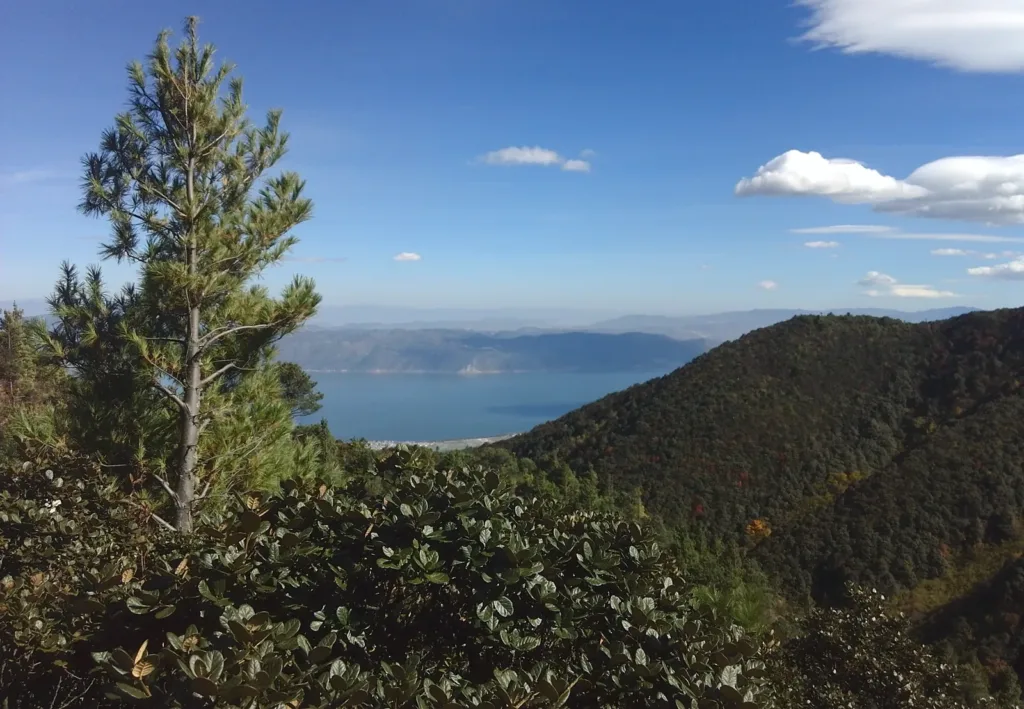
- Cangshan and Erhai Lake viewed from within the Dali-Cangshan UNESCO Global Geopark, photographed on 16 November 2017. Photo: Toni WöhrlPhoto: CC BY-SA 4.0