


Get to know Dali Bai Autonomous Prefecture
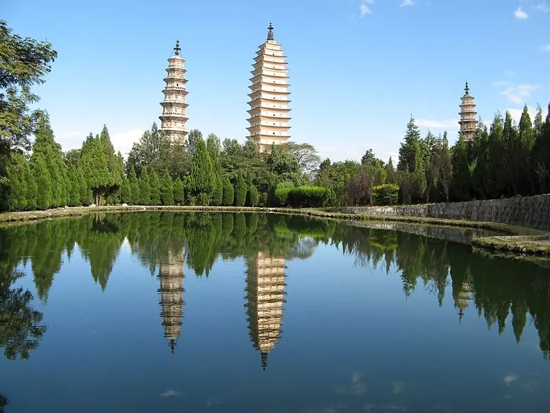
Photo adjustments
Full frame retained; proportionally resized and converted to WebP. No retouching or changes to the photographed subject. Card displays may crop the view.
- Administrative area
- Autonomous prefecture · 自治州
- Part of
- Yunnan
- Chinese name
- 大理白族自治州
- Local areas
- 12 local areas
Area & population
- Area in the source
- 29,459.00 km²
- Population · 2010
- 3,456,000
Source: cited geographic source, as of the dates shown.
The Dali Bai Autonomous Prefecture has a long history. As far back as the Neolithic Age, the ancestors of ethnic minorities such as the Bai people and Yi people and thrived here. During the Tang and Song dynasties, local governments such as the "Kingdom of Nanzhao" and the "Kingdom of Dali" emerged. In 1956, the Dali Bai Autonomous Prefecture was established.
Explore Dali Bai Autonomous Prefecture
Core places to explore, with English and Chinese names.
Nuodeng Old Village 诺邓古村
Yunlong Tianchi Lake Viewing Area 天池正规开放观景区
Shaxi Ancient Town 沙溪古镇
Shibao Mountain 石宝山
Wuliangshan Cherry Blossom Valley 无量山樱花谷
Xizhou Ancient Town 喜洲古镇
Dali Old Town 大理古城
Three Pagodas 崇圣寺三塔
Erhai Ecological Corridor 洱海生态廊道
Cangshan Mountains 苍山
Shuanglang Village 双廊
Jizu Mountain 鸡足山
Weibao Mountain 巍宝山
Weishan Old Town 巍山古城
Baotai Mountain 宝台山
Cibi Lake 茈碧湖
Dali Geothermal Kingdom 大理地热国
Shimenguan Canyon 石门关
Xinhua Silverware Village 新华村银器小镇
Huanglongtan Pools 黄龙潭
Dali 大理市
Yangbi Yi Autonomous County 漾濞彝族自治县
Xiangyun County 祥云县
Binchuan County 宾川县
Midu County 弥渡县
Nanjian Yi Autonomous County 南涧彝族自治县
Weishan Yi and Hui Autonomous County 巍山彝族回族自治县
Yongping County 永平县
Yunlong County 云龙县
Eryuan County 洱源县
Jianchuan County 剑川县
Heqing County 鹤庆县
Places to explore around Dali Bai Autonomous Prefecture
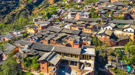 Nuodeng Old Village · 诺邓古村
Nuodeng Old Village诺邓古村
Nuodeng (诺邓) is a Bai village in Yunlong County, Dali Prefecture, Yunnan, built around a salt well worked for more than two thousand years.
Read the place guide → AI illustration · AI 示意图(仅供参考,非该地点实拍)
Yunlong Tianchi Lake Viewing Area天池正规开放观景区
Yunlong Tianchi is a high-altitude lake and forest area within Yunlong Tianchi National Nature Reserve, central Yunlong County, Yunnan.
Read the place guide →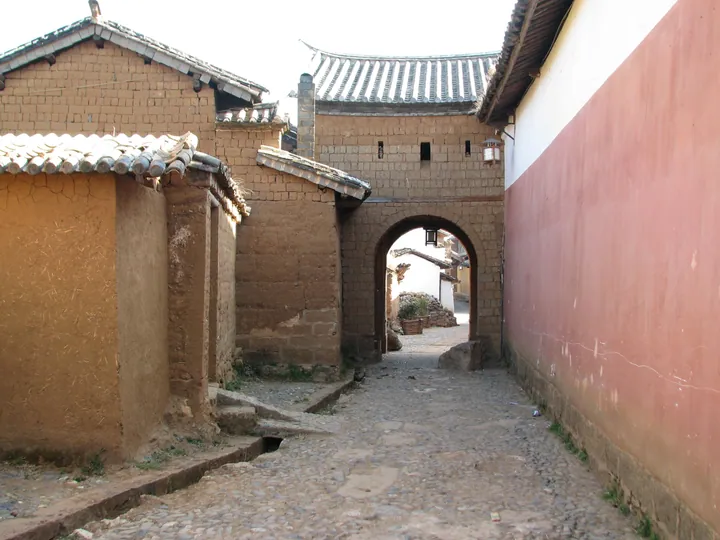 A gate archway on a street in Shaxi Ancient Town, Jianchuan County, Dali Prefecture · 云南大理州剑川县沙溪古镇街巷牌楼 Source-recorded photograph date: 2008-02-23 10:14:13.
Shaxi Ancient Town沙溪古镇
Shaxi’s historic core is Sideng Street, where Xingjiao Temple faces the old theatre across the market square. This compact arrangement makes the former trading settlement easy to understand: religious buildings, performance…
Read the place guide → Baoxiang Temple beside a stepped waterfall at the Shibaoshan (Stone Treasure Mountain) scenic area, Jianchuan County · 剑川县石宝山宝相寺及叠水瀑布 Source-recorded photograph date: 2014-09-17 11:55:25.
Shibao Mountain石宝山
Shibaoshan (石宝山) is a Danxia-landform mountain in Jianchuan County, Dali Bai Autonomous Prefecture, Yunnan, whose cliffs hold the Shizhongshan Grottoes (石钟山石窟), a rock-carving site begun in the Tang dynasty under Nanzhao rule.
Read the place guide →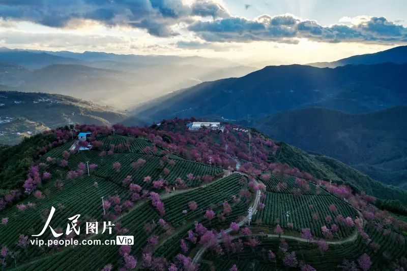 Wuliangshan Cherry Blossom Valley · 无量山樱花谷
Wuliangshan Cherry Blossom Valley无量山樱花谷
Wuliangshan Cherry Blossom Valley (无量山樱花谷) is a tea-growing valley in Nanjian Yi Autonomous County, Dali Bai Autonomous Prefecture, Yunnan, where winter-flowering cherry trees have been planted among the tea gardens.
Read the place guide →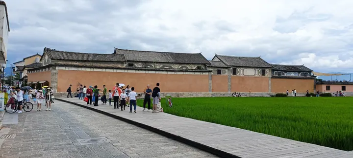 The perimeter wall of the Linden Centre beside rice paddies in Xizhou old town, Dali · 大理市喜洲古镇喜林苑外墙及稻田 Source-recorded photograph date: 2022-08-01 16:27:33.
Xizhou Ancient Town喜洲古镇
Xizhou (喜洲古镇) is a historic Bai settlement in Dali city, Yunnan, below the Wutai peak of Cangshan on the west shore of Erhai, known for a large complex of Bai courtyard residences built mainly by early-20th-century merchant families.
Read the place guide →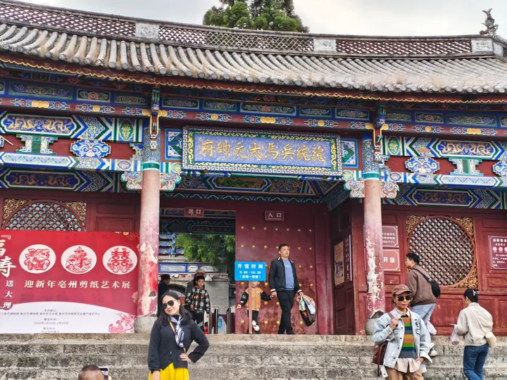 The former Du Wenxiu commander-in-chief's residence hall inside Dali Old Town, Dali City · 大理古城内的杜文秀总统兵马大元帅府,大理市 Source-recorded photograph date: 2026-02-23 17:18:49.
Dali Old Town大理古城
Dali Old Town sits between Cangshan and Erhai, with a street grid that makes its layout easy to read. Fuxing Road links the north and south gate areas, while side streets lead past shops, courtyards and local museum spaces…
Read the place guide →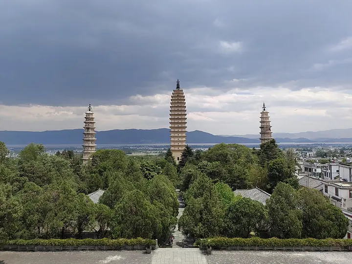 The Three Pagodas of Chongsheng Temple in Dali · 大理崇圣寺三塔 Photograph date recorded by the source: 2 May 2024, 13:12:32.
Three Pagodas崇圣寺三塔
The Three Pagodas stand below Cangshan in a triangular arrangement. The tall central Qianxun Pagoda has a square plan and closely spaced eaves, while the two smaller companions are octagonal. Their different forms are easiest to…
Read the place guide →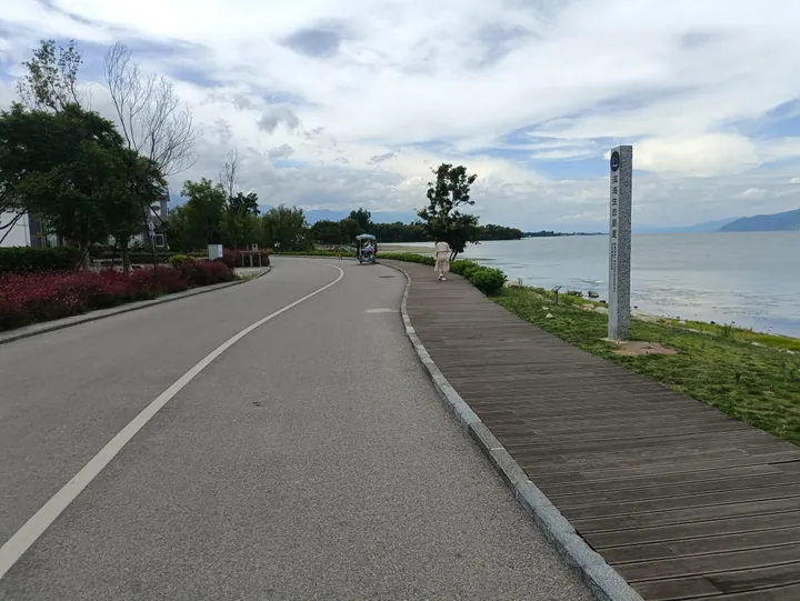 Lakeside boardwalk marked with a stone sign for the Erhai Lake Ecological Corridor, Dali City · 大理市洱海生态廊道湖滨栈道 Source-recorded photograph date: 2023-07-25 14:54:19.
Erhai Ecological Corridor洱海生态廊道
The Erhai Ecological Corridor (洱海生态廊道) is a lake-encircling conservation and public-access project along the shore of Erhai in Dali city, Yunnan, combining a cycling path, lakeside boardwalks and restored wetland with the lake-shore Bai villages it passes.
Read the place guide →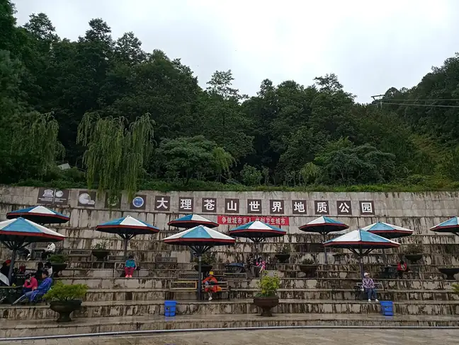 Cangshan Mountains · 苍山
Cangshan Mountains苍山
Cangshan (苍山) is a mountain range of nineteen peaks above Dali city, Yunnan, forming the Dali Cangshan World Geopark together with the lake-shore and plateau-lake landscapes around neighbouring Erhai.
Read the place guide →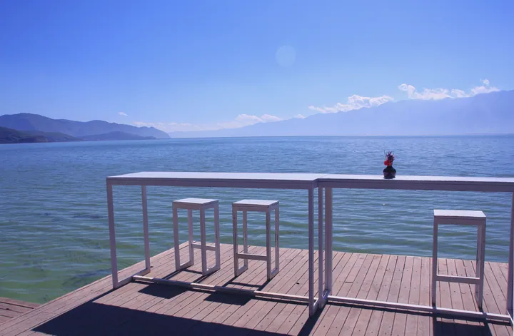 A lakeside deck overlooking Erhai Lake at Shuanglang, Dali · 大理双廊镇一处临洱海的观景平台 Source-recorded photograph date: 2013-11-02 14:33:46.
Shuanglang Village双廊
Shuanglang (双廊) is a Bai lakeside village on the northeast shore of Erhai in Dali city, Yunnan, whose name comes from the two curving bays and two islands that frame it, and which became known from the 2000s for artist-designed buildings alongside its older fishing and temple life.
Read the place guide →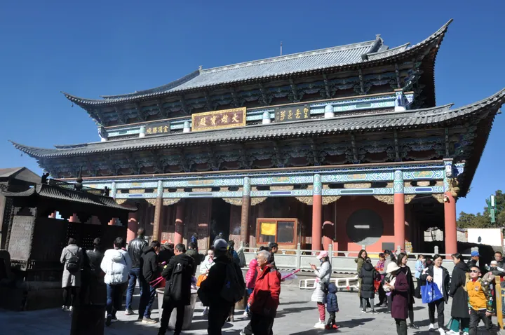 The Daxiong Baodian hall of Jinding Temple at the summit of Jizu Mountain, Binchuan County · 宾川县鸡足山金顶寺大雄宝殿 Source-recorded photograph date: 2019-02-03 11:37:07.
Jizu Mountain鸡足山
Jizushan (鸡足山) is a Buddhist mountain in Binchuan County, Dali Bai Autonomous Prefecture, Yunnan, named for its shape of three peaks in front and one trailing ridge, traditionally associated with the Buddha's disciple Mahakasyapa.
Read the place guide →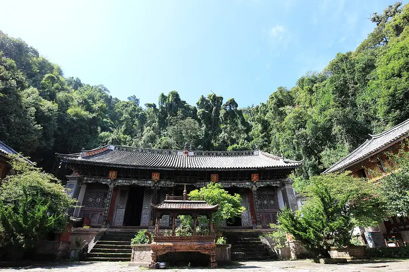 Weibao Mountain (巍宝山), Weishan Yi and Hui Autonomous County. Photograph: "Qingxia Taoist Temple of Weibao Mountain".
Weibao Mountain巍宝山
Daoist mountain south of Weishan, cradle of the Nanzhao kingdom, with Qing temples in forest and the nationally listed Changchun Cave.
Read the place guide →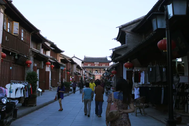 Ri Sheng Road inside Weishan Old Town, Dali · 大理州巍山彝族回族自治县巍山古城日昇路 Source-recorded photograph date: 2013-06-12 20:21:51.
Weishan Old Town巍山古城
Weishan’s old town keeps a street grid organised around substantial gateway and tower buildings. Gongchen Tower marks the northern approach, while Xinggong Tower stands over a four-way junction, with arched openings beneath its…
Read the place guide →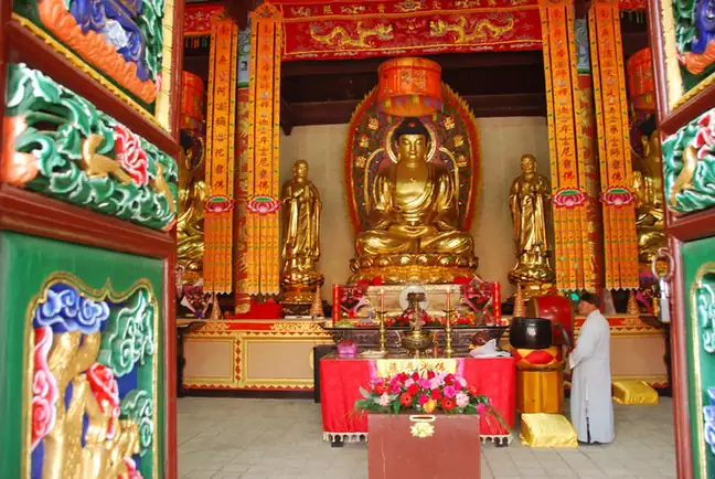 Baotai Mountain · 宝台山
Baotai Mountain宝台山
Baotaishan (宝台山) is a forested mountain beside the historic Bonan Ancient Road in Yongping County, Dali Bai Autonomous Prefecture, Yunnan, holding the Ming-dynasty Jinguang Temple within an area of primeval forest.
Read the place guide → Cibi Lake (Cibi Lake) viewed from its north shore in Eryuan County, Dali · 洱源县茈碧湖北岸风光 Source-recorded photograph date: 2012-01-25.
Cibi Lake茈碧湖
Long plateau lake north of Dali at the head of the Erhai system, named for its white cibi water lily, with Liyuan pear village on the north shore.
Read the place guide →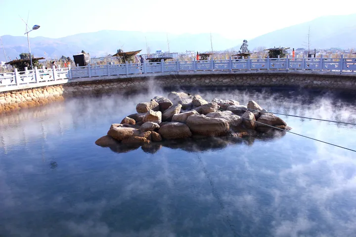 The Big Boiling Pot hot-spring pool at Dali Geothermal Kingdom, Eryuan County, Dali · 大理州洱源县大理地热国景区内的“大滚锅”温泉 Source-recorded photograph date: 2012-01-25.
Dali Geothermal Kingdom大理地热国
Dali Geothermal Kingdom (大理地热国) is a hot-spring park beside Cibi Lake, northeast of the county town in Eryuan County, Dali Bai Autonomous Prefecture, Yunnan, in a county recognised nationally for its geothermal activity.
Read the place guide → AI illustration · AI 示意图(仅供参考,非该地点实拍)
Shimenguan Canyon石门关
Shimenguan (石门关) is a canyon on the west slope of Cangshan in Yangbi Yi Autonomous County, Dali Bai Autonomous Prefecture, Yunnan, named for the two facing cliffs at its mouth that resemble an opened stone gate.
Read the place guide → AI illustration · AI 示意图(仅供参考,非该地点实拍)
Xinhua Silverware Village新华村银器小镇
Xinhua Village (新华村), also known as Yindu Shuixiang ('silver capital water town'), is a Bai silversmithing village in Heqing County, Dali Bai Autonomous Prefecture, Yunnan, whose metalworking history goes back more than 500 years.
Read the place guide → AI illustration · AI 示意图(仅供参考,非该地点实拍)
Huanglongtan Pools黄龙潭
Huanglongtan (黄龙潭) is a group of three connected spring-fed pools at the foot of Luofeng Mountain southwest of Heqing's old town in Heqing County, Dali Bai Autonomous Prefecture, Yunnan, paired with the hillside Zhaoxia Temple.
Read the place guide →Local life & food
Dali Bai Autonomous Prefecture local specialties
大理白族自治州特色美食 · 14 specialties to discover
 Xizhou baked filled bread 喜洲粑粑AI dish illustration / AI 菜品示意图
A crisp surface contrasts with soft layers. The savoury version can be rich with fat, while sweet versions give a very different snack.
Source ↗Read the dish guide →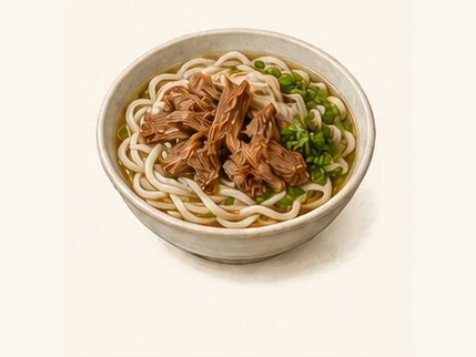 Weishan braised-pork rice noodles 巍山扒肉饵丝AI dish illustration / AI 菜品示意图
The noodles have a smooth, resilient bite against very soft meat. The broth carries the pork's richness through the bowl.
Source ↗Read the dish guide →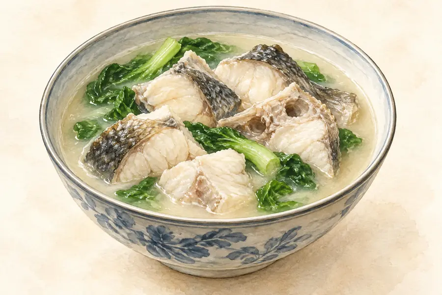 Dali Clay Pot Fish 大理砂锅鱼AI illustration · AI 示意图(仅供参考,非实拍)
Dali Clay Pot Fish (大理砂锅鱼) is fish from Erhai Lake (洱海) stewed with a large assortment of other ingredients in a clay pot.
Read the dish guide →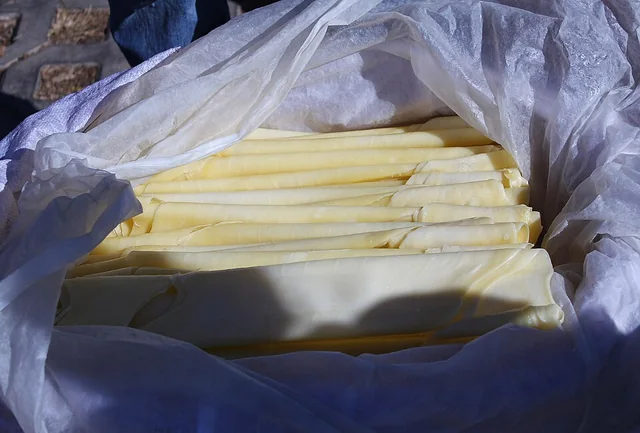 Dali rushan 大理乳扇
Heating makes the sheet softer or crisp at the edges, with a concentrated dairy aroma. Sweet toppings create a very different result from plain fried pieces.
Source ↗Read the dish guide →
Photo adjustments
EXIF orientation applied where present; resized proportionally to at most 640 px on the long edge and encoded as WebP. No crop, retouching, recoloring or subject changes.
 Lightly Torched Raw Pork Skin 生皮
Lightly Torched Raw Pork Skin (生皮) is the Bai (白族) dish of Dali Bai Autonomous Prefecture (大理白族自治州) in which pork skin and meat are eaten with a sour-sweet dip. In the Bai language it is called 'haige' (海格).
Read the dish guide →Photo adjustments
EXIF orientation normalized; resized without changing aspect ratio; converted to WebP. No subject edits.
 Weishan Braised Pork Rice Noodles 巍山耙肉饵丝
Weishan Braised Pork Rice Noodles (巍山耙肉饵丝) combine soft rice strips with slow-cooked pork and a thick, pale broth. They are associated with morning meals in Weishan (巍山), Dali Bai Autonomous Prefecture (大理白族自治州), Yunnan.
Read the dish guide →
Photo adjustments
Full frame retained; proportionally resized and converted to WebP. No retouching or changes to the photographed subject. Card displays may crop the view.
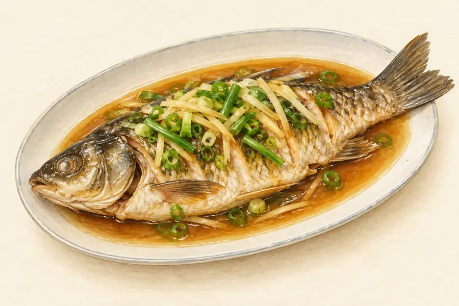 Dali Hot and Sour Fish 大理酸辣鱼AI illustration · AI 示意图(仅供参考,非实拍)
Dali Hot and Sour Fish (大理酸辣鱼) is fish cooked in a sour, chilli-hot broth in Dali Bai Autonomous Prefecture (大理白族自治州). In Eryuan County (洱源县), at the source of Erhai Lake (洱海), cooks make it with local white papaya (白木瓜).
Read the dish guide → Erhai Water Flower Greens and Taro Soup 洱海海菜芋头汤AI illustration · AI 示意图(仅供参考,非实拍)
Erhai Water Flower Greens and Taro Soup (洱海海菜芋头汤) is a home-style soup from Dali (大理) combining an aquatic plant with taro, beans and a little cured pork.
Read the dish guide →All dish names · 全部菜名 (14)
- Xizhou baked filled bread · 喜洲粑粑
- Weishan braised-pork rice noodles · 巍山扒肉饵丝
- Dali Clay Pot Fish · 大理砂锅鱼
- Dali rushan · 大理乳扇
- Lightly Torched Raw Pork Skin · 生皮
- Weishan Braised Pork Rice Noodles · 巍山耙肉饵丝
- Dali Hot and Sour Fish · 大理酸辣鱼
- Erhai Water Flower Greens and Taro Soup · 洱海海菜芋头汤
- Yangbi Rolled Rice Noodles · 漾濞卷粉
- Yongping yellow-braised chicken · 永平黄焖鸡
- Jianchuan Goat Milk Cheese · 剑川羊乳饼
- Bai Three-Course Tea · 白族三道茶
- Steamed Pork Belly with Carved Plums · 雕梅扣肉
- Cold Chicken Rice Noodles · 凉鸡米线
More dishes from across Yunnan are in the Yunnan food guide.
Counties & districts in Dali Bai Autonomous Prefecture
12 areas belong directly to Dali Bai Autonomous Prefecture.
12 areas
Dali 大理市
Dali City is the county-level seat of the Dali Bai Autonomous Prefecture in northwestern Yunnan, China. Dali City is administered through 12 township-level districts, two of which are also commonly referred…
Explore the area →Autonomous countyYangbi Yi Autonomous County 漾濞彝族自治县
Yangbi Yi Autonomous County is a county of the Dali Bai Autonomous Prefecture located in the west of Yunnan Province, China.
Explore the area →CountyXiangyun County 祥云县
Xiangyun County (simplified Chinese: 祥云县; traditional Chinese: 祥雲縣; pinyin: Xiángyún Xiàn; Bai: Piel-dant) is a county in the Dali Bai Autonomous Prefecture located in the west-central part of Yunnan…
Explore the area →CountyBinchuan County 宾川县
Binchuan County (simplified Chinese: 宾川县; traditional Chinese: 賓川縣; pinyin: Bīnchuān Xiàn; Bai: Bil•gel) is a county in the Dali Bai Autonomous Prefecture located in the west of Yunnan Province, China.
Explore the area →Show fewer areas
Midu County 弥渡县
Midu County (simplified Chinese: 弥渡县; traditional Chinese: 彌渡縣; pinyin: Mídù Xiàn) is a county in the Dali Bai Autonomous Prefecture located in the northwest of Yunnan province, China.
Explore the area →Autonomous countyNanjian Yi Autonomous County 南涧彝族自治县
Nanjian Yi Autonomous County (simplified Chinese: 南涧彝族自治县; traditional Chinese: 南澗彝族自治縣; pinyin: Nánjiàn Yízú Zìzhìxiàn) is a county in the Dali Bai Autonomous Prefecture located in northwestern Yunnan…
Explore the area →Autonomous countyWeishan Yi and Hui Autonomous County 巍山彝族回族自治县
Weishan Yi and Hui Autonomous County is an autonomous county in the Dali Bai Autonomous Prefecture, in northwestern Yunnan Province, China. It was known as Menghua (蒙化) until the 1950s.
Explore the area →CountyYongping County 永平县
Yongping County is a county of the Dali Bai Autonomous Prefecture, located in the west of Yunnan Province, China. It borders Yangbi County to the east, Changning County to the south, Longyang District to the…
Explore the area →CountyYunlong County 云龙县
Yunlong County (simplified Chinese: 云龙县; traditional Chinese: 雲龍縣; pinyin: Yúnlóng Xiàn) is under the administration of the Dali Bai Autonomous Prefecture in the northwest of Yunnan Province, China; it is the…
Explore the area →CountyEryuan County 洱源县
Eryuan is a county in the Dali Bai Autonomous Prefecture located in northwestern Yunnan Province, China. It borders Heqing County to the east, Dali City and Yangbi County to the south, Yunlong County to the…
Explore the area →CountyJianchuan County 剑川县
Jianchuan County (simplified Chinese: 剑川县; traditional Chinese: 劍川縣; pinyin: Jiànchuān Xiàn; Bai: Jinp•cuinl), historically known as Yidu is a county in the Dali Bai Autonomous Prefecture located in the…
Explore the area →CountyHeqing County 鹤庆县
Heqing County (simplified Chinese: 鹤庆县; traditional Chinese: 鶴慶縣; pinyin: Hèqìng Xiàn; Bai: Hhop•kait) is a county in the Dali Bai Autonomous Prefecture located in the northwest of Yunnan Province, China.
Explore the area →No areas match this name.
Plan your visit
Getting there
Search for 大理白族自治州 in a map app to find stations and your accommodation.
Where to stay →Build your route
Nuodeng Old Village and Yunlong Tianchi Lake Viewing Area are both listed here. The linked place guides have entrance and visit details.
Continue with Yunnan →More in Yunnan
Sources & geographic information
Administrative names and parent areas: Official geographic directory · Reference date 2026-09-06.
Background text adapted from Dali Bai Autonomous Prefecture — Wikipedia contributors, under CC BY-SA 4.0. Text has been shortened and reorganized; source revision 1346823355.
Photo: Nuodeng Old Village · Source photographer · License not provided. EXIF orientation normalized; resized without changing aspect ratio; converted to WebP. No subject edits.
Photo: Shaxi Ancient Town · Matthieu Lelievre · CC BY-SA 2.0. Full frame retained; proportionally resized and converted to WebP. No retouching or changes to the photographed subject. Card displays may crop the view.

Photo: Shibao Mountain · Halazhang · CC BY-SA 4.0. Full frame retained; proportionally resized and converted to WebP. No retouching or changes to the photographed subject. Card displays may crop the view.

Photo: Wuliangshan Cherry Blossom Valley · Source photographer · License not provided. EXIF orientation normalized; resized without changing aspect ratio; converted to WebP. No subject edits.
Photo: Xizhou Ancient Town · Kcx36 · CC BY-SA 4.0. Full frame retained; proportionally resized and converted to WebP. No retouching or changes to the photographed subject. Card displays may crop the view.

Photo: Dali Old Town · Ngguls · CC BY-SA 4.0. Full frame retained; proportionally resized and converted to WebP. No retouching or changes to the photographed subject. Card displays may crop the view.

Photo: Three Pagodas · Yumeto · CC BY-SA 4.0. Full frame retained; proportionally resized and converted to WebP. No retouching or changes to the photographed subject. Card displays may crop the view.
.jpg)
Photo: Erhai Ecological Corridor · Kcx36 · CC BY-SA 4.0. Full frame retained; proportionally resized and converted to WebP. No retouching or changes to the photographed subject. Card displays may crop the view.

Photo: Cangshan Mountains · Source photographer · License not provided. EXIF orientation normalized; resized without changing aspect ratio; converted to WebP. No subject edits.

Photo: Shuanglang Village · Zhangmoon618 · CC BY-SA 3.0. Full frame retained; proportionally resized and converted to WebP. No retouching or changes to the photographed subject. Card displays may crop the view.

Photo: Jizu Mountain · Zhangmoon618 · CC BY-SA 4.0. Full frame retained; proportionally resized and converted to WebP. No retouching or changes to the photographed subject. Card displays may crop the view.

Photo: Weibao Mountain · Xin · CC BY-SA 4.0. Full frame retained; EXIF orientation normalized, proportionally resized to at most 800 pixels and converted to WebP. No generated pixels or subject changes. Cards may crop the display.

Photo: Weishan Old Town · Zhangmoon618 · CC BY-SA 3.0. Full frame retained; proportionally resized and converted to WebP. No retouching or changes to the photographed subject. Card displays may crop the view.

Photo: Baotai Mountain · Source photographer · License not provided. EXIF orientation normalized; resized without changing aspect ratio; converted to WebP. No subject edits.
Photo: Cibi Lake · Zhangmoon618 · CC BY-SA 3.0. Full frame retained; proportionally resized and converted to WebP. No retouching or changes to the photographed subject. Card displays may crop the view.

Photo: Dali Geothermal Kingdom · Zhangmoon618 · CC BY-SA 3.0. Full frame retained; proportionally resized and converted to WebP. No retouching or changes to the photographed subject. Card displays may crop the view.

Map data © OpenStreetMap contributors. Pins mark approximate centres, not entrances or boundaries.