


Get to know Mengla County
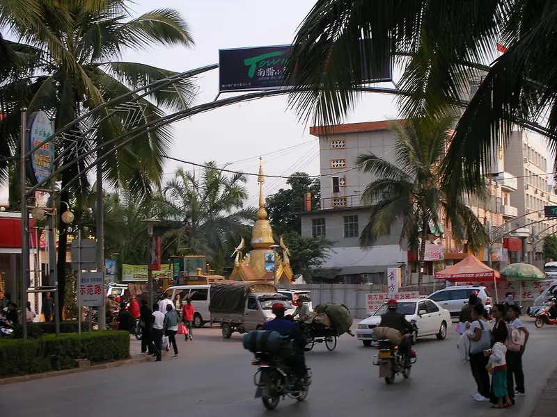
Photo adjustments
Full frame retained; EXIF orientation normalized, proportionally resized to at most 800 pixels and converted to WebP. No generated pixels or subject changes. Cards may crop the display.
- Administrative area
- County · 县
- Part of
- Xishuangbanna Dai Autonomous Prefecture
- Chinese name
- 勐腊县
- Local areas
- County guide
Area & population
- Area in the source
- 7,056.00 km²
- Population · 2020 census
- 304,950
Source: cited geographic source, as of the dates shown.
Setting and landscape
The land rises from 480 metres to 2,023 metres, higher in the northeast and lower to the south and southwest. The Lancang fault lies along the west and the tail of the Wuliang Mountains (无量山) reaches in from the north. Karst landscape marks the middle of the county and broad valley basins the south. The county town, Mengla (勐腊镇), is 172 kilometres from Jinghong (景洪), the prefecture seat. The county government gives forest cover as 83.65 percent.
Mohan (磨憨) is the southernmost town in Yunnan, and its border crossing faces Boten (磨丁) in Laos. The China-Laos Railway (中老铁路) has stations at Mengla and Mohan. On the Lancang, Guanlei (关累) is a first-class state river port with a direct water route to Laos, Myanmar, Thailand, Cambodia and Vietnam.
History
The county was set up in 1927 as Zhenyue County (镇越县) and later renamed Mengla. The county government traces a long history of growing, processing and trading tea here, including tribute tea. It counts five of the six ancient tea mountains of Pu'er tea (普洱茶) within the county. The Mengla section of the Tea Horse Road (茶马古道) is a national heritage monument, with stretches around Mahei village (麻黑村) and other parts of Yiwu (易武) town.
What to see
The Xishuangbanna Tropical Botanical Garden (中国科学院西双版纳热带植物园) of the Chinese Academy of Sciences stands on Hulu Island (葫芦岛) in Menglun (勐仑) town. It is a 5A scenic area of about 900 hectares, founded in 1959 under the botanist Cai Xitao (蔡希陶). It holds more than 12,000 kinds of living plants in 38 themed sections, along with about 250 hectares of primary tropical rainforest.
The 4A Wangtianshu (望天树) scenic area covers 20 hectares of the Bubeng (补蚌) nature reserve, northeast of the county town. Wangtianshu is the Chinese name of Parashorea chinensis, an evergreen tree that can reach 70 to 80 metres; within Xishuangbanna it grows only in Mengla, at places such as Bubeng and Jingpiao (景飘). A 2.5-kilometre steel-cable canopy walkway runs 20 metres above the ground, linking the tall trees. Mengyuan Wonderland (勐远仙境) is another 4A scenic area. In Yiwu, Shizijie village (十字街村) was among the first Chinese traditional villages listed in 2012.
Highlights
- Xishuangbanna Tropical Botanical Garden 中国科学院西双版纳热带植物园: 5A scenic area on Hulu Island in Menglun, founded in 1959; more than 12,000 kinds of living plants.
- Wangtianshu scenic area 望天树: 4A area in the Bubeng reserve with a 2.5 km canopy walkway 20 m above the ground.
- Yiwu 易武: Town with stretches of the Tea Horse Road, a national heritage monument, and the traditional village of Shizijie.
- Mengyuan Wonderland 勐远仙境: 4A scenic area named by the county government.
Sources for this guide
勐腊县概况 · Mengla County People's Government
中国科学院西双版纳热带植物园 - 维基百科,自由的百科全书 · Wikipedia (Chinese) · CC BY-SA 4.0
勐腊县 - 维基百科,自由的百科全书 · Wikipedia (Chinese) · CC BY-SA 4.0
易武镇 - 维基百科,自由的百科全书 · Wikipedia (Chinese) · CC BY-SA 4.0
Original English written from the listed sources and checked sentence by sentence against quoted extracts by a separate reviewer. Updated 2026-09-25.
Explore Mengla County
Core places to explore, with English and Chinese names.
Places to explore around Mengla County
 Xishuangbanna Tropical Botanical Garden (中国科学院西双版纳热带植物园), Mengla County. Photograph: "Tropical Botanical Garden, Xishuangbanna - panoramio - Colin W (1)".
Xishuangbanna Tropical Botanical Garden中国科学院西双版纳热带植物园
Chinese Academy of Sciences garden on Hulu Island in Menglun, founded by Cai Xitao in 1959, with over 14,000 plant taxa and 250 ha of rainforest.
Read the place guide →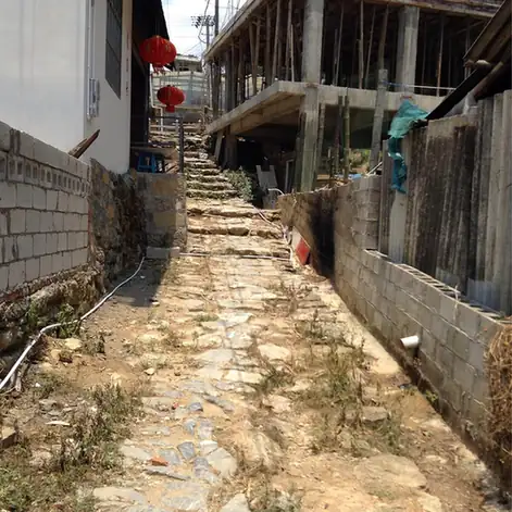 Yiwu Ancient Town · 易武古镇
Yiwu Ancient Town易武古镇
Yiwu (易武) is an old tea-trading town in Mengla County, Yunnan, built around a legacy of Puer tribute-tea production.
Read the place guide →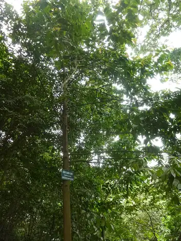 Wangtianshu Rainforest Scenic Area · 望天树
Wangtianshu Rainforest Scenic Area望天树
Wangtianshu Rainforest Scenic Area scenic area is a tropical-rainforest reserve in Mengla County, Yunnan, named for its emergent canopy tree species.
Read the place guide →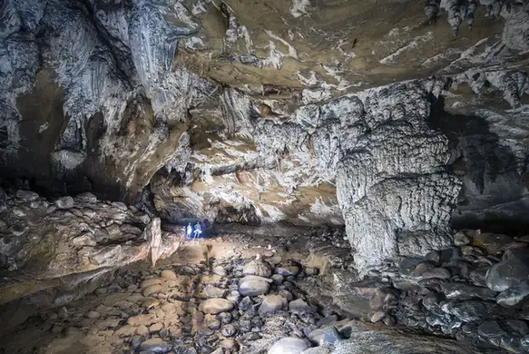 Mengyuan Fairyland · 勐远仙境
Mengyuan Fairyland勐远仙境
Mengyuan Fairyland (勐远仙境) is a rainforest and cave scenic area in Guanlei township, Mengla County, Yunnan, within the experimental zone of the Xishuangbanna National Nature Reserve.
Read the place guide →Plan your visit
Getting there
Mengla County is about 100 km in a straight line from central Xishuangbanna Dai Autonomous Prefecture. Search for 勐腊县 in a map app to find stations and your accommodation.
Where to stay →Build your route
Xishuangbanna Tropical Botanical Garden and Yiwu Ancient Town are both listed here. The linked place guides have entrance and visit details.
Continue with Xishuangbanna Dai Autonomous Prefecture →More in Xishuangbanna Dai Autonomous Prefecture
Sources & geographic information
Administrative names and parent areas: Official geographic directory · Reference date 2026-09-06.
Some facts checked against 中国科学院西双版纳热带植物园 — Wikipedia contributors, CC BY-SA 4.0.
Some facts checked against 勐腊县 — Wikipedia contributors, CC BY-SA 4.0.
Some facts checked against 易武镇 — Wikipedia contributors, CC BY-SA 4.0.
Photo: Xishuangbanna Tropical Botanical Garden · Colin W · CC BY-SA 3.0. Full frame retained; EXIF orientation normalized, proportionally resized to at most 800 pixels and converted to WebP. No generated pixels or subject changes. Cards may crop the display.

Photo: Yiwu Ancient Town · Source photographer · License not provided. EXIF orientation normalized; resized without changing aspect ratio; converted to WebP. No subject edits.
Photo: Wangtianshu Rainforest Scenic Area · Hungda · CC BY-SA 3.0. EXIF orientation normalized; resized without changing aspect ratio; converted to WebP. No subject edits.

Photo: Mengyuan Fairyland · Source photographer · License not provided. EXIF orientation normalized; resized without changing aspect ratio; converted to WebP. No subject edits.
Map data © OpenStreetMap contributors. Pins mark approximate centres, not entrances or boundaries.